Curated OER
Flat Earth Society
Students explore map distortion. In this geography instructional activity, students compare Mercator projection maps to globes in order to understand the strengths and weaknesses of projection maps.
Curated OER
Exploring Maps: Lesson 2 Guide: Navigation
Students explore and examine how maps have been used in navigation. They research how travelers collected observations to keep track of their positions and plotted information on maps. Each student then makes a Mercator projection...
Curated OER
United States Map- Rivers
Students learn about rivers. In this maps lesson, students describe rivers and what human activities take place in a river. Students use a map to locate the rivers in the United States.
Curated OER
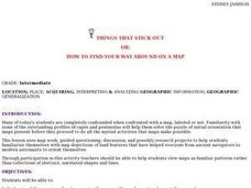
Things That Stick Out Or: How To Find Your Way Around on a Map
Students explain the meaning of and recognize the map outlines of a peninsula, an isthmus, and a cape.
University of California
Migration of Early Humans: Evidence and Interpretations
While much of prehistory is cloaked in mystery, ancient ancestors left evidence in DNA, languages, and materials from their time. Using photographs of items such as cave paintings and ancient tools, as well as maps of linguistic patterns...
Curated OER
Geography Skills
Students practice their geography skills. For this geography skills lesson, students locate, plot, and label places on maps and globes.
Curated OER
3D Textured Globe
The earth, our home planet, and the star of Earth Day celebrations everywhere! Celebrate Earth Day or examine Earth's place in the solar system, with a fun and easy craft, perfect for children nine and up. Paper mache ornaments, paint,...
Curated OER
Where in the Latitude Are You? A Longitude Here.
Students distinguish between latitude and longitude on the map. In this mapping lesson, students participate in mapping skills to recognize spatial relationships, and where to find natural resources on the map. Students create their own...
Curated OER
Navigation
Students explain that globes are the best way to show positions of places, but flat maps are portable and can show great detail. They make a mercator projection of the route Lewis and Clark took on their journey.
Curated OER
Arkansas History Lesson Plan: Identifying Arkansas on a Map
Students investigate their hometown of Arkansas. In this U.S. Geography lesson, students identify Arkansas on a map and distinguish it form the other states. Students investigate the history, state line, and personal experiences that...
Curated OER
Where in the world is...
Students identify locations around the world. In this mapping lesson, students place tag board pieces with names of locations on a wall map of the world. Initially, students identify states, then cities, then continents, eventually...
Curated OER
Where in the World Is…
Young scholars identify countries, oceans, states, and more on a globe and on a flat map. For this geography lesson plan, students also locate places around their school.
Curated OER
Globe Skills Lesson 2: Paving the Way for Columbus
Students explore the expedition of Christopher Columbus. In this geography skills lesson, students consider the technological advances that made Columbus's expedition possible as they complete a latitude and longitude activity.
Curated OER
CLASSROOM MAPS
Students do a blind tour of their school by responding to verbal commands. They look and discuss various maps in the classroom. They locate the direction of the sunrise and discuss the compass directions of North, South, East, and West.
Curated OER
Map of the Ottawa Valley
Students locate Ottawa Valley on a map. They then answer questions in reference to the map such as: What was the first use of timber in the Ottawa Valley?, What occurred first in Gatineau?, and On the Ontario side of Ottawa River, how...
Curated OER
Where in the World is Mr. Fultz?
Students use maps and other geographic resources to learn about their world while problem solving. They read clues each day and use classroom resources to narrow down where the prize is located.
Curated OER
Exploring an Atlas
Students explore global geography by participating in an atlas activity. In this countries of the world lesson plan, students collaborate in small groups and analyze an atlas while researching continents, countries and demographics....
Curated OER
Mapmaking
Young scholars examine the craft of cartography and how the Lewis and Clark expedition created and used maps. They analyze maps, read a handout, create a map, participate in a mini expedition and map out a route based on travel...
Curated OER
Absolute Location
Fifth graders examine the geographic concept of absolute location. Using a variety of resources, they create a life-size classroom grid and locate the coordinates of a point, identify latitude and longitude of different locations, and...
Curated OER
Mexico: One Land, Many Cultures
Students, through a variety of activities, discover the geography and culture of Mexico. They make maps, read folktales, write a journal, create pinatas and other artistic pieces, and review the history of Mexico.
Curated OER
Volcanic Activity in the U.S.
Students locate and map ten volcanoes in United States, create chart comparing volcanoes by last eruption, type of volcano, location, and interesting fact, and create Powerpoint slide show describing basic
information about volcanoes and...
Curated OER
Cacao Tree Geography
Learners use a map to learn about where chocolate comes from. In this lesson on the cacao tree, students locate various regions where the cacao tree grows. They will discuss why the cacao tree grows more favorably in particular climates...
Curated OER
Geography Puzzles
Students study the continents of the world. In this Internet geography lesson, students connect to online mapping games. Students collaborate in order to develop their understanding of world geography, including countries and capital...
Curated OER
Map Making
Learners use a tennis ball and paper to construct a student-made globe. They sketch in continents and major map features and then compare a flat map to a globe.


