Curated OER
Immigration: Creating Change
Students explore how immigration has changed the culture of America. After identifying the foods and diets of Europeans and Native cultures, students create a map indicating where foods came from. Students design a restaurant menu,...
Curated OER
Identifying Border States of the U.S.
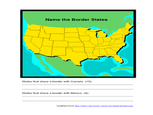
For this identifying border states of the U.S. worksheet, 3rd graders visually identify then write the names of the states that border Canada and Mexico; page 1 is a lesson, page 2 is the worksheet.
Curated OER
Globe Skills Lesson 1 Some Early American Cultures
Middle schoolers apply their knowledge of geography. In this geography skills lesson, students read brief selections regarding early Americans. Middle schoolers respond to the questions included in the self-guided map skills lesson.
Curated OER
Travel to Mesoamerica
Students research books, watch movies, and look on the internet to find information on ancient America, Mexico, and Central America. In this Mesoamerica lesson plan, students participate in a social studies unit on North America of the...
Curated OER
Globe Lesson 4 - Intermediate Directions
Students explore the concept of intermediate directions. In this geography skills lesson, students use map skills in order to identify intermediate directions as they complete a map activity.
Curated OER
Developing Cultural Awareness through Mexican Folktales
Students explore the culture of Mexico through folktales. They identify cultural differences and similarities through the reading of folktales. Students create pocket books related to Mexican folklore. They read and discuss literary...
Curated OER
Max Knows Mexicao, United States and Canada
Students utilize their map skills to explore the regions of North America. They explore the physical characteristics and climates of the regions. Students label their map and prepare a presentation of their findings.
Curated OER
Colonies and Revolution: Comparing US and Mexican History
Students examine the emergence of the United States and Mexico as independent nations. They compare the colonial history of the two countries and discover the emergence of social classes.
Curated OER
The Legend of the Poinsettia
Students explore the poinsettia and its symbolism as a Christmas flower. Students will listen to a story about the poinsettia and its origins in Mexico and discuss what they know about Mexico. They will discuss the poinsettia's...
Curated OER
State to State Scavenger Hunt
In this states activity, students utilize the Internet to access one specific website to locate the answers to five fill in the blank statements about the states found on a United States map.
Curated OER
Hispanic Heritage: Introduction to Hispanic Culture
Third graders locate the country of Mexico on a map and discuss its relationship to the United States. They examine the Mexican flag and discuss the colors and symbolism used in the flag. They create an original and accurate drawing of...
Curated OER
Estimation, Sampling, and Beyond
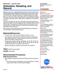
Students examine an ISS EarthKAM image of farm land in Texas and New Mexico. They select sample region of image and count the number of fields in that region. They estimate how many fields are in the entire region.
Curated OER
Getting to the Core of World and State Geography
Students create topography relief maps. In this geography skills lesson, students review geography core knowledge skills, design and make a state relief map, and compile a student atlas.
Curated OER
Along the El Camino Real
While studying each of the 21 missions in California, your class will learn about the founders and founding dates of each mission. Note: Some resource links may not be working, but can be supplemented with additional activities found on...
Curated OER
Hidalgo's Fight for the Independence of Mexico
Tenth graders study and examine the life of Miguel Hidalgo while working to identify major themes. Small groups create sequence of event chains, analyze and label maps of Hidalgo's travels, and work together to create giant chalk maps...
Curated OER
Biome Map
In this biomes activity, students color the map of North America according to the biome clues. Students then answer questions about the North American biomes.
Curated OER
Cabeza de Vaca
Fourth graders observe the 1529 map of the Gulf of Mexico and describe the accuracy of the map, including the unknown landscape that Cabeza de Vaca would traverse. They read the discuss the excerpt of his journey including his treatment...
Curated OER
United States Map- Rivers
Students identify major rivers on a map of the United States. In this geography lesson, students discuss what a river is and use a map marker to identify the symbol of a river on a map.
Curated OER
Oaxaca Geography and the Climate
Students examine the diverse geography of the country of Mexico and the state of Oaxaca. They analyze how the geography of the state of Oaxaca affects its climate and create maps showing the different climate areas.
Curated OER
The Power of Maps & Native American Cultures
Sixth graders discover where and how five Native American cultures lived in North America in what is currently the United States. They examine their way of life and the regions they inhabited. Additionally, 6th graders will understand...
Curated OER
North America, Then and Now
Students identify ocean, lake, gulf, and continent on maps of North America from 1845 and the present, and identify Pacific and Atlantic Oceans, the Great Lakes, and the Gulf of Mexico on maps of North America from 1845 and the present.
Curated OER
Mapping the United States
In this map of the United States worksheet, students label mountains, surrounding countries, oceans, and more. Students complete 12 tasks.
Curated OER
Capitals, Oceans, And Border States
Students investigate geography by completing games with classmates. In this United States of America lesson, students examine a map of North America and identify the borders of Mexico and Canada as well as the Pacific and Atlantic....
Curated OER
Coral Reef Geography
In this coral reef geography worksheet, students find locations of reefs on a globe or map. There are 10 instructions to follow. There is no map provided--an atlas, globe or map is needed.


