Curated OER
Spy the Flycatcher
Explore the symbols and special features of Oklahoma. By focusing on Oklahoma's state bird, the flycatcher, learners identify similes, write metaphors, and answer questions about this famous state symbol.
Curated OER
Capitals, Oceans, And Border States
Students investigate geography by completing games with classmates. For this United States of America lesson, students examine a map of North America and identify the borders of Mexico and Canada as well as the Pacific and Atlantic....
Curated OER
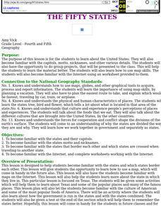
The Fifty States
Students become familiar with the states. They study capitols, mottos, nicknames, and other various details. They create group projects that be presented to the class.
Curated OER
United States Map- Continent, Country, State
Students identify their continent, country, and state on a globe. In this geography lesson, students use a globe to identify the seven continents, the United States, and the state which they live in. Students define key terms.
Curated OER
Max Knows Mexicao, United States and Canada
Students utilize their map skills to explore the regions of North America. They explore the physical characteristics and climates of the regions. Students label their map and prepare a presentation of their findings.
Curated OER
State Capitals Fun
Third graders study the capitals of each state. For this social studies lesson, 3rd graders use a map of the United States to identify and locate each state's capital city. Students discuss map symbols used to identify capital cities.
Curated OER
People Change the Landscape
Students examine ways in which humans have brought change to the natural environment. In this ecology and literacy instructional activity, students listen to the book Island Boy by Barbara Cooney. Students observe and define map-reading...
Curated OER
50 States: New England States
Students discover where certain states are located and what the look like. They look for their information on a web site. Each student is assigned a state which they must research then present to the entire class.
Curated OER
Race and Ethnicity in the United States
Students explore race and ethnicity as it is defined by the U. S. Census Bureau. They compare data from 1900, 1950, and 2000 and identify settlement patterns and changes in population. In groups, they map these changes and discuss...
Curated OER
Puerto Rico: The 51st State?
Students explore Puerto Rico. For this Puerto Rico current events lesson, students conduct a Webquest to answer questions about Puerto Rico's culture. Students discuss whether Puerto Rico is a country or a state, and defend...
Curated OER
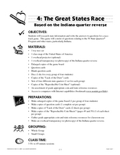
The Great States Race
Here is another in the interesting series of lessons that use the special State Quarters as a learning tool. This one uses the Indiana State Quarter. During this lesson, utilize a brilliantly-designed board game that is embedded in the...
Curated OER
Our 50 States
Students identify the location of the 50 states using an interactive map. They practice geography skills by playing a fun game. Pupils become familiar with the state abbreviations for the US states. Students become familiar with the...
Curated OER
Map Memory
Fifth graders, working in a whole class setting, label a United States map with the names of all the states that they know. They transfer the names of the states to an individual map and color it. Next, they receive directions on how to...
US Mint
Symbols in My Eyes
Explore the hidden meanings behind the images on US currency with this elementary school lesson on symbolism. Starting with a class discussion about symbols, children go on to brainstorm different objects that represent the Unites...
National Endowment for the Humanities
The Creation of the Bill of Rights: “Retouching the Canvas”
While the Constitutional Convention lay the foundation of the new government for the United States, the protections given under the Bill of Rights were controversial. Using documents, such as James Madison's and Thomas Jefferson's...
University of California
The Civil War: Secession of the South
Was the Southern states' decision to secede from the Union protected by the United States Constitution? Eighth graders discuss the constitutionality of the South's justification for secession, particularly the secession of South...
Curated OER
United States Map
Students describe cities they are familiar with. In this United States Map instructional activity, students understand how cities are listed on a map. Students become aware of a map legend and the information in it.
Curated OER
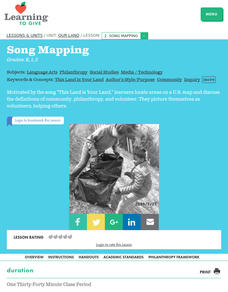
Our Land Lesson 2: Song Mapping
Students study the meaning of philanthropy as giving of time. talent, and treasures. They sing This Land Is Your Land while locating five of the places on a map of the United States showing that relief office are everywhere. They decide...
Curated OER
Soil: Food Mapping
Learners examine the concept of food mapping . In this agriculture lesson, students explore food and agriculture systems in the United States in the past and today. Learners complete food mapping activities.
Curated OER
Memorable Maps
Students draw an assigned map from memory about the United States or any other region they are studying. In this maps lesson plan, students draw a map from their memory at the beginning of the year, and do the same assignment at the end...
Curated OER
Mapping Electricity
Students complete Internet research and use their map reading skills to learn about how the United States creates and uses electricity in different states. In this energy sources lesson, students study the mini map of energy usage...
US Mint
Rename That State!
As Shakespeare famously wrote, "A rose by any other name would smell as sweet," but can the same be said for a state? For this elementary geography lesson, learners are assigned specific states to research using the information...
Discovery Education
Architects in Action
Hands-on and real-world applications are great ways to teach mathematical concepts. Creative thinkers examine how ratios are used to create scale models of buildings and structures. They practice working with ratios by looking at a map...
Curated OER
The Great Lakes
In this Great Lakes worksheet, students observe the Great Lakes location on a partial U.S. map, write their names in the acronym HOMES, list them in order from largest to smallest, and identify states that border them. Students write...
Other popular searches
- United States Maps
- United States Maps Regions
- Northeast United States Maps
- 50 United States Maps
- Create United States Maps
- Western United States Maps
- Custom United States Maps
- Outline Maps United States
- Blank United States Maps
- United States Landforms Maps
- United States Geography Maps
- United States Political Maps


