Curated OER
Historic Cemetery Project
Students use the Virtual Atlas to examine the cemetaries in the state of Washington. In groups, they view photographs of local monuments to celebrate the lives of local members. They choose one to focus on and research. To end the...
Curated OER
Case Studies: Cross-Cultural Comparison
Students examine maps of Lebanon, Vietnam and Nigeria, discuss relationship between ethnicity, land and conflict, review material from case studies, complete comparison chart, and write essays comparing two of the case studies.
Curated OER
Splitting the Motherland?
Students explore issues such as Tibet's struggle for independence and China's invasion in 1950. They create a KWL chart, explore maps of Tibet, and read articles concerning China, the Dalai Lama, and President Bush's relationship to...
Curated OER
Brother Against Brother
Eighth graders read Across Five Aprils and correlate it to a unit on the Civil War. They culminate the unit by writing a a piece of historical fiction in the first person entitled "Brother Against Brother."
Curated OER
The Colony of Virginia as Far as the Mississippi
Students study George Washington's map and journal of his 1754 expedition to the French. They draw conclusions about the importance of western lands and the problems involved in tapping the resources of the West during that era.
Curated OER
Fort Pickens and Fort Barrancas Historic District
Students use maps, readings, photos and diagrams to identify and describe events in Pensacola, Florida that preceded the Civil War. They examine the role of Fort Pickens during the Civil War and consider the community impact of military...
Curated OER
Character in Leadership
Fifth graders inquire and research using secondary and primary resources. In this leadership traits unit, 5th graders investigate information about Harry S. Truman and present on his early life and leadership abilities....
Curated OER
Racists Actions Toward the Native Americans
Students explore Thomas Jefferson and his attitude toward Native Americans. They study maps from European colonization and the westward movement that pushed the Native Americans further west. Students analyze primary source writings of...
Curated OER
Sectionalism, Popular Sovereignty, and Secession
Young scholars examine sequence of national events that resulted in the Civil War by using primary sources, and creating timelines and maps.
Curated OER
Togo's New President
Students read an article about Togo's new President. They locate Togo on a map. They practice using new vocabulary they find in the story. They also complete worksheets.
Curated OER
Scale Basketball
Students understand that a spreadsheet can be used to find the best scale to use in a model. They place the distances of the planets of the solar system to the Sun in one column of the spreadsheet. Students try different scales so that...
Curated OER
What Would Pink Say
Students create Venn diagrams of similarities and differences between two main characters in Pink and Say by Patricia Polacco.
Curated OER
President's Day: George Washington
Young scholars celebrate President's Day by studying George Washingtion, the US flag, and the American colonies. They sing, Yankee Doodle Dandy.
Curated OER
Getting from Place to Place
Students examine modes of transportation. In this transportation lesson, students listen to their instructor present a lecture on modes of transportation over the past 300 years. Students respond to questions about...
Curated OER
Past and Present
Students identify George Washington on the obverse of the quarter and read about George Washingington. They compare Washington to the current president and practice distinguishing between events in the past and the present.
Curated OER
What an Accomplishment
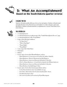
Students identify and discuss the images on the back of the South Dakota quarter. They discuss the differences between facts and opinions, and research information about the four presidents memorialized on Mount Rushmore.
Other popular searches
- United States Maps
- United States Maps Regions
- Northeast United States Maps
- 50 United States Maps
- Create United States Maps
- Western United States Maps
- Custom United States Maps
- Outline Maps United States
- Blank United States Maps
- United States Landforms Maps
- United States Geography Maps
- United States Political Maps


