Howard Hughes Medical Institute
Lesson 6: Biomes and Landscapes
Aside from the amazing animals in Gorongosa National Park, what else is there to discover? The sixth installment in an eight-part themed series contains an interactive map where scholars can learn more about the geographic features of...
British Council
Weather 1
Match weather words with pictures in a weather vocabulary learning exercise. Beginning readers look at pictures of various weather patterns and choose/write the word that describes the weather. They create a map and write about the...
Curated OER
Reading a Local and National Weather Map
Students examine weather maps. They examine icons and map symbols. Students explore vocabulary words related to weather. Students analyze and evaluate information provided on the weather map.
Curated OER
Cookie Mapping
Students study the components of a bedrock geology map through a hands-on activity involving a cookie and graph paper.
Curated OER
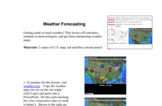
Weather Forecasting
Learners discover how to read a current weather map. In this weather forecasting lesson plan, students view weather maps from three consecutive days and observe how quickly weather moves and changes. Learners review key terms associated...
Oregon State
World Map of Plate Boundaries
Young geologists piece together the puzzle of plate tectonics in an earth science lesson. Given a physical map of the world, they search for land formations that indicate the location of different types of plate boundaries.
Curated OER
Weather Predictions
Students play the role of weather personalities by making five day forecasts based on data gathered from observations, weather instruments, and weather maps. Each day a small group makes a class forecast for the next day and reviews the...
Curated OER
Weather Patterns
In this weather worksheet, students identify with the symbols found on a weather map that show the locations of fronts, high- and low-pressure areas, and various types of precipitation across the United States. Then they use the map...
Curated OER
Weather Predictions
Fourth graders explore meteorologists. They explore symbols on a weather map and make five day forecasts.
Curated OER
Exploring For Copper Deposits
Pupils examine ore deposits and identify factors in their origin. They analyze geologic maps, and locate porphyry copper deposits on a sediment geochemistry map.
Curated OER
Pollution Prevention At Ft. Riley
Student examine methods of pollution reduction used at Ft. Riley military institution. Students review the economic impact of the use of enviromentally sensitive materials.
US Geological Survey
Usgs: Geologic Maps
This site has a good description of what this particular type of map represents. It also explains the colors and letter symbols, faults, and strike and dips.


