Curated OER
50 States: New England States
Students discover where certain states are located and what the look like. They look for their information on a web site. Each student is assigned a state which they must research then present to the entire class.
Curated OER
Race and Ethnicity in the United States
Students explore race and ethnicity as it is defined by the U. S. Census Bureau. They compare data from 1900, 1950, and 2000 and identify settlement patterns and changes in population. In groups, they map these changes and discuss...
Curated OER
Puerto Rico: The 51st State?
Students explore Puerto Rico. For this Puerto Rico current events lesson, students conduct a Webquest to answer questions about Puerto Rico's culture. Students discuss whether Puerto Rico is a country or a state, and defend...
Curated OER
The 50 States and its Holidays
Though the format of this ELL lesson is confusing (the standards listed are for plate tectonics, yet the objectives are for American geography and holidays), a teacher could glean some ideas from the main idea. Here, pupils complete a...
Curated OER
Our 50 States
Students identify the location of the 50 states using an interactive map. They practice geography skills by playing a fun game. Pupils become familiar with the state abbreviations for the US states. Students become familiar with the...
Curated OER
United States Map- State Capitals
Young scholars explore the state capitals. In this geography lesson, students use a political map to identify the state capitals and place post-it notes on various capitals.
Curated OER
Mapping Your State's Role in the Vietnam War
Learners recognize reasons to celebrate Memorial Day. Students create a map of victims of the VIetnam War. Using the internet, learners research information about soldiers from their state who were killd in action in Vietnam. Students...
National Endowment for the Humanities
The Creation of the Bill of Rights: “Retouching the Canvas”
While the Constitutional Convention lay the foundation of the new government for the United States, the protections given under the Bill of Rights were controversial. Using documents, such as James Madison's and Thomas Jefferson's...
University of California
The Civil War: Secession of the South
Was the Southern states' decision to secede from the Union protected by the United States Constitution? Eighth graders discuss the constitutionality of the South's justification for secession, particularly the secession of South...
Curated OER
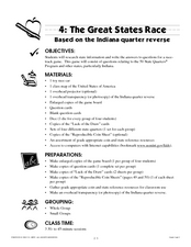
The Great States Race
Here is another in the interesting series of lessons that use the special State Quarters as a learning tool. This one uses the Indiana State Quarter. During this lesson, utilize a brilliantly-designed board game that is embedded in the...
Curated OER
Map Memory
Fifth graders, working in a whole class setting, label a United States map with the names of all the states that they know. They transfer the names of the states to an individual map and color it. Next, they receive directions on how to...
Curated OER
Weather Pals
Students study maps of the United States to locate weather pals from a list of schools. They communicate with Weather Pal schools through the use of closed circuit TV. Using weather data collected in their area, they exchange the...
Curated OER
Soil: Food Mapping
Learners examine the concept of food mapping . In this agriculture lesson, students explore food and agriculture systems in the United States in the past and today. Learners complete food mapping activities.
Curated OER
United States Map - Lesson 11
Students explore lakes of the United States. In this geography lesson, students identify noteworthy lakes on a map of the United States.
Curated OER
United States Map
Students describe cities they are familiar with. In this United States Map instructional activity, students understand how cities are listed on a map. Students become aware of a map legend and the information in it.
US Mint
Symbols in My Eyes
Explore the hidden meanings behind the images on US currency with this elementary school lesson on symbolism. Starting with a class discussion about symbols, children go on to brainstorm different objects that represent the Unites...
Curated OER
The Great Lakes
In this Great Lakes worksheet, students observe the Great Lakes location on a partial U.S. map, write their names in the acronym HOMES, list them in order from largest to smallest, and identify states that border them. Students write...
Curated OER
Memorable Maps
Students draw an assigned map from memory about the United States or any other region they are studying. In this maps lesson plan, students draw a map from their memory at the beginning of the year, and do the same assignment at the end...
Curated OER
The Four Corners Region of the United States Cultures, Ruins and Landmarks
Students who live in the inner city are introduced to the four corners region of the United States. In groups, they examine how the region differs compared to where they live and their culture. They develop maps of the area and locate...
Curated OER
Spanish Influence in the U.S.
Eighth graders research the role of the first Spanish conquistadors who explored the now United States. Using the internet, they gather information on different explorers and write a paper about why he is important in American history. ...
US Mint
Rename That State!
As Shakespeare famously wrote, "A rose by any other name would smell as sweet," but can the same be said for a state? For this elementary geography lesson, learners are assigned specific states to research using the information...
EngageNY
Mid-Unit Assessment: Research Simulation
As part of a mid-unit assessment, scholars complete a research simulation about food deserts to mimic the research process. Afterward, they engage in a think-pair-share to discuss what they've learned throughout the unit.
Curated OER
Introduction to the United States Map
Students explore the United States using a map. In this map instructional activity, students discover how to use a United States map and a globe to locate places.
Curated OER
United States Map- Continent, Country, State
Students identify their continent, country, and state on a globe. In this geography lesson, students use a globe to identify the seven continents, the United States, and the state which they live in. Students define key terms.
Other popular searches
- United States Maps
- United States Maps Regions
- Northeast United States Maps
- 50 United States Maps
- Create United States Maps
- Western United States Maps
- Custom United States Maps
- Outline Maps United States
- Blank United States Maps
- United States Landforms Maps
- United States Geography Maps
- United States Political Maps


