Curated OER
Molly Pitcher -- "Out of Many, One"
Young scholars research, brainstorm and analyze the events that lead up to the Revolutionary War. They critique a piece of artwork depicting a scene from the Revolutionary War. Each major battle is plotted on a map to show a visual...
Curated OER
Blowing Through History
Students explore hurricanes, consider the damage caused by Hurricane Charley, and research various hurricanes that have hit the United States to create a class guide on these major storms.
Curated OER
The Immigrant Experience
Young scholars utilize oral histories to discover, analyze, and interpret immigration and migration in the history of the United States. A goal of the unit is fostering a discussion and encouraging students to make meaning of the bigger...
Curated OER
Major American Water Routes
Sixth graders locate and identify the major bodies of water and waterways in the United States. Through a simulation activity, they describe how early explorers would have described their surroundings. Working in groups, they create...
Curated OER
HIV/AIDS and Contemporary Population Dynamics
Students describe the spread and occurrence of HIV/AIDS at multiple scales.
They explain global and regional variations in the occurrence of HIV/AIDS
and the spread of HIV/AIDS in the United States
Curated OER
The Nez Perce and the Dawes Act
Eleventh graders explore westward expansion in the United States. In this US History lesson, 11th graders watch the epic struggle of the Nez Perce. Students evaluate how a variety of Americans viewed Nez Perce through a role play.
National Endowment for the Humanities
How "Grand" and "Allied" Was the Grand Alliance?
Learn more about the Grand Alliance with a scaffolded lesson plan that includes four activities. Class members use primary sources to complete a map exercise, understand the goals and objectives of each individual nation, and participate...
Curated OER
Hispanic Heritage: Introduction to Hispanic Culture
Third graders locate the country of Mexico on a map and discuss its relationship to the United States. They examine the Mexican flag and discuss the colors and symbolism used in the flag. They create an original and accurate drawing of...
Curated OER
It's a Grand Ol' Government!
Students discuss the three branches of government and the different levels. They talk about the purpose of laws and use the Internet to locate information about governments. They watch the video, "United States Constitution" and look up...
Curated OER
The Final Question
Students analyze their own feelings about the death penalty before considering court cases involving the death penalty. They determine what their definition is of cruel and unusual punishment, and analyze how different states handle the...
Curated OER
Africa's Climatic Regions
Students are introduced to the different climates and vegetation of Africa, and compare them to similar climatic regions found in the United States.
Curated OER
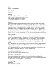
Women's Wartime Roles
Students explore the role of women during times of war. They examine the various roles that women have played in wars throughout United States history and how they have changed over time. In addition, they role-play presentations as if...
Curated OER
How Does Preserving Wilderness Enhance Forestry
Students identify events of the environmental movement in the United States. For this environment lesson students study Theodore Roosevelt and John Muir, who had a great impact on the environmental movement.
Curated OER
My Secret War: Lesson 3
Fifth graders read My Secret War. In this social studies lesson, 5th graders discuss how United States citizens worked together to ensure success in the war. Students discuss primary and secondary sources. Students paraphrase.
Curated OER
The Physical Geography of Australia, Oceania, and Antarctica
Students access information from the United States Geological Survey's Web site This Dynamic Earth to research the Ring of Fire. They answer four questions and then apply what they have learned to create a bulletin board display.
Curated OER
High and Low Tides
Students collect real world data from the Web regarding high and low tides at various locations in the United States. They find a function which models this data and make predictions on tide levels based on the information found.
Curated OER
Landform Tag
Third graders explore various landforms. They play landform tag while exploring the various types of landforms that are found within the United States. Students locate landforms as they are called by the teacher.
Curated OER
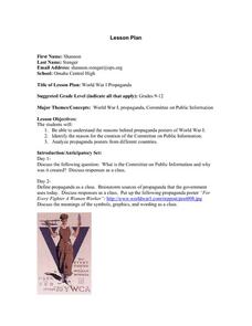
World War I: Propaganda
Young scholars examine propaganda from the World War I era. Using the examples, they identify how they were able to change the opinions of those viewing it. They discuss whether the United States entered the war to find new markets and...
Curated OER
The Inventions and Effects of the Industrial Revolution
Students understand that the Industrial Revolution began in England, spreading to the rest of Western Europe and the United States and with it came an increased demand for raw materials from the Americans, Asia, and Africa.
Curated OER
Yut, a Traditional Korean Game
Students play a Parcheesi type game. They explore a new culture, to compare and contrast likenesses and differences in American and Korean families and leisure time and to experience a traditional Korean game. They identify where...
Curated OER
Women's Suffrage
Pupils investigate the changes of attitudes about Women's suffrage over the passage of time. They read a background on the fight for women's suffrage and its eventual success in the United States and also around the world.
Curated OER
Cruciferous Crusaders Connection
Young scholars explore the agriculture of the United States. In this leafy green vegetables lesson, students complete an activity that requires them to identify the locations where the vegetables are grown.
Curated OER
America's Wars
Students classify information regarding American involvement in wars. In this classification lesson, students examine the causes of the war in which the United States has been involved, and classify them as mainly political, social,...
Curated OER
Maryland’s Chesapeake Bay Landscape Long Ago and Today
Combine a fantastic review of primary source analysis with a study of Captain John Smith's influence on the Chesapeake Bay region in the seventeenth century. Your young historians will use images, a primary source excerpt, and maps...
Other popular searches
- United States Maps
- United States Maps Regions
- Northeast United States Maps
- 50 United States Maps
- Create United States Maps
- Western United States Maps
- Custom United States Maps
- Outline Maps United States
- Blank United States Maps
- United States Landforms Maps
- United States Geography Maps
- United States Political Maps


