Curated OER
Basic Mapping Skills
Establish and study the parts of a map with your class and, then they will work in small groups to create their own detailed map, including a legend. There are specific instructions to follow on what needs to be included.
Space Awareness
The Sun Compass of the Vikings
Evidence shows the Vikings likely navigated by using a simple sundial to find their course. Videos, a short story, and discussion help bring this time period to life as they study European history with a hands-on experiment. Scholars...
Curated OER
Introduction to Field Mapping with a Compass and Pace
Students practice using compass and calibrate their own pace, take field measurements of pre-set course with compass and pace, convert measurements into map, using angles and vectors, and make composite class map by adjusting different...
Maths Revisions
Scaled Drawings
Your carpenters will enjoy learning scaled drawing techniques and applying their new knowledge to make some real-life scale drawings of gardens. Your carpenter scholars will be reviewing some basic skills in a warm-up section of problems...
Curated OER
Christopher Columbus: The Man, the Myth, the Legend
Learn more about maps by examining Christopher Columbus's voyage to the New World. Kindergartners will learn about basic map skills and how to identify the compass rose, oceans, and land masses. They will also discover the purpose of...
Curated OER
Compass Crusaders
Learners discover how to use a compass and how to use that knowledge in the field while applying orienteering and mathematical skills.
Curated OER
Mapping with a Compass: A Simulated Survey
Students use compasses and grids to map the locations of artifacts found in a simulated dig site. In groups, they role-play as future archeologists excavating a school site. Groups begin at their assigned datum and site the artifacts...
Curated OER
Direction and Angle: Positions and Directions
This is an interesting mix of concepts. Half of this presentation provides double-digit addition and subtraction practice and the other half has students discuss cardinal directions and right angles. Use these together, or use them on...
Curated OER
Map Making/Floor Plans/Map Reading
Students apply their knowledge of scale when mapping the classroom. They determine the use of a map legend and orient a map using a compass. They create the classroom maps using transfer graph paper.
Curated OER
TE Activity: The Trouble with Topos
Pupils study the uses of topographical maps including the many forms that they take. They discover that the map features show its intended use such as city maps, wilderness maps, and state maps. They complete a worksheet in which they...
Curated OER
Mapmaker, Mapmaker, Make Me a Map
Second and third graders practice with basic map skills. They create their own map including a legend and a compass rose. This fabulous plan has many excellent websites linked which allow learners to explore maps of all kinds; including...
Curated OER
Journey of the Nez Perce
Students study the retreat of the Nez Perce Native Americans into Montana while tracing their journey on a map. They use the law of cosines to solve problems based on the navigational methods of the Nez Perce. They work with both the law...
Curated OER
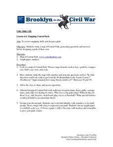
Mapping Central Park
Students use the mapping skills to explore New York's Central Park. They examine a map of Central Park to discover its features. After discussing the characteristics of the park, students design their own dream park and draw it to scale.
Curated OER
Caddo Circle Book
Pupils are introduced to the Caddo Indians of Texas. Using a compass, they draw a circle given specific dimensions and cut them out. Using the text, they read one section abut the Indians and complete the task listed on one of their...
Curated OER
Getting it Right!
Students investigate error. As shown in earlier activities from navigation lessons 1 through 3, without an understanding of how errors can affect position, one cannot navigate well. Students explore how computers can help in navigation....
Curated OER
Treasure Hunt
Students find lost "treasure" using a treasure map after being shown a map that you have created where terms and symbols are discussed. The class is divided into small groups where they locate your treasure and then read a section from...
Curated OER
Are We There Yet?
Students discover how to use maps and why they are important when using a map. They calculate distance using a map scale and time using travel speed and a map scale.
Curated OER
Muppet Treasure Island
Students watch the movie "Muppet Treasure Island" and then taking on roles of characters in the movie answer navigational questions to try discover the location of a treasure hidden by the teacher.
Curated OER
Mapping a Site Using a Coordinate Plane
Learners map their playground as if it were an archeological site. They locate objects on the playground and determine their location using coordinate points. A related lesson is Coordinate Grid: Mapping an Archeological Site.
Curated OER
Lagoon Lake
Students develop skill in using co-ordinates. Up to eight cardinal points of the compass are used making this a useful activity in simple map and grid work. They utilize educational software to gain practice.
Curated OER
Classroom Triangles
Middle schoolers use bearing measurements to triangulate and determine objects' locations. Working in teams of two or three, students must put on their investigative hats as they take bearing measurements to specified landmarks in their...
Curated OER
Measuring the Earth (Eratoshenes' method)
Sixth graders engage in problem solving, communicating, reasoning, and connecting to represent and solve problems, using geometric models.
Curated OER
Where Is Japan? How Far Is That?
First graders use literature and hands-on activities with maps and globes to explain distance and tools used to measure distance. They select tools to measure various objects in the classroom, then apply those concepts to their map...
Curated OER
Public Land
Young scholars examine the needs of their community for public space and determine the solutions to math problems related to planning landscape designs. They read and discuss an article from the New York Times, create their own designs...


