Curated OER
Bedroom Floor Plan
Students identify and compare the characteristics of floor plans and zoning to family activities and needs. They draw an accurate floor plan--either existing or a work in progress to scale. Then, students roughly sketch their bedroom...
Alabama Learning Exchange
Creating a Reflection
Investigate geometric reflections in this geometry lesson. Create geometric reflections that show the reflection across the x and y axis of a coordinate graph. Learners watch a teacher demonstration before proceeding on their own. They...
Curated OER
Interior/Exterior Polygon Angles and Tessellations
Students discover the sum of the interior and exterior angles of several polygons. In this Geometers sketchpad lesson, students work in groups to find the stated measurements of triangles, quadrilaterals, pentagons and hexagons. Students...
Curated OER
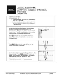
Asymptotes And Zeros of Rational Functions
Budding mathematicians graph polynomial functions and examine their zero and y-intercepts. They analyze how the zero and y-intercepts of the numerator and denominator affect the graph of a rational function. Several great additional...
Curated OER
Earth's Winds, Crust, and Atmosphere
This site provides a variety of activities and worksheets about the problem-based learning activity about Earth and its atmosphere. The lessons can be used separately or together in a geology unit. The resources and charts are very...
Curated OER
Functions and the Vertical Line Test
Young scholars examine functions and function notation. They use computer activities to discover how to graph functions, and conduct a vertical line test. Students describe spatial relationships using coordinate geometry.
Curated OER
Another Dartboard
Fifth graders solve a word problem that involves predicting probabilities of an event and making deductions from probabilities. They discuss dice and coins and the probability of rolling each number or face of the coin, and in small...
Curated OER
Population-Building a Foundation
Students research to find information about populations and complete world maps by labeling the current population, and determining the 10 countries with the largest population. They search the "World Population Data Sheet." On the third...
Curated OER
Pythagorean Theorem Spreadsheet
Studetns use a spreadsheet to organize data on the sides of a triangle. They use the Pythagorean Theorem and the If then spreadsheet function to decide whether the three sides determine a right triangle. Young scholars work individual...
Curated OER
The Hudson's Ups and Downs
Fifth graders practice interpreting line graphs of the Hudson River water levels to assess the tides and tidal cycles in the estuary. They explore how weather can affect water levels and tides and observe that high tides and low tides...
Curated OER
Introducing Powers and Models
Young scholars construct two dimensional models to illustrate squared numbers. For this geometry lesson, students use graph paper and an x/y axis to build squares exponentially. Young scholars identify powers and relationships between...
Curated OER
Biomimicry, Nature: Architecture of the Future
Students explore the relationship between nature and architecture. In this cross curriculum history, culture, and architecture lesson, students observe and discuss structures visible in nature. Students view websites in which Native...
Curated OER
Probability Using M&M's
Students estimate and then count the number of each color of M&M's in their bag. In this mathematics lesson, students find the experimental probability of selecting each color from the bag. Students create pictographs and bar graphs...
Curated OER
Strike a Pose: Modeling in the Real World (There's Nothing to It!)
Adjust this lesson to fit either beginning or more advanced learners. Build a scatter plot, determine appropriate model (linear, quadratic, exponential), and then extend to evaluate the model with residuals. This problem uses real-world...
Curated OER
History's Thermometers
Students explain the concept of paleoclimatological proxies. In this oxygen isotope lesson, students interpret data and make inferences about climate changes in the geologic past.
Pennsylvania Department of Education
Dividing with Fractions
Fifth graders explore the strategies to solve word problems using multiplication and division. In this problem solving lesson, 5th graders recognize the relationship between multiplication and division to solve problems. Students...
Curated OER
Monthly Cost of Living - Food
Students determine how much they would need to feed a family for a month. They plan meals and use Internet grocery stores to find the cost of individual food items. They brainstorm in small groups to come up with 1 weeks worth of menus.
Curated OER
Return Intervals & Reasoning from Tabular Data
Students calculate derivatives from a set of data. In this calculus lesson plan, students estimate the limit at infinity. They complete a Return Interval handout at the end of the lesson plan.
Curated OER
Career Math Puzzles
Third graders come up with a career for each letter of the alphabet.
Curated OER
Collage/Assemblage
Learners identify different shapes and patterns. They locate France on a world map and examine the works of artist, Henri Matisse. They discover shapes that are related to Math.
Curated OER
Moving Rhythms
Students explore the elements of tempo, beat and rhythm. They create rhythm patterns and an original dance. In groups, students perform their phrases for their peers. As a class, they explore choreographic principles, processes and...
Curated OER
Meteorological Predictions
Pupils make a link between prediction and hypothesis in math and science. Based on data collected over one week, students evaluate the predictions of local weather forecasters, compare the predicted outcomes to the actual weather...
Curated OER
Fingerprints
Students analyze their fingerprints. In this fingerprint lesson, students make prints and observe the patterns for arches, loops, and whorls. They write a brief autobiography about themselves titled "I'm Thumbody."
Curated OER
Using GIS to Construct Water Table Maps and Flow Nets
Pupils examine how to use GIS software to analyze patterns of groundwater flow. Seepage lake elevation data from the Sand Hills of Nebraska is used to construct a water table map and flow net using Esri's Arc Map software.

