Curated OER
Geography and Artifacts of Mexico
Pupils review the structure of government in Mexico and discuss how it is different than the United States. Using artifacts, they must label and identify the city or state in which the artifact originated. They use the artifact clues...
Curated OER
Rivers, Maps, and Math
Middle schoolers use maps to locate and label the major rivers of North and South America. Using the internet, they identify forests, grasslands, mountain ranges and other landforms on the continents as well. They compare and contrast...
Curated OER
Mapping the Border
Students create maps of the borderland region. They decorate their maps with colors, pictures, icons, scenes, words that reflect their understanding of the character and history of the borderland.
Curated OER
Foods and Languages of the World
Young scholars review Mexico's location and language and learn to pronouns 10 new Spanish food words. Students listen as the book, Corn is Maize is read, touching and passing around an ear of Indian corn. Young scholars discuss the...
Curated OER
Raton Pass and Glorieta Battlefield
Students complete a variety of activities that go along with the study of and possible fieldtrip to Raton Pass and Glorieta Battlefield on the Sante Fe Trail in New Mexico.
Curated OER
World Hunger - A Cultural Crisis
Students explore the problem of world hunger and starvation. After a class discussion, students use a map to identify specific areas where populations are starving. In groups, students research reasons for the lack of food. They prepare...
Curated OER
The First North Americans
Students identify and interpret the different North American Indian groups, by region, and the type and impact of their interaction with Europeans.
Then they complete an overview of one main Native American group during the age of...
Curated OER
Four Immigrant Groups: Their Lives and Music
Fourth graders examine the experiences of four immigrant groups. Class members brainstorm a list of misconceptions of those groups and discuss if these perceptions are still present today. Using maps, groups locate the countries of...
Curated OER
Establishing Borders: The Expansion of the United States 1846-48
Students investigate how the United States acquired land after the Revolutionary War ended. In this establishing borders lesson, students use maps to identify territories acquired by the US and the states that later developed. Students...
Curated OER
The Roosevelt Presidency
Students explore the history of America from 1900-1912. Students explore how past events and philosophies have affected the management of modern-day conflicts. Through research, students write an essay on the handling of the Panama Canal...
Curated OER
Seas, Gulfs and Bays
Learners define gulf, bay, and sea. In this bodies of water mapping lesson, students locate seas, gulfs and bays and explain how they knew which body of water it was.
Curated OER
Latin America: Places and Regions
Seventh graders create a Latin American portfolio in the form of a country presentation using PowerPoint software. They use their knowledge of geographic concepts to interpret maps, globes, charts, diagrams, and timelines.
Curated OER
Life on the Border
Students discuss different types of boundaries. They research the United States/Mexico border and answer questions about their findings. They create collages, posters, or multimedia presentations showcasing various areas of concern...
Curated OER
Zip Codes
Students discover how a zip code is used. In this zip code lesson, students use the parts of a zip code to find where a letter is going, then find the first number of zip codes based on geographic regions.
Curated OER
Who's The Boss?
Upper elementary and middle schoolers research and analyze some different types of governments. Democracies, Monarchies, and Dictatorships are some of the types that are looked at. Learners use the Internet to gather information that...
Curated OER
Developing a Gateway to the West
Students identify various topographical features that contribute to the growth of a city. They identify how military strategies contribute to the growth of a city.
Curated OER
NAFTA Trade Unit
Students research the geography, economics and government of Canada and how that affects US/Canadian trade relations. For this NAFTA lesson, students play a game, read about Canadian history, and creat a graph.
The Newberry Library
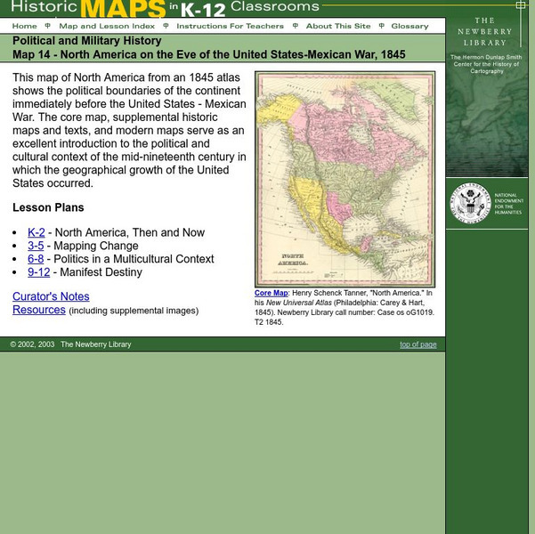
Newberry: Political and Military History: Map 14: u.s. Mexican War, 1845
Lessons for learners in K-12 depicting North America prior to the United States and Mexico War, 1845. Students explore the mid-century political and cultural context in which the U.S. experienced growth and expansion.


