K5 Learning
Landforms
Valleys, mountains, and plateaus are just a few geographic landforms on our Earth. Read about these types and more in a brief landform passage. After reading, learners respond to six short answer comprehension questions.
Curated OER
Landforms
In this landform review worksheet, students use 17 provided terms to complete a paragraph about different landforms. After filling in the blanks, they name 4 kinds of mountains and provide examples of each.
Curated OER
Landforms
In this landforms worksheet, students answer 2 questions about the major land forms and types of mountains. They match 10 landforms and types of mountains with their definitions.
Curated OER
Carve That Mountain
Learners investigate major landforms (e.g., mountains, rivers, plains, hills, oceans and plateaus). They build a three-dimensional model of a landscape depicting several of these landforms. Once they have built their model, they act as...
Curated OER
Across the Landscape
Students create a unique, stunning display of the Earth's landforms. They discuss the many different types of the Earth's landforms such as deserts, mountains, oceans, plateaus, coastlines, and marshlands. Students discuss what...
Curated OER
Geographic Landforms
Each slide is a simple notebook page with one landform in blue and its definition in red. There are 26 vocabulary terms in all, some you may want to use, and others easily hidden. It is recommended that you add photos or other graphic...
Curated OER
Sea to Sky
Students investigate the Earth's major landforms and how they occur, and how engineers apply this knowledge for the design of transportation systems, mining, and measuring natural hazards. They listen to a teacher-led lecture, match...
Curated OER
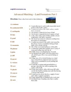
Advanced Matching--Land Formations Part 1
Using this activity, learners could review information they have covered about land forms, such as hills, mountains and plateaus. This 17 question activity could be used with upper elementary or ESL students to test or review information...
Curated OER
Sub-Saharan Maps
In this geography skills worksheet, students draw real or imaginary maps that feature escarpment, rift valleys, gorges, diamond mines, plateaus, mountains, lakes, rivers, and gold mines.
Curated OER
Early Arkansas Geography
Seventh graders locate and describe historical Arkansas while using a historical map.
Curated OER
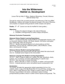
Into the Wilderness: Habitat vs. Development
By studying the once-assumed extinction, then rediscovery of the Ivory-Billed Woodpecker, learners look at the physical changes that have occured in habitats throughout Arkansas. This outstanding lesson is chock full of terrific...
Curated OER
Landscape Picture Map: Natural Features
Students discover six landscapes. In this natural features lesson, students review the meaning and examples of natural features. Students use a landscape picture map to identify six natural features.
Curated OER
The Seven Continents Scavenger Hunt
Who doesn't enjoy an engaging scavenger hunt? Here, scholars listen to, and discuss, the informative text, Where is my Continent? by Robin Nelson. They then explore the seven continents and four major oceans using Google Earth.
Curated OER
The 1927 Flood
Upper elementary and middle schoolers examine the Great Flood of 1927 in the state of Arkansas. They each prepare an oral report about this flood and the huge impact it had on the economics of that time. Additionally, learners research...
Curated OER
Lesson 2 Its a Small World (Day 2)
Students are able to explain how the water cycle recycles the earth's water supply. They are able to make use of the knowledge of land forms learned in social studies. Students are able to form a hypothesis on how/why the water cycle...
Curated OER
Topography of Africa
Young scholars study Africa's diverse landscape and investigate how these features impact the available water supply, food sources, and population distribution of the continent. They compare topographical features and
their affect on...
Curated OER
The Water Cycle
Students simulate the water cycle. In this water cycle lesson, students create a model of the water cycle. Students draw the water cycle and write a paragraph explaining their drawing.
DiscoverE
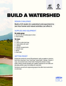
Build a Watershed
What's the best way to learn how watersheds work? Build one! Combining engineering, the water cycle, and ecology concerns, the activity is the perfect fit for an interdisciplinary unit. Teams construct a model watershed with simple...
Indian Land Tenure Foundation
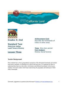
More Tribal Homelands
Here is a very fun idea that introduces young learners to how geographical location affects cultural development. They are introduced to four areas where Native Americans have lived in the past by reading stories and examining images....
Mr. E. Science
Introduction to Earth Science
From the layers of Earth's spheres to latitude and longitude to looking at topographic maps, learners discover the elements of Earth's systems.
Columbus City Schools
Constructive and Destructive Geologic Processes
Show the class the world as they've never seen it before—from way above! Learners try to unravel the mysteries presented by rich satellite imagery, learn to interpret topographic maps, and study erosion by constructing their very own...
Curated OER
Geologic Age
Students investigate radioactivity as a tool for measuring geologic time and how geologists use this information to determine the absolute age of rocks or minerals.
Curated OER
Using Different Kinds of Maps
Third graders explore the landforms and population diversity. They read maps and examine geographic terms. Students create their own map of the United States and answer questions about the location of people. After exploring the map, 3rd...
Curated OER
What on Earth is in the Earth?
Students explore the physical properties of sand, soil, and rocks and sort, classify, compare, and contrast the materials found in the soil. The differences between the living and non-living parts of the soil is discussed.


