Cedar Ridge Elementary
Thinking Map Templates
Help your class understand and organize concepts, facts, ideas, and events with a set of graphic organizers and flow charts. Included in this packet is a bridge map, multi-flow map, flow map, double bubble map, bubble map, circle map and...
ReadWriteThink
Concept Map
When you think of one topic, related ideas and details invariably follow. That's concept mapping! Jot down ideas with a straightforward graphic organizer that works both electronically and as a printed resource.
EngageNY
Close Reading of Bullfrog at Magnolia Circle: Text-Dependent Questions, Main Ideas, and Key Vocabulary about the Bullfrog
As your 3rd grade class finishes reading Bullfrog at Magnolia Circle, the eighth lesson plan of this unit helps readers from an understanding of the very specific information on the final page of the book. As with the entire unit,...
EngageNY
Mid-Unit Assessment: Close Reading of Bullfrog at Magnolia Circle: Bullfrog Life Cycle
The sixth lesson plan in this Bullfrog at Magnolia Circle unit assesses your third graders' ability to read and understand informational text. The included assessment asks learners to take notes about the main idea and supporting details...
Florida Center for Reading Research
Vocabulary: Word Analysis, Meaning Map
Lead young learners to understand new vocabulary with this series of word maps. The first of these organizers asks children to determine the definition and provide examples and descriptions of each word with the help of dictionaries,...
Curated OER
Identifying, Mapping, and Personifying Countries Involved in WWII
Get artsy with this WWII group activity, starting with a whole-class assignment. Create a map of Europe, Northern Africa, and the Pacific using geometric shapes cut from construction paper and placed on the floor. Consider splitting the...
Mathematics Vision Project
Circles: A Geometric Perspective
Circles are the foundation of many geometric concepts and extensions - a point that is thoroughly driven home in this extensive unit. Fundamental properties of circles are investigated (including sector area, angle measure, and...
Curated OER
United States Map- Map Legend/City Symbols
Young scholars investigate the United States map. In this map skills geography lesson, students explore city symbols on the map legend and identify them. Young scholars use post-it notes to mark various symbols.
Curated OER
Countries Involved in World War II
Students create their own floor map of Europe, Northern Africa, and the Pacific. They locate, identify, and speak for one of the countries involved. In addition, they classify the country they represent as an Axis Power or as an Allied...
Curated OER
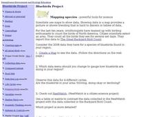
Bluebirds Project: Mapping Species
In this bluebirds project: mapping species activity, students create a map based on data for bluebirds in their area, then answer 5 questions about the mapping of the species. This page has numerous links to helpful web resources.
Curated OER
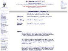
Introduction to the United States Map
Students identify a map of the United States. In this United States map lesson plan, students study a map of the United States and find various locations on the map. Students then locate and list the state that touches their state.
Curated OER
United States Map - Lesson 11
Students explore lakes of the United States. In this geography lesson plan, students identify noteworthy lakes on a map of the United States.
Curated OER
United States Map- State Capitals
Students explore map skills. For this state capital lesson, students view a United States Political Map and identify and use post-it notes to label the state capitals.
Curated OER
United States Map
Students describe cities they are familiar with. In this United States Map lesson, students understand how cities are listed on a map. Students become aware of a map legend and the information in it.
Curated OER
Mapping the Library
Learners compare their school library with another library such as: town library, for example, or a virtual library and identify the most important features. Students use their observations to create a map of the school library that can...
Curated OER
Introduction to the United States Map
Students explore the United States using a map. In this map lesson, students discover how to use a United States map and a globe to locate places.
Curated OER
United States Map- State Capitals
Students explore the state capitals. In this geography lesson, students use a political map to identify the state capitals and place post-it notes on various capitals.
Education Outside
Nature's Treasure Map
Youngsters construct a map of treasures that they find along a nature trail as they hike. They also make sketches and create place names of some of the spots along the trail. Once back in class, pupils use their treasure maps to help...
Novelinks
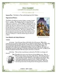
The Hobbit: Concept/Vocabulary Analysis
Considering using Tolkien's The Hobbit for book circles or whole-class reading? Check out this packet that provides an overview of the novel, some interesting background materials, and links to additional resources.
Curated OER
Spider Map
In this language arts worksheet, students examine a blank spider map which could help organize ideas for a report or book response. Students write their topic in the center circle and the main ideas on the slanted lines that connect to...
Curated OER
"Yarning" About Latitude and Longitude
Students identify various locations using latitude and longitude. In this map skills lesson, students use yarn and labels to create a "human globe." Students identify the Prime Meridian, the Equator, and Northern and Southern Hemisphere.
Curated OER
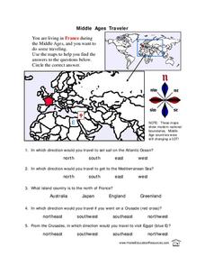
Middle Ages Traveler
In these Middle Ages worksheets, students use the maps to help them find the answers to the questions that help them understand the directions of north, south, east and west. Students also color another map of France according the...
Curated OER
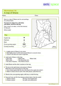
A Map of Ghana
In this Map of Ghana instructional activity, students are given a blank map and key. They are told to label major features and color according to directions.
K12 Reader
Tap on the Map
Work on -ap words with a straightforward exercise. Class members read a short poem that includes plenty of -ap words and respond to three included reading comprehension questions.


