Curated OER
United States Map- Continent, Country, State
Students identify their continent, country, and state on a globe. In this geography lesson, students use a globe to identify the seven continents, the United States, and the state which they live in. Students define key terms.
Curated OER
United States Map
Students compare the United States on a globe and on a map. In this map lesson, students relate the sizes of the continents and locate the United States. Students identify the location of the continental US as well as Alaska and Hawaii.
EngageNY
Examples of Dilations
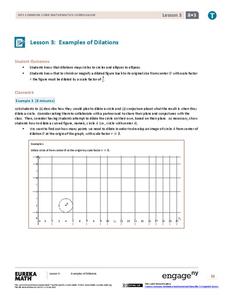
Does it matter how many points to dilate? The resource presents problems of dilating curved figures. Class members find out that not only do they need to dilate several points but the points need to be distributed about the entire curve...
EngageNY
Close Reading of Bullfrog at Magnolia Circle: Predators and Prey
Reading is fantastic, especially when it's reading about bullfrogs. Kids get cozy with predator/prey relationships as they hone their information-reading skills. They start out as they read a portion of the text aloud, then they...
Curated OER
Introduction to the United States Map
Students identify the United States of America and it's states on a map. In this mapping lesson, students examine a globe and find the United States as well as a few land marks (Florida and the Great Lakes). Students then look at a...
Curated OER
Middle Ages Traveler
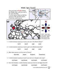
In this map worksheet, students are given three maps of France to use to answer multiple choice questions. Students complete an activity from the perspective of a Middle Ages traveler.
Curated OER
Country Capitals
Students locate country capitals on a world map. In this map skills lesson, students review the definition of the word country and discuss what a capital is. Students locate and label capital cities on a world map using a map marker.
Curated OER
World Map and Globe - Lesson 15 Mountains of the World
Young scholars locate major world mountain ranges. In this geography lesson, students identify major mountain ranges on 6 on of the 7 continents on a large world physical map.
Curated OER
Latitude and Longitude
Students find latitude and longitude on a map or atlas. They create maps with a cruise route. They practice plotting locations given latitiude and longitude.
Curated OER
Reading the World, Then and Now
Students distinguish geographic features using Ptolemy's map of the world.
Curated OER
Bow-Wow County
In this maps and reasoning skills worksheet, students use the 8 clues provided to label the towns on the map. Students make sure the towns they have labeled on the map fit all the clues.
Curated OER
World Map and Globe - Lesson 1 Introduction to the Globe
Learners explore the earth with maps and globes. In this map lesson, students use maps and globes to locate oceans and continents.
Curated OER
The Underground Railroad
Students explore the Underground Railroad routes. In this map skills and Civil War lesson, students use map and globe reading vocabulary and skills to track the routes the slaves followed from the Bahamas to the United States and from...
Curated OER
Cattle Trails
Students identify and locate cattle trails on a globe. For this map skill lesson, students use a marker to locate Texas and Montana and use the map scale to calculate the distance of the cattle trail.
Curated OER
Globe Skills Lesson 4 The Colonial Period
Students practice their map skills. In this Colonial geography lesson, students complete an activity that requires them to locate English colonial locations using latitude and longitude coordinates.
Curated OER
Introduction to the Globe
Students investigate how to use a globe. In this map skills instructional activity, students define what a globe is and locate the various continents on the globe. Students are also asked to locate the four oceans on the globe.
Curated OER
Continents of the Globe
Learners identify the continents on the globe. In this map skills lesson, students define the term "continent" and identify the seven continents on the globe.
Curated OER
Stately Names
In this algebra worksheet, learners complete a word puzzle with clues that links the name to that of a State. There are 26 word problems with an answer key.
Curated OER
Estimate Distances on a Map
In this estimation worksheet, students estimate the distance on a city map based on the scale given to them. Students answer 4 short answer questions.
Curated OER
Maps As Models of The Earth
In this social studies worksheet, students find the different locations on an imaginary map with the focus upon reading retention and application.
Rice University
Algebra and Trigonometry
Move on into trigonometry. An informative eBook takes the content of a College Algebra course and adds more relating to trigonometry and trigonometric functions. The content organization allows pupils to build upon their learning by...
Curated OER
Spherical Geometry: A Global Perspective
Students investigate spherical geometry using a globe and an apple. In this spherical geometry lesson plan, students translate Euclidean geometry terms to spherical geometry terms using a globe. They answer 3 questions about spherical...
Curated OER
Investigating Latitude and Longitude
Learners examine the lines of latitude and longitude on a map, and explain why these lines might be useful. In this lesson students also explore websites that provide information to improve their understanding of how and why latitude and...
Curated OER
Graphic Organizer Collection: Character
In this collection of graphic organizers for a literature unit, students will complete 22 different graphic organizers on the topic of character development. For example, this collection includes character analysis and various attribute...


