Curated OER
Wales: An Interdisciplinary Unit
Young scholars practice basic map and geographic skills as they compare Oregon to Wales. Students color map of Wales and Oregon using color codes to distinguish between land, water, and bordering nations or states, listen to stories and...
Institute for Geophysics
Understanding Maps of Earth
Here is your go-to student resource on primary geography concepts, including facts about the surface of the earth and its hemispheres, latitude and longitude, globes, types of maps, and identifying continents and oceans.
Curated OER
Azimuth and Altitude
Students use a compass and their hands to find positions of stars and planets in the night sky or of the sun during the day.
Curated OER
Vectors
In this vectors worksheet, 10th graders solve and complete 7 various types of problems related to vectors. First, they find the third side and the angle labeled in each right triangle. Then, students resolve each of the vectors into its...
Mr. Head's 6th Grade Classroom
Absolute Location
How do we know where we are in the world? A presentation for middle schoolers explains absolute location and other geography terms such as relative location. It also gives scholars the opportunity to practice finding absolute location on...
Curated OER
Places on the Planet: Latitude and Longitude
Young scholars locate different places on globes and maps by learning about latitude and longitude lines. In this latitude and longitude lesson plan, students identify specific locations based on the degrees of latitude and longitude.
Curated OER
USA State Tag / Mississippi River Shuffle
Students are given the opportunity to play a tag game while studing geographical sites in the U.S.A. (relative to the Mississippi River or to other geographic features you may choose).
Curated OER
Survey of the Louisiana Purchase in 1815
Students explore the survey of the Louisiana Purchase by creating their own surveying and mapping techniques such as natural maps, pace maps, and orienting. Other students then try to follow the maps.
Curated OER
Wind Effects- A Case Study
Students explore hurricanes. In this weather data interpretation instructional activity, students draw conclusions about the impact of Hurricane Floyd as it related to weather conditions. Students read and interpret a tide data...
Curated OER
The Era of Good Feelings
Setting the context for the first part of the 19th century, the slides presented here display the "Era of Good Feelings," including the presidencies of Monroe and Adams. Maps and photographs help students to contextualize the concepts of...
Curated OER
Magellan and Coronado
The best part of elementary school is learning about the explorers. Take your 5th graders on a quick trip with European explorers Coronado and Magellan. Described here are their routes, personal histories, and encounters in the New...
Describing Egypt
Ty Mastaba
Many know the beauty of a pillared hall, but what makes those from ancient Egypt so breathtaking? An eye-catching resource takes viewers on a journey through the Ty Mastaba to discover the importance of pillars to architecture. They see...
Curated OER
The Fact Finders
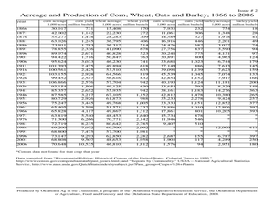
Students analyze agricultural data and make predictions about events in history. In this history lesson, students correlate the relationship between historic events and issues in agriculture to see if there is a correlation. They analyze...
Curated OER
Arthur Young and the President
Students work with NASS data by converting it into prose. In this historical agriculture information lesson, students read about how George Washington communicated information about crop yields, livestock, and land values. They apply the...
Curated OER
George Washington and the First Census of Agriculture
Sixth graders compare modern agricultural statistics with those that are extracted from a primary source letter of George Washington. They complete worksheets and discuss what they have learned.
Curated OER
In the Eye of the Hurricane
In this science worksheet, students read about temperature and thermal energy in a hurricane. Students also draw their own hurricane and label 5 different parts.
Curated OER
Students Slide to School on Air-Powered Sled
Students locate the Great Lakes on a US map, then read a news article about a sled being used as a wintertime school bus in Wisconsin. In this current events lesson, the teacher introduces the article with a map and vocabulary activity,...
Curated OER
Is the Hudson River Too Salty to Drink?
Students explore reasons for varied salinity in bodies of water. In this geographical inquiry lesson, students use a variety of visual and written information including maps, data tables, and graphs, to form a hypothesis as to why the...
Curated OER
Where in the World Is Mexico?
Students practice map-reading skills as they locate Mexico and its cities on a world map. By creating a puzzle out of a map of Mexico, students engage in a meaningful hands-on activity to help them explore that country's geography.
John Wiley & Sons
Build a Pyramid
Learners discover fascinating facts about the Great Pyramid of ancient Egypt and construct a scale model of the pyramid with this fun activity worksheet.
Curated OER
Temperature in a Cultural Context
Fourth graders investigate the effects of temperature on Native American lifestyle and culture. In small groups they conduct research on cultural practices showing a connection to the climate and create a poster displaying their...
University of Wisconsin
Noting Notable Features for Rain Gardens
Eight groups in your class are each responsible for a different aspect of surveying the campus for a suitable rain garden location. Features to consider include water flow, topography, sun/shade patterns, land surface, vegetation,...
Balanced Assessment
County Concerns
Apply area concepts to help farmers and settle county disputes. Scholars use a given diagram and information about an insecticide spraying campaign to determine the monetary benefit to farmers. They then decide which of two counties has...
Curriculum Corner
Earth Day Book
This Earth Day, celebrate our beautiful planet with an activity book that challenges scholars to show off their map skills, complete a crossword puzzle, write acrostic poems, alphabetize, and reflect on their personal Earth-friendly habits.


