Curated OER
Vikings in Vinland
Students examine the role of archaeology in gaining information about past civilizations. After reading an article, they discover evidence of the Viking settlement of North America. They summarize the information in the article by...
California Academy of Science
Tropical Belt
Where in the world is the equator? Explore a world map with your class, coloring in oceans, continents, and rainforests while locating the three major lines of latitude: the equator, Tropic of Cancer, and Tropic of Capricorn. Discuss how...
Alabama Learning Exchange
The Sun and the Earth
Third graders study and diagram the positions of the Earth and sun during the four seasons. They predict weather for cities in the northern and southern hemispheres.
Curated OER
Regions of South America
Students explore facts about South America in the four lessons of this unit. Booklets are created from the materials produced as the class delves into the topic.
Curated OER
Ocean Currents
Fourth graders work in groups to research ocean currents and create posters with their findings. They locate the patterns and names of major ocean currents and identify them on a map. Students also use red pencil to show ocean currents...
Curated OER
Ocean Currents
Young scholars discover the geography of Earth by analyzing water currents. In this oceanography lesson, students create visual references on a map of the globe where and why major ocean currents are moving water. Young...
Curated OER
Ocean Currents
For this ocean currents worksheet, students will use maps of the Atlantic Ocean currents and the Pacific Ocean currents to complete 6 short answer questions.
Curated OER
Stellar Navigation
Middle schoolers are introduced to the concept of stellar navigation. Inside a portable digital planetarium they identify various stars that were used as a navigational tool. They go through several activities in which they attempt to...
Curated OER
Latitude, Longitude, Seasons
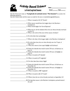
In this latitude and longitude worksheet, students use their classroom notes on both longitude and latitude lines as well as seasons to complete 20 fill in the blank questions.
Curated OER
The Big Crush
Middle schoolers examine weather maps from their state from the past few days. They examine the Highs and Lows on the maps to determine what kind of weather they produce. They use that information to better prepare for their activities...
Curated OER
Landforms All Around
Students create a "Landform Dictionary". They develop an overlay map and participate in hands-on activities to identify the key characteristics of landforms. They discuss the plant and animal life of these areas. Handouts for the lessons...
Curated OER
Stellar Navigation Curriculum
Students investigate the concept of star mapping and how it is used in space navigation. They conduct various activities to see the effect of mapping. Also the teacher uses models and demonstrations in order to communicate the main...
Curated OER
Chart the Weather for Cities Around the World
Students orally describe Northern and Southern hemispheres, identify 7 continents, and point out specific countries and cities. They locate and record weather information.
Curated OER
Latitude/Longitude Activity
Youngsters work in groups to solve clues involving latitude and longitude coordinates in order to decipher mystery animals in this fun learning experience!
Polar Trec
Global Snow Cover Changes
Snow is actually translucent, reflecting light off its surface which creates its white appearance. Pairs or individuals access the given website and answer questions about snow cover. They analyze graphs and charts, examine data, and...
PHET
Where to See an Aurora
Where can you see an aurora in North America? After completing an astronomy activity, scholars can locate the exact coordinates. Pupils plot points of the inner and outer ring of the auroral oval and answer questions based on...
Calvin Crest Outdoor School
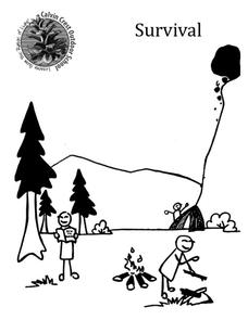
Survival
Equip young campers with important survival knowledge with a set of engaging lessons. Teammates work together to complete three outdoor activities, which include building a shelter, starting a campfire, and finding directions in the...
Curated OER
Latitude
Your young geologists generate a graph given a table of values from the context of latitude and percent of the earth's surface north of that latitude. The questions in the activity then focus the learners to a deeper understanding of the...
Curated OER
How Does the Earth's Energy Budget Relate to Polar Ice?
Students use satellite data to see how radiation budget relates to the ice that is present in the North. In this energy instructional activity students correlate data to see a relationship.
Curated OER
Hurricanes!
Students access hurricane reports form the national weather service online, and draw hurricane paths. They discuss how hurricanes form and move. The research should be reported in a comprehensive presentation that can be given to a whole...
Curated OER
Baseball Challenge - Basic Geography Skills
A fabulous presentation/activity based on geography. The author has designed a "baseball game" where batters advance to the next base if they correctly answer a multiple choice question about geography. Geographic terms are used, along...
Curated OER
Observing the Sky
Students explore astronomy. In this astronomy lesson, students discuss the history of the movement of celestial bodies and then communicate with other students regarding the movements that they observe in the sky nightly. Students...
Curated OER
The North and South Magnetic Poles
In this north and south magnetic poles worksheet, students read about the presence of auroras over the earth's magnetic poles as opposed to the geographic poles. Students use 2 photographs taken by the IMAGE FUV and the Polar instruments...
Curated OER
Travel to Mesoamerica
Students research books, watch movies, and look on the internet to find information on ancient America, Mexico, and Central America. In this Mesoamerica lesson plan, students participate in a social studies unit on North America of the...
