Curated OER
If I Can't See It, How Do I Know It's There?
Young scholars build a model ocean using a variety of materials representing the various levels of the ocean. They collect data about the ocean floor in a partner activity. They practice working with topographical mapping grids.
Curated OER
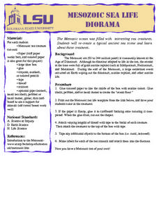
Mesozoic Sea Life Diorama
Learners create a diorama depicting Mesozoic sea life. They color a template and add shells and pebbles to the diorama to depict the ocean floor.
Curated OER
Oceans Away
Young scholars explore oceans. In this science lesson plan, students locate oceans, seas and continents of the world, identify ocean-related occupations, and complete activities pertaining to food chains as well as pollution.
Curated OER
Bathymetric Mapping
Students draw contour lines based on NOAA soundings on a nautical chart. They color the contours and glue label tags for topographic features. They determine that the floor of the ocean is composed of hills, plains, ridges, trenches,...
Curated OER
Density and Convection Currents
Students listen as the teacher explains convection currents in the ocean. They experiment with finding a smoking match in the classroom with their eyes closed. Students discuss what might effect their ability to pinpoint the smoke...
Curated OER
Area
Students solve problems involving area. In this geometry activity, students calculate the area of an object and relate it to the area of the ocean. They define what exactly and area is and then solve problems relating to the real world.
Curated OER
Lost Liners Scavenger Hunt
Students practice research skills by scouring Internet for facts and information about the lost ocean liners Titanic, Lusitania, and Empress of Ireland.
Curated OER
Mapping the Unknown
Pupils explain how early maps of the ocean bottom were made. They describe and execute a method for producing a low-resolution map of a surface that cannot be seen or touched. Students analyze the data from a mapping activity and...
Alabama Learning Exchange
Action at Plate Boundaries
Students diagram the spreading of the ocean floor. In this earth science lesson plan, students read an article on plate boundaries of the ocean. Students are expected to diagram the oceanic convergent boundary, and...
Curated OER
Plate Tectonics Day 3 Sea Floor Spreading: Evidence for Continental Drift
Learners are introduced to Sea Floor Spreading and how it provides evidence for Hess's and Deitz's theory of Continental Drift. They use paleomagnetic data to calculate the rate of Sea Floor Spreading.
NOAA
Wet Maps
How do oceanographers make maps under water? Junior explorers discover the technologies and processes involved in creating bathymetric maps in part three of a five-part series designed for fifth- and sixth-grade pupils. The lesson...
Curated OER
Sea Floor Spreading II
Students import ocean bathymetry data from text files. They then graph these observations along with model predictions to assess the model's ability to simulate observed topographic features of the North Atlantic. Students use Excel to...
Curated OER
Nemo Tag 2
Several students are chosen to be taggers (and wear goggles), 2 more are chosen to be Dorie (and carry the blue fish), and Merlin (and carry the orange fish). The rest of the students are Nemo's. The Nemos begin on one of the mats...
Curated OER
Ocean Life
Students explore the types of plants and animals that can be found in the ocean. They browse books and/or magazines to identify and gain a knowledge base of plant and animal life found in the ocean, then create a collage.
Curated OER
Food Web Mystery
Young scholars describe typical marine food webs, and explain why food is generally scarce in the deep-ocean environment. They discuss reasons that seamounts may support a higher density of biological organisms than would appear to be...
Curated OER
Sea Floor Spreading I
Students use Excel to explore the geodynamics Model equation for ocean depth around a sea-floor spreading center. They complete an introductory tutorial on Excel for students with no prior Excel experience.
Curated OER
Big Fleas Have Little Fleas!
Students study seamounts and learn the importance of structures to species. In this ocean explorer lesson, students participate in an activity that teaches them how to modify a seamount so that they are more suitable for species.
Curated OER
Habitats and Deep Sea Environments
Young scholars examine and identify the characteristics of the four zones of the ocean. They discover the amount of diversity in marine habitats. They also explore the adaptations organisms have that have allowed them to survive.
Curated OER
Diatom Ooze
Learners explore seafloor sediment. In this ocean environment instructional activity, students describe the characteristics of different types of seafloor sediment and oozes. They compare and discuss locations of sediments and oozes by...
Curated OER
Under The Sea
Second graders study how a tsunami is formed by underwater events such as earthquakes, volcanoes or landslides. They discuss what they knew about living and non-living things in the ocean.
Curated OER
TOPSY TURVY MAPS
Eighth graders use the data analyzer and motion detector to collect data and measure distances. They create topographic maps drawn to scale of a given setup and relate the concepts to the creation of historical ocean maps.
Curated OER
Altimetry
Fifth graders accurately measure the distance to eight points on an uneven surface by conducting a simulation of sattelite altimetry. They create a two-dimensional model of the simulated ocean surface by graphing data from the Radar Run...
Curated OER
Tides & Lunar Cycles
Students demonstrate how the moon affects the tides, a neap tide, and spring tides by using their bodies as models. After students observe the model they created, they draw and label the diagram on a provided worksheet. They then log...
Curated OER
Living Light
Learners explain bioluminescence. In this life science lesson plan, students discuss bioluminescence and conjure examples of organisms that carry this trait and how it is useful in their environment.
Other popular searches
- Ocean Floor Landforms
- Ocean Floor Diagram
- Ocean Floor Mapping
- Ocean Floor Spreading
- Ocean Floor Diagram Labeled
- The Ocean Floor
- Ocean Floor Research
- Ocean Floor Models
- Model of Ocean Floor
- Ocean Floor Activity
- Mapping the Ocean Floor
- Ocean Floor Sediments

