Curated OER
TOPSY TURVY MAPS
Eighth graders use the data analyzer and motion detector to collect data and measure distances. They create topographic maps drawn to scale of a given setup and relate the concepts to the creation of historical ocean maps.
Curated OER
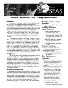
Mapping the Unknown
Pupils explain how early maps of the ocean bottom were made. They describe and execute a method for producing a low-resolution map of a surface that cannot be seen or touched. Students analyze the data from a mapping activity and...
Curated OER
The Rocks Under Illinois
The goal of this fine geology lesson is to have learners create a map that shows how the rock layers are arranged far underground where they can't be seen. The ambitious lesson plan requires high schoolers to learn the law of...
Curated OER
Oceans of the World
Second graders demonstrate their ability to find the five oceans on a globe and on a world map and relate their knowledge of mountains and other physical characteristics of land masses to the physical characteristics of the ocean floor.
Curated OER
If I Can't See It, How Do I Know It's There?
Young scholars build a model ocean using a variety of materials representing the various levels of the ocean. They collect data about the ocean floor in a partner activity. They practice working with topographical mapping grids.
Curated OER
The Distance Between Us and Them: Sea Floor Spreading in the Atlantic Ocean
Students examine how geologists determine rates of sea floor spreading between two tectonic plates. They apply mathematical concepts such as the calculation and use of velocities and conversion from one set of units to another.
Curated OER
Oceanography
Fourth graders define new vocabulary associated with oceanography. They locate and label the four oceans. They also identify features of the ocean floor.
Curated OER
Continents and Oceans on the Move
Students create an awareness of the vast percentage of water covering the earth. They relate similarities/differences between topographical maps and other maps of various time periods. Students examine how to use a topographical map.
Curated OER
Top to Bottom
Marine science classes read about the 2005 North Atlantic Stepping Stones Expedition and review climate change. They use maps to locate the seamount chains. In collaborative groups, they research how climate change may be altering the...
Curated OER
Creature From The Deep
Students become familiar with oceanography terms by writing an oceanography horror story.
Curated OER
Oceans Away
Young scholars explore oceans. In this science lesson plan, students locate oceans, seas and continents of the world, identify ocean-related occupations, and complete activities pertaining to food chains as well as pollution.
Curated OER
Plate Tectonics Day 3 Sea Floor Spreading: Evidence for Continental Drift
Learners are introduced to Sea Floor Spreading and how it provides evidence for Hess's and Deitz's theory of Continental Drift. They use paleomagnetic data to calculate the rate of Sea Floor Spreading.
NOAA
Community Ecology and Sampling
Seamounts in the Coral and Tasman Seas are home to more than 850 different species. Groups explore hydrothermal vents, researching the organisms found there and their energy source. They also learn about seamounts, exploring their unique...
Curated OER
Diatom Ooze
Learners explore seafloor sediment. In this ocean environment instructional activity, students describe the characteristics of different types of seafloor sediment and oozes. They compare and discuss locations of sediments and oozes by...
Curated OER
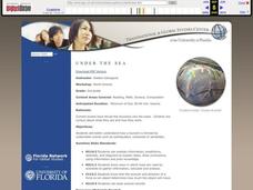
Under The Sea
Second graders study how a tsunami is formed by underwater events such as earthquakes, volcanoes or landslides. They discuss what they knew about living and non-living things in the ocean.
Curated OER
Geography Terms
Students identify different landforms and fill out a worksheet where they explain what each landform is. In this geography lesson plan, students fill in a landform map and then use landform words as they describe the landforms.
Curated OER
Mapping Seamounts in the Gulf of Alaska
Students describe major topographic features on the Patton Seamount, and interpret two-dimensional topographic data. They create three-dimensional models of landforms from two-dimensional topographic data.
Curated OER
Sea Secrets
Students study the following: For centuries, people have been challenged by the mysteries that lie beneath the blue depths of our ocean planet. Very little was known about the ocean until late in the nineteenth century, although nearly...
Curated OER
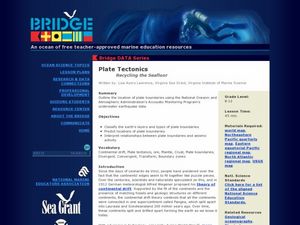
Plate Tectonics: Recycling the Seafloor
Students classify earth's layers and plates using Ocean Seismicity data. In this plate tectonics lesson, students outline where the plate boundaries are on the world map. They then compare these predicted boundaries with USGS map of the...
Curated OER
The Big Blue
Third graders create paper mache globes with balloons. They label the 4 oceans on their balloons with reference to large wall map, classroom globe, and Encarta Virtual Globe CD-ROM projected on large screen TV with Tvator or other...
Curated OER
Finding Our Place in the Community
Third graders search TDC database for images of our hemisphere, continent, ocean, country, state, and city. They identify their place in the hemisphere, continent, ocean, country, state, and city.
Curated OER
A Model of Three Faults
Students investigate faults. In this science lesson, students explore the many stresses and strains in the earth's layers and research the types of faults in their state.
Curated OER
Coral Bleaching in the Caribbean
Students use authentic satellite data on the NASA website to determine when the sea surface temperature meets the criteria to induce coral bleaching.
Discovery Education
Sonar & Echolocation
A well-designed, comprehensive, and attractive slide show supports direct instruction on how sonar and echolocation work. Contained within the slides are links to interactive websites and instructions for using apps on a mobile device to...

