Curated OER
Exploring Climate Change with GIS
Students investigate climatological changes that are occurring to the Earth. For this climate change lesson, students access an assigned web site to view maps and lessons that show how climate change makes a difference to life on Earth.
Curated OER
Finding the Mother Lode
Young scholars engage in a paper treasure hunt to find a lode deposit of gold using the placer deposit concentrations of metals found in stream sediments. They use topographic maps and metal concentrations to assist them. Students...
Curated OER
Size It Up
Students practice their math skills in determining the water/land proportions of the Earth. Using globes, they locate the seven continents and oceans and determine which covers more space. They use this information to participate in...
Curated OER
Biome Web Quest
Third graders create paper mache globes, paint them and label the oceans and the continents. In groups, they research a biome, write about it and create an artistic visual representation of the biome and present it to the class.
Curated OER
Amos and Boris: Text Study
Twenty insightful questions follow a read aloud of the story, Amos and Boris by William Steig. Scholars then show what they know through completion of a cause and effect chart, reading fluency assessment, and a written...
Curated OER
Plotting Plates
Students investigate plate tectonics and their correlation with natural phenomena like earthquakes and volcanoes. They use the internet to see real-time data about earthquakes and volcanoes. Students plot latitude and longitude points on...
Curated OER
Sea Secrets
Students study the following: For centuries, people have been challenged by the mysteries that lie beneath the blue depths of our ocean planet. Very little was known about the ocean until late in the nineteenth century, although nearly...
Curated OER
Ocean Floor
Students identify ocean floor features. In this earth science instructional activity, students predict the object inside a close box to make them realize the difficulties scientists faced then. They label the different zones of the ocean...
Curated OER
Science: Hurricanes As Heat Engines
Students conduct Internet research to track the path of Hurricane Rita. They record the sea surface temperature of the Gulf of Mexico during and after the hurricane and draw conclusions about how hurricanes extract heat energy from the...
Curated OER
Coral Bleaching in the Caribbean
Students use authentic satellite data on the NASA website to determine when the sea surface temperature meets the criteria to induce coral bleaching.
Curated OER
Secrets in a Grain of Sand
Pupils working in small groups examine beach sand to discover signs of erosion, weathering, ocean currents and waves. They present their findings to the class.
Curated OER
Observing Lava Flows
Learners examine the difference between fast and slow spreading lava flows. They identify various types of lava flow and determine the factors that cause them to form. Viewing photographs of lava flows, students working in groups,...
Curated OER
Recent Volcanoes And Earthquakes:
Students investigate the current model for the structure of the Earth. On a world map, they mark areas where they think earthquakes and volcanoes occur and compare those areas with earthquake and volcano location patterns.
Curated OER
A Comparison of Cloud Coverage Over Africa
Students use a NASA satellite data to contrast amounts of cloud coverage over different climate regions in Africa. They explore how Earth's major air circulations affect global weather patterns, and relate to local weather patterns.
Curated OER
Into the Wilderness: Habitat vs. Development
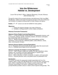
By studying the once-assumed extinction, then rediscovery of the Ivory-Billed Woodpecker, learners look at the physical changes that have occured in habitats throughout Arkansas. This outstanding activity is chock full of terrific...
Ocean Explorer
Looking for Clues
Upper graders become "shipwreck detectives" by studying the debris field from a shipwreck in the Aegean Sea which took place in the 700s. A website is accessed that gives specific information about the debris field, and pairs of...
Curated OER
Leapin' Landmarks: Locating 10 man-made landmarks around the world
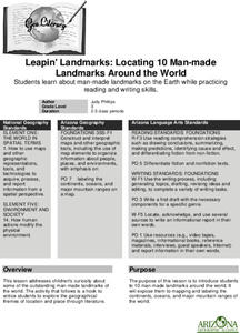
Third graders engage in a lesson which addresses their curiosity about some of the outstanding people-made landmarks of the world. They explore the geographical themes of location and place through literature.
Curated OER
Sea Water Mixing and Sinking
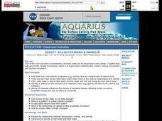
Middle schoolers investigate the role of temperature and salinity in determining seawater density. They use a Temperature-Salinity Diagram to examine the effects of mixing on density.
Curated OER
Where's the Water? Stream Side Science
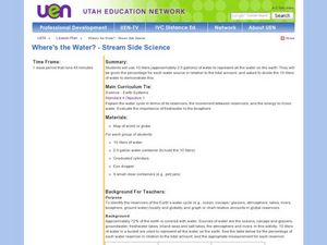
After a whole-class discussion of water reservoirs, ten liters of water are given to each lab group to represent Earth's total amount of water. They divide the water into smaller containers, each representing one of those reservoirs. The...
Curated OER
European Elevation Sort
Given a prepared database of European countries, sixth graders sort the countries in ascending order by elevation and identify the five countries with the highest elevations. This cross-curricular lesson combines elements of computer...
Polar Trec
Where in the World Is Our Teacher?
Kirk Beckendorf, a middle school teacher, joined researchers at the McMurdo Station in Antarctica to help maintain automatic weather stations. The lesson encourages pupils to track his travels around the region. They connect with the...
Curated OER
Tracing Our Own Family Pilgrimages
The Pilgrims may have arrived in North America by way of the Mayflower, but chances are, your class members' ancestors came to the United States in another way. Guide them through an exploration of their own heritage, countries of...
Channel Islands Film
Island Rotation: Lesson Plan 1
How do scientists provide evidence to support the theories they put forth? What clues do they put together to create these theories? After watching West of the West's documentary Island Rotation class members engage in a series of...
Curated OER
A Comparison of Cloud Coverage over Africa
Learners identify different climate regions and local weather patterns. In this cloud coverage lesson students use NASA satellite data and import it into Excel.
