Curated OER
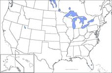
United States Map
In this United States outline map worksheet, students make note of the political divisions of 50 states of the nation. This map may be used in a variety of classroom activities.
Curated OER
Europe Map
In this blank outline map learning exercise, students explore the political boundaries of the continent of Europe. This map may be used in a variety of classroom activities.
Curated OER
Australia Map
In this blank outline map instructional activity, students explore the political boundaries of Australia. This map is labeled and may be used in a variety of classroom activities.
Curated OER
Australia Map: Labeled
For this blank outline map worksheet, students explore the political boundaries of Australia and its provinces and territories. This map is labeled and may be used in a variety of classroom activities.
Scholastic
Organization Outline
Forming a strong organizational outline is important when reading a complex text, writing an informative essay, or analyzing a complicated problem. Use a straightforward organization outline to teach learners about concept mapping.
Curated OER
Nazi Concentration Camps -- Map and Chart-Reading Activities
Students use an informational chart about Nazi concentration and death camps to complete a mapping activity and a chart-reading activity.
TRAIN Educational & Community Services
Multicultural Activities
From catching stars developed by African pygmy tribes to chop stix pick-up or the Hanukkah dreidel, use this list of diverse multicultural activities to help your learners draw connections to unique cultures of the world.
Curated OER
England Outline Map
In this outline map activity, students examine the political boundaries of the England. The map may be used in variety of activities that individual teachers create to accompany it.
Curated OER
Orienteering - Lesson 2 - Topographical Maps
One of the most important skills in orienteering is being able to read a topographical map. Understanding the contour lines and symbols and the scale of the map will make planning your route so much better. In this instructional...
Curated OER
Peace Brainstorming Activity
Students study the topic of peace and use brainstorming techniques to create a clustering diagram. In this peace brainstorming activity, students organize brainstorming material to complete a writing assignment. Students create their own...
Curated OER
Czech Republic Outline Map
In this blank Czech Republic outline map worksheet, learners study the physical boundaries of the country. This outline map may be used for a variety of geographic activities.
Curated OER
Identifying, Mapping, and Personifying Countries Involved in WWII
Get artsy with this WWII group activity, starting with a whole-class assignment. Create a map of Europe, Northern Africa, and the Pacific using geometric shapes cut from construction paper and placed on the floor. Consider splitting the...
Curated OER
Central American Map
In this Central American political map worksheet, students examine the boundaries of this region of the world. The map may be used in a variety of classroom activities.
Curated OER
Romania
In this blank outline map learning exercise, students explore the political boundaries Romania located in Europe. This map may be used in a variety of classroom activities.
Rainforest Alliance
Knowing the Essential Elements of a Habitat
To gain insight into the many different types of habitats, individuals must first get to know their own. Here, scholars explore their school environment, draw a map, compare and contrast their surroundings to larger ones. They then write...
Fremont Unified School District
4th Grade California Relief Map Project
Bring life to your next California geography lesson with this great project! Learners design a three-dimensional wall relief map of California, painting and decorating regions using a variety of materials and labeling major geographical...
Scholastic
STEM Challenges and Activity Sheets for Grades 6–8
From 3-D cities to building bridges, young engineers engage in innovative STEM challenges that promote brainstorming and collaboration. Learners take on the roles of different types of engineers as well as become familiar...
Curated OER
Central and Northern Asia: Political
In this Central and Northern Asia outline map, students examine the political boundaries of the nations in this region and note the location of their capital cities. This unlabeled map may be used in a variety of classroom activities.
Curated OER
Map Skills
Students create two types of maps. In this map skills lesson, students discuss map vocabulary and view maps of Florida. Students draw a free hand map of Florida and include major cities, bodies of water and land forms. Students work...
Curated OER
Maps
Maps, globes, and computer software aid young explorers as they locate state capitols, major cities, geographic features, and attractions for states they are researching. They then use desktop publishing software to create a map to share...
Curated OER
Mapping the Civil War
Students identify the locations of pivotal American Civil War battles. In this map skills activity, students label Fort Sumter, Antietam, Vicksburg, Gettysburg, and the Battle for Atlanta on an outline map. The map is not included.
Curated OER
Map Maker, Map Maker
Map maker, map maker, make me a map! Your class can sing this tune as they work to create their own regional maps by taping paper to the wall, projecting an overhead transparency image, and tracing. Where this lesson plan intends for the...
Curated OER
Outline Map of Japan
In this geography worksheet, students examine a black line outline map of Japan. There is a compass rose on the page. There are no labeled cities.
Curated OER
Food on the Map
Students work together to examine the tastiest towns in the United States. After discovering the names of the equipment, they identify the seven continents. They take a survey and locate the cities and states of the foods mentioned.


