Indian Land Tenure Foundation
Maps and Homelands
You are never too young to learn about maps. To better understand the concept of a homeland, students work together to construct a map of their local area out of paper puzzle pieces. They'll put the maps together and then add details by...
Curated OER
Countries Involved in World War II
Learners create their own floor map of Europe, Northern Africa, and the Pacific. They locate, identify, and speak for one of the countries involved. In addition, they classify the country they represent as an Axis Power or as an Allied...
Curated OER
Using Social Studies in Five Shared Reading Lessons: Geography
After several short 15-minute mini-lessons, your learners will gain an understanding of the characteristics of a non-fiction text. Using the book Map It by Elspeth Leacock, your class will become acquainted with non-fiction terms such as...
Houghton Mifflin Harcourt
Off to Adventure!: Challenge Activities (Theme 1)
Off to Adventure! is the theme of an English language arts unit comprised of a variety of challenge activities. Scholars enhance skills and reinforce concepts by taking part in a grand book discussion, giving an oral report, and writing...
Curated OER
You Are Here
Students map local places and learn to use scale and distance. In this mapping lesson, students map their school and a favorite place. Students recreate their maps showing distance and scale sizes. Students locate their location on a...
SeaWorld
Animal Migrations
Here is a fabulous set of activities for your young scientists. Each lesson contains map, hands-on, and game activities that will help the class understand why and how animals migrate from one place to another. First they'll examine the...
Curated OER
Rivers, Maps, and Math
Students use maps to locate and label the major rivers of North and South America. Using the internet, they identify forests, grasslands, mountain ranges and other landforms on the continents as well. They compare and contrast the...
Curated OER
Mapping Your State's Role in the Vietnam War
Learners recognize reasons to celebrate Memorial Day. Students create a map of victims of the VIetnam War. Using the internet, learners research information about soldiers from their state who were killd in action in Vietnam. Students...
Curated OER
Plate Tectonics: Fifth Grade Lesson Plans and Activities
Fifth graders continue their investigation of the plate tectonics cycle with an exploration of the movement of Earth's crust. During the lab, young geologists conduct an experiment to discover the result of different types of stress...
Curated OER
Boundaries and People
Students map watersheds to find their boundaries. In this watershed activity students map and then give their "watershed address." Students show the trail from stream, larger stream to oceans. Students describe the boundaries of the...
Curated OER
Where Is Rome?
Third graders discover Ancient Rome through maps and worksheets. In this world history lesson, 3rd graders locate Rome on a world map and identify the scope of the Roman Empire. Students label an entire map of Italy after printing one...
Curated OER
Saudi Arabia -- Future city
Seventh graders summarize an article on Masdar. In this summarizing instructional activity students clearly explain three of the four points provided in an outline of the article. The students write an essay and identify six physical...
Curated OER
Mapping School Grounds
Young scholars map and analyze the natural and cultural environment of the school grounds. In small groups, they sketch the natural and cultural features of each side of the school building, create a map, participate in a class...
Curated OER
United States Map - Lesson 11
Students explore lakes of the United States. In this geography lesson, students identify noteworthy lakes on a map of the United States.
Curated OER
Map Memory
Fifth graders, working in a whole class setting, label a United States map with the names of all the states that they know. They transfer the names of the states to an individual map and color it. Next, they receive directions on how to...
Curated OER
Mapping Landforms of South Carolina
Third graders analyze South Carolina maps. In this geography lesson, 3rd graders locate the five land regions in the state are and discuss how the regions are different. Students identify the major bodies of water and analyze how they...
Curated OER
North Africa & Southwest Asia Map Quiz
In this geography skills instructional activity, students examine the blank outline map of North Africa and Southwest Asia. Students label the countries located in the region.
Boston University
Scramble for Africa
In this fantastic simulation, your young historians take on the roles of imperialistic European countries in the nineteenth century and then "scramble" to carve up the continent of Africa! This is a very hands-on activity that will help...
Curated OER
Working With Electronic Topography Maps
Junior geologists examine topographic maps online and learn how to read them. they answer seven associated follow-up questions. This lesson plan is only a general outline and does not provide the details or the websites that you would...
Curated OER
Weather Maps
Students interpret information on a weather map in order to construct a graph, and discuss how the weather impacts their lives.
Curated OER
Things That Stick Out Or: How To Find Your Way Around on a Map
Students explain the meaning of and recognize the map outlines of a peninsula, an isthmus, and a cape.
Curated OER
What's Your Temperature?
Learners take a look at the local newspaper and focus on the weather section. They get into small groups, and each one looks at the same map, but of a different part of the country. They must prepare a presentation that shows how...
Calvin Crest Outdoor School
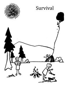
Survival
Equip young campers with important survival knowledge with a set of engaging lessons. Teammates work together to complete three outdoor activities, which include building a shelter, starting a campfire, and finding directions in the...
NY Learns
Geography of the Fertile Crescent by ECSDM
Using Google Earth, a vocabulary assignment, and map handout, your class members will outline the Fertile Crescent in Mesopotamia and identify the source of the Tigris and Euphrates rivers. They will then complete graphic organizers...


