Curated OER
Planning Your Essay
Young scholars discover how to organize essays effectively. In this writing lesson, students construct a spider map to develop their ideas for an essay.
Curated OER
The Water Around Us
Students discuss importance of reading maps and knowing about the geography of the United States, and locate bodies of water on different types of maps and examine how they are used in the state or local community.
Curated OER
Salt Relief Map of Virginia
Fourth graders create a salt relief map of the four regions of Virginia. They indentify land forms and bodies of water, and summarize how they made their project.
Curated OER
Where Am I?
Students apply map reading skills by locating places through the use of latitude and longitude.
Curated OER
An Atlas of Health Care
Pupils use educational software to create an alphabetical directory of maps that indicates the precise location of the community's health care facilities.
Curated OER
Nursery Rhymes
Students recall details of nursery rhyme read by teacher, identify main characters, and demonstrate knowledge of poem by creating concept map about story that includes title, clip art, and changes in font and color.
Curated OER
China: Dim Sum: 3 Mapping Lessons
Fourth graders, after studying maps, draw a very large outline map of Asia and then a large map of China on it in the appropriate place. They label the appropriate information.
Curated OER
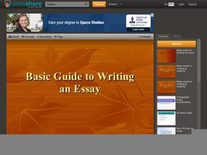
Basic Guide to Writing an Essay
Introducing your class to essay writing? The gentle tone, concise explanations, and clear examples provided by a 17-slide presentation introduces young writers to the expository essay format. All that's missing is a complete essay with...
Miama-Dade County Public Schools
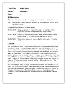
Ancient Rome
This resource outlines several general activities for a study of Ancient Rome, and includes guiding questions, a handout on the story of Romulus and Remus, and ideas for incorporating mapping and timeline activities into your review.
Curated OER
Mapping the Circulatory System
Students investigate the circulatory system in human beings. In this human body lesson, students create an outline of a human body using colored markers and butcher paper. Students use red and blue colors to simulate the...
Curated OER
Organizing Your Ideas Into an Effective Outline
Students explain the components of a speech outline and write an interesting speech.
Curated OER
Map a World of Facts
Pupils mark ten places on a world map while they follow fun facts on the included printable sheet. They research using a variety of resources to determine the location of the ten places.
Curated OER
Early European Explorers Map
Fifth graders create an explorer's map. In this explorers lesson students use a map of the world as reference to draw their own map of Europe, North America, Central America, and the Caribbean Islands. The students use their maps to show...
Curated OER
Three Mapping Activities
Pupils label three maps of China after being introduced to background information about the country. In this geography lesson plan, students color two maps and label various points of interest in China. Finally, pupils draw...
Curated OER
Making a Region Map of a State
Fourth graders create salt maps of a state and indicate its regions. They include topographical elements including mountains, valleys, lowlands and major water bodies and a compass rose.
Curated OER
Mapping Australia
In this mapping Australia worksheet, students locate and label various features and places on a blank map, 10 total. A reference web site is given for additional activities.
Curated OER
Africa Test Map
In this geography worksheet, students examine an outline map of Africa that has all of the countries numbered on it. They write the names of the 54 countries on the lines below the map.
Cornell University
Constructing and Visualizing Topographic Profiles
Militaries throughout history have used topography information to plan strategies, yet many pupils today don't understand it. Scholars use Legos and a contour gauge to understand how to construct and visualize topographic profiles. This...
Happy Housewife
State Notebooking Pages
When learning about US geography, it can hard to remember facts about 50 different states. Help your young scholars organize all of this information with a collection of easy-to-use note-taking guides.
Curated OER
Mush! Tracking Travelers on the Trail
Students get to know Alaska and the Iditarod route that is run by dogs as they track the mushers' progress on a map that they create specifically for the race. They learn about latitude, longitude, plotting on a map, checkpoints, and...
Curated OER
Journey of Discovery and Rivers
Students investigate the rivers encountered and mapped by the Corps of Discovery. They analyze maps, outline and label rivers on a blank map, complete a chart, and answer discussion questions while watching a National Geographic video,...
Curated OER
Community Building
Seventh graders discover the similarities and differences between cities, towns, and rural communities. Using a Neighborhood map Machine, they create a Venn diagram and map of their own community. Students build a 3-D representation of...
Curated OER
How Many Ways Can You Say Merry Christmas?
Students create a multicultural holiday bulletin board map! students research and study saying Merry Christmas in different languages. They correctly locate the countries on a world map.
Curated OER
South American Indian Empires
Students study South American Indian Empires. In this South American Indian Empires lesson, students access an interactive web site to determine the answers to a drag and drop activity. They locate the Mayas, Inca, and Aztecs on a blank...
Other popular searches
- Outline Maps of Europe
- Blank Outline Maps
- Us Outline Maps
- World Outline Maps
- Outline Maps of States
- Outline Maps of Wwi
- Outline Maps United States
- Europe Outline Maps
- Belgium Outline Maps
- Kazakhstan Outline Maps
- Outline Maps (Continents)
- Blank Outline Maps Americas
