Curated OER
Canada's Landform Regions
Students identify and describe the processes that created the landform regions in Canada. They map the regions and research one region to discover more about it. They present their findings to the class.
Curated OER
Greetings!
Learners investigate the ways in which people greet each other. They read a book about greetings, participate in a role-playing game about greetings, interview family members about greeting styles and report their observations to the class.
Curated OER
Push/Pull factors in Immigration
Students explore the push/pull factors experienced by immigrant families. They interview a parent and an American about their family's immigration history. Students write a summary of the interview and compare the push/pull factors of...
Curated OER
Canada's Landform Regions
High schoolers use a atlas to identify and describe Canada's Landform region. Using the information they collect, they create a thematic map of the region and describe all of the physiographic regions and the processes that formed them....
Curated OER
Designing The Character Of Louisiana Purchase Louisianians
Students investigate the history of the Louisiana Purchase. They gather information using a digital library and internet resources. The information is used to construct a detailed summary of how the people of time lived. They also use...
Curated OER
Painting a Neighborhood
Students explore the concept of neighborhoods and identify primary and secondary colors. For this colors and community lesson, students read the book Harold and the Purple Crayon and then discuss the concept of a neighborhood. Students...
Curated OER
Macbeth Madness
Young scholars participate in various social studies activities in correlation to William Shakespeare's Macbeth. For this Macbeth lesson, students study maps of Scotland, England, and Norway to identify locations mentioned in Macbeth....
Curated OER
Sandscapes to Landscapes
Students explore landscapes and create their own in a creative project.
Curated OER
Chart Making for Navigators
Young scholars discuss the importance and function of nautical maps for sailors. They, in groups, take soundings of a simulated bay in a shoebox and develop a nautical chart that enable them to navigate the shoebox safely.
Curated OER
Charting Neptune's Realm: Profiles
Students identify and describe the importance of nautical profiles in early navigation. They draw a profile of a street or mall and explore the effectiveness of different types of directions.
Curated OER
Cutting Down Trees
Learners research what kind of problems force a city or town to decide to remove trees. Students research what controversy has occurred in other cities or towns. Learners interview those responsible for such decisions in your city or...
Curated OER
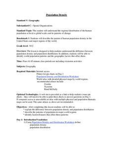
Population Density
Students examine world population density and population distribution. They create pie charts showing population distribution and analyze population patterns in the United States and major regions of the world. They identify...
Curated OER
Around the World At 30o North Latitude
Reinforce the use of an atlas and reference materials with writers. They discover how geographic location can make living easier or harder. They draw an assigned journey on a map, categorize survival needs, and prioritize options during...
Curated OER
Scarcity of Land Throughout the World and in Hawaii
Students discuss the importance of "land." They review the four types of land classification--urban, rural, agricultural and conservation--and participate in an activity involving an apple that demonstrates the use of land in Hawaii....
Curated OER
Location, Location, Location: Civilization's Ultimate Advantage
Students discover how geographical advantages, locational and regional, ultimately led to western Eurasian societies' disproportionate accounting of world power and innovation. They utilize a workbook which can be downloaded within this...
Curated OER
Shake, Rattle and Roll
Students explore how to locate the location of an earthquake and why earthquakes happen more frequently in some areas more than others.
Curated OER
Eminent Domain: Whose Land is it Anyway?
Students research eminent domain and whether or not there has been a land dispute in their community. Students search local newspapers, local history books or talk with civic leaders and long-time citizens and create a chart showing the...
Curated OER
Mapping Perceptions of China
Pupils discuss what types of things are included on a map. They compare and contrast maps of China with a map they create and practice using different types of maps. They write analysis of their classmates maps.
Smithsonian Institution
Watching Crystals Grow
Amazing science can sometimes happen right before your eyes! The class gets cozy as they watch crystals grow. They use Epsom salts, rocks, and food coloring to create crystals. They'll observe the entire process, documenting every step...
Curated OER
Revolutionary Money
Examine paper money from the American revolution! Historians study the paper bills and discuss the history of money. How has money changed over the times? Activities are included.
Curated OER
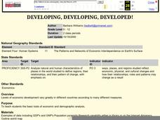
Developing, Developing, Developed!
Students differentiate among and explain various levels of economic development around the world. They see that levels of economic development vary greatly in different countries according to many different measures.
Curated OER
Buying in Bulk
Learners investigate buying purchases in bulk. In this buying in bulk lesson, students consider ways to cut costs and reduce waste in landfills by making bulk purchases.
Curated OER
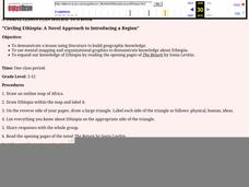
Circling Ethiopia: A Novel Approach to Introducing a Region
Learners read a novel to gain insight into a different region of the world. Using a graphic organizer, they share the information they have already gathered about Ethiopia. They draw an outline map of Africa and read the opening pages of...
Curated OER
2.0 "Water Is Life" Global Water Awareness Mini-Unit (Grades3-5)
Students study the amount of potable water on the Earth. In this water lesson, students examine the amount of potable water as compared to all the water on the Earth. They discuss why many parts of the world do not have access to good...


