Curated OER
Africa Political Map
In this blank outline map learning exercise, students explore the political boundaries of the continent of Africa, the countries located there, and label other geographic features.
Curated OER
Africa Map
In this blank Africa map worksheet, students investigate the continent of Africa and it's political boundaries. No country borders are denoted.
Curated OER
Africa & Asia: Labeled Map
In this African and Asian political map worksheet, students examine national boundaries and national capitals of the continents.
Curated OER
Map Activities
In this geography learning exercise, students follow the directions and shade 3 different regions of a UK political map, shade European Union countries on a political map of Europe, match 4 physical feature of Africa to their...
Curated OER
Africa Outline Map: Labeled
In this Africa outline map worksheet, students explore the political boundaries of the continent of Africa the countries located there. Each of the nations is labeled on the map.
Curated OER
Africa Outline Map
In this outline map worksheet, students discover and investigate the continent of Africa and the political boundaries of its nations. This blank outline map may be used for a variety of classroom activities.
Curated OER
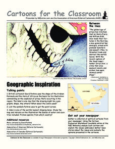
Cartoons for the Classroom: Geographic Inspiration
In this current events worksheet, students analyze a political cartoon about piracy near the Arabian Peninsula and respond to 3 talking point questions.
Curated OER
Cartoons for the Classroom: Geographic Inspiration
A wonderfully graphic cartoon entices learners to read more about issues near the Arabian Peninsula. They will use the provided cartoon and critical thinking question to practice building their analytical and critical thinking skills....
Facts and Files
The Nile
While it may not be possible to take an entire class to Egypt and explore the ancient wonders, it is possible to engage your young historians in activities that ask them to research these and other antiquities and place them on their...


