Curated OER
Discovering the Northwest Territories Through the Five Themes of Geography
Students use the Atlas of Canada to find basic geographical information about the Northwest Territories.
Curated OER
Where Are Our Prime Ministers Found?
Students research the provinces that prime ministers represent, parties that they led, and possible patterns established by the history of politics in Canada.
Curated OER
NAFTA Trade Unit
Students research the geography, economics and government of Canada and how that affects US/Canadian trade relations. In this NAFTA lesson, students play a game, read about Canadian history, and creat a graph.
Curated OER
Some Like It Cold
Sixth graders study Canada's northern territories and four settlements above the Arctic Circle. In this northern Canada lesson, 6th graders maps and timelines to locate physical, political, and economic features of northern Canada....
Curated OER
Historical Research on Explorers of Canada
Eighth graders navigate an online Atlas of Canada to research an explorer. They examine the areas that were explored.
Curated OER
Why Not Come to North Amercia?
Students examine the motives for French expansion into the New World, they evaluate primary source documents to determine who, what, when, where and why.
Curated OER
Nunavut, Our Communities
Students locate the communities of Nanavut on a territorial map and identify community characteristics. They research the online Atlas of Canada
Curated OER
Canada Data Map
Students collect data and analyze it. In this algebra lesson, students collect data on the population characteristic in different regions. They use population, culture, settlement and others to help in their criteria.
Curated OER
The First North Americans
Students identify and interpret the different North American Indian groups, by region, and the type and impact of their interaction with Europeans.
Then they complete an overview of one main Native American group during the age of...
Curated OER
Migrating Across Borders
Learners research and map the migratory patterns of the golden-winged warbler. They develop a strategy to protect this species and, in teams representing different countries, negotiate treaties with each other to protect the bird.
Curated OER
What Do You Bring To The Dance?
Students appreciate the contributions of every Province of Canada. They develop information links with fellow Canadians across the country. They focus on the dynamic interplay between the regions and the federal government.
Curated OER
Parliamentary Structure and Process on " Deck"
Tenth graders design a "deck" of individual slides on Power Point to synthesize, in a graphic organizer, their recently acquired knowledge of different levels of government in Canada.
Curated OER
Grade 8 Unit 4
Eighth graders analyze aspirations and ideals of the people of the new nation, in terms of its physical landscapes and political divisions, and the territorial expansion of the United States during the terms of the first four presidents.
Curated OER
Nunavut, Our Communities
Young scholars research the Online Atlas of Canada to locate the communities of Nunavut. Students examine the geographic area and characteristics of the communities.
Curated OER
Discovering Dinosaurs: Planning your Summer Vacation
Students utilize the features of the Atlas of Canada website to plan an imaginary vacation from Victoria, British Columbia to Drumheller, Alberta.
Curated OER
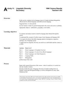
Linguistic Diversity Secondary
Don't be scared off by the title! Read this information packet with your class, or send them off on their own. After each section, you'll find a series of comprehension questions. Great preparation for state testing!
Curated OER
Treaties- Grade 7
Seventh graders examine treaties pertaining to the Canadian natives. In this Canadian history lesson, 7th graders research and discuss the negotiations that took place between the First Nations cultures and the Canadian government over...
Historica-Dominion Institute
Underground Railroad - Secondary
This is a one-day activity to explore the Underground Railroad and its impact on Canadian immigration. Class members explore the government's immigration policies in the past and present. It requires viewing a short video clip and...
Curated OER
What Is a Primary-Source Document?
Students discover what a primary-source document is, what different types there were back in 1867, and what newer kinds there are today. They play a form of bingo using printed cards that reproduce documents related to Confederation.
Curated OER
Role-Playing Jean Talon
Students explore New France. In this New France lesson, students examine census data compiled by Jean Talon in 1665 and 1666. Students take on the role of Talon trying to convince the King of France to increase his investment in New...
Curated OER
Sars
Students discuss the Sars outbreak in 2003. In this biology lesson, students research the effect of the outbreak to the world. They create a public announcement about the topic.
Curated OER
Life on the Border
Students discuss different types of boundaries. They research the United States/Mexico border and answer questions about their findings. They create collages, posters, or multimedia presentations showcasing various areas of concern...
University of Texas at Austin
University of Texas: Perry Castaneda Library: Canada Maps
The University of Texas at Austin provides an extensive collection of maps relating to Canada. Links are given for maps of Canada on many other web sites.


