Curated OER
Site and Situation: Right Place at the Right Time
Middle schoolers put their geography skills to work. In this geography skills instructional activity, students research maps and other primary and secondary sources to simulate the site selection process for the Pennsylvania Railroad...
Curated OER
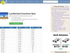
Landlocked Countries Quiz
In this online interactive geography quiz worksheet, students examine the chart that includes details about the population in 44 landlocked countries. Students identify the names of the countries in 5 minutes.
Curated OER
Analyzing the Job Market for Babysitting in Your Neighborhood
Learners conduct research on a neighborhood in Canada. In this data analysis instructional activity, students use data from the 2006 Canadian census to draw conclusions about a population group.
Curated OER
Asia's Global Influence
Middle schoolers explore Hong Kong. For this geography skills lesson, students watch "Asia's Global Influence," and then research the culture, landmarks, and geographic features of Hong Kong. Middle schoolers use their research findings...
Curated OER
Finding Your Way On the Farm
Third graders explore the food industry by viewing a presentation about farming. In this farming geography lesson, 3rd graders view globes and maps while identifying the prime geographical locations for fertile land. Students view a...
Curated OER
"Four" Goodness Sake
Fourth graders recognize that ethnicity, religion and geography are reflected in the food choices we make. In this food choices lesson, 4th graders discuss different types of food from different places. Students compare a menu to the...
Curated OER
The Equator
Learners investigate cultures located along the equator. In this geography skills lesson, students research the geography, history, culture, and tourism of Ecuador, Indonesia, Kenya, Brazil, and Singapore. Learners write an article based...
Curated OER
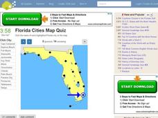
Florida Cities Map Quiz
In this online interactive geography instructional activity, students examine a map of Florida and identify the 12 noted cities on the map using a pull down menu within 3 minutes.
Curated OER
Texas Cities Map Quiz
In this online interactive geography worksheet, students examine a map of Texas and identify the 15 noted cities on the map using a pull down menu within 3 minutes.
Curated OER
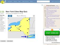
New York Cities Map Quiz
In this online interactive geography activity, students examine a map of New York and identify the 11 noted cities on the map using a pull down menu within 3 minutes.
Curated OER
Let Me Tell You About My State
Fifth graders research one of the 50 U.S. States that they were unfamiliar with. In this U.S. Geography lesson, 5th graders utilize encyclopedias as well as the Internet to research a chosen U.S. State in order to write a report....
Curated OER
Global Connections: Internet Research
In this geography Internet research worksheet, students find out facts about the capital cities of 12 nations. Students then research facts about Australia, and also find out the country of origin for 4 prominent organizations such as...
Curated OER
Regions of the USA
Fourth graders research the physical characteristics of the four regions of the United States. In this geography activity, 4th graders research the four regions and use a quilt square organizer to record notes. Students complete the...
Curated OER
Proud to Live in New Jersey
Students explore New Jersey. In this New Jersey social studies lesson, students define vocabulary and participate in activities centered around the agriculture, geography, industry, history, and culture of New Jersey. Students construct...
Curated OER
This is America
Students explore world geography by viewing a documentary film in class. In this national parks lesson, students view the Ken Burns documentary about the subject and identify the contributions of individuals in support of the parks...
Curated OER
England: Discover a World of Culture and History
England is a very interesting country full of cultural and historical geography. Here is an impressive collection of lessons that will familiarize your students with England's cultural and historical geography. The activities presented...
Curated OER
Terrestrial Ecozones, Population Density and Species at Risk
Tenth graders navigate and use the online Atlas of Canada. They explain the cause and effect relationship between human settlement and the natural environment and wildlife species. They utilize a worksheet imbedded in this plan.
Curated OER
Immigration: Another Perspective
Students research the geography and history of immigration and then take a look at current immigration issues. They prepare biographies, conduct interviews, view films, sample foods, prepare an oral presentation, complete worksheets and...
Curated OER
Geography: Mapping Newspaper Coverage
Students examine the locations of stories appearing in newspapers and determine where to assign reporters. Using various maps, they connect the stories to the correct maps and create charts of the story locations. Students explain their...
Curated OER
HIV/AIDS And Contemporary Population Dynamics
Students describe the spread and occurence of HIV/AIDS at multiple scales. They explain global and regional variations in the occurence of HIV/AIDS and explain the spread of HIV/AIDS in the United States.
Curated OER
The Cultural Geography of Egypt
Middle schoolers describe Egypt's historical, cultural and recreational sites and activities. They explain Egyptian customs and conduct; and apply what they have learned to create a travel brochure about Egypt.
Curated OER
50 States: New England States
Students discover where certain states are located and what the look like. They look for their information on a web site. Each student is assigned a state which they must research then present to the entire class.
Curated OER
The Motivation for Movement
Students explore the geographic theme of movement. In this migration lesson plan, students discuss push-pull factors that motivate immigrants and interpret illegal immigration data. Students also discuss the difficulties that illegals face.
Curated OER
These Maps are for the Birds
Students identify and study New York State Breeding Bird Atlas maps to learn where different bird species nest and how their distributions have changed over time. They also identify how maps serve as representations of a geographic...
Other popular searches
- Population Geography Graph
- Population Geography Map
- Geography Population Density
- Geography World Population
- Population Geography Factors
- Population Geography Data
- Population Geography Brazil
- Geography Population
- Geography Italy Population
- Geography Population Change
- Population Geography India
- World Geography Population

