Curated OER
Island Biogeography and Evolution: Solving a Phylogenetic Puzzle With Molecular Genetics
Students engage in solving a logic problem based on real organisms and real data. They develop phylogenies for seven related populations of lizards living on the Canary Islands.
Curated OER
Our Watershed
Learners work with the Tribal Council and Elders to explain the historical importance of the area's watershed. They develop a model of the watershed and map the route of water flow from the watershed to the ocean.
Curated OER
Life During the Civil War for Women and Civilians
Students follow an overview of the American Civil War from a film, the text and/or teacher direct instruction. They create a timeline with a large map of the U.S. in the 1860's available for student reference as they do the spider activity.
Curated OER
A Flip of Life in the 13 Colonies
Fourth graders create a flip book illustrating the 13 original colonies. They study the growth and development of each of the three groups of the original colonies. They use maps to observe and interpret geographic information and...
Curated OER
Louisiana Regional Foodways
Students strengthen their research techniques in locating, selecting, and synthesizing information from a variety of texts, media, references and internet resources to study regional food way traditions in Louisiana. They assess the...
Curated OER
Louisiana
Third graders study factual information about Louisiana including the state flag, bird, tree, and important geographical points using the Internet and maps. They explain the different groups that settled the state in this mini-unit.
Curated OER
Border to Border
Students use the Internet to gather information on the country of Mexico. They also discover the culture of their people and compare them with the United States population. They take a virtual tour of some of Mexico's most historical ruins.
Curated OER
Countries of South America
Students focus on the geography of the countries of South America. Using a map, they identify the European countries who claimed the South American countries and research the influences they had on South America. To end the lesson,...
Curated OER
Foreign Language: Travel Brochure
Students research either French or Spanish speaking countries. After compiling information covering the geography, people,government, economy, and culture, they produce travel brochures on their respective countries.
Curated OER
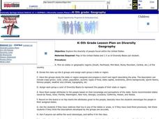
Diversity
Students work in groups to research and prepare an oral report about a region. In this regions lesson plan, students find out about the geography, population, state capitals, and landmarks. Students assign attributes to the...
Curated OER
Comparing Countries
Students compare facts about different countries. In this comparing lesson, students collect information about the US and another country and compare them. Students locate countries on the map and make a hypothesis about the lives of...
Curated OER
Push/Pull Factors and Welsh Emigration
Students view and discuss short sections of movies that relate to immigration. Working in groups, students create a map that shows directions of internal migration in their assigned geographical area. Students review ads/booklets created...
Curated OER
Journeys...The Voices of Change
Students trace the immigration patterns of their ancestors. They plot information on a world map, develop a timeline of target immigration patterns, research and write a report on immigration and participate in a class play.
Curated OER
Urban and Agricultural Settlements Why are They There?
Seventh graders identify types of human settlements, urban and agricultural, and determine geographic influence on why people settle where they did by use of maps and charts. They, in groups, identify the needs of a new settlement, which...
Curated OER
Our Fifty States
Seventh graders identify and locate all fifty states in the United States and their capitals. Individually, they research one state identifying when it became a state, its motto, song, flower and nicknames. To end the lesson plan, they...
Global Oneness Project
Documenting Architectural Heritage
Imagine going from being one of the richest, most important cities in the world to one of the poorest. Imagine the history captured in the architecture of such a city. Imagine these same now abandoned buildings being destroyed. How would...
Curated OER
Biggest Cities in Each State Quiz
In this online interactive geography quiz worksheet, students examine the chart that includes the names of 50 U.S. states. Students identify the names of the two largest cities in each state in 8...
Curated OER
Location of Cities 201
Students work in pairs to locate the ancient cities on a world atlas using the longitude and latitude measurements. They examine the physical and human futures that explain their locations.
Curated OER
A Sense of West Virginia
Students consider their perceptions of the world through their 5 senses while visiting the West Virginia State Museum. In this West Virginia history lesson, students discover how knowing about the past helps with their understanding of...
Curated OER
City to Country Quiz
In this online interactive geography quiz instructional activity, students examine the chart that includes 20 world cities. Students identify the names of the countries where the cities are located in 4 minutes.
Curated OER
Country Flags Quiz
In this online interactive country flag quiz instructional activity, students examine the 20 pictured country flags and try to name all of the countries represented in 4 minutes.
Curated OER
Famous Streets Quiz
In this online interactive geography quiz worksheet, students examine the chart that includes the names of 18 famous streets in the world. Students have 4 minutes to identify the names of the cities where the streets...
Curated OER
State Nicknames Quiz
In this online interactive geography quiz worksheet, students examine the chart that includes the names of 49 states. Students identify the nicknames of the states in 6 minutes.
Curated OER
Famous Lakes Quiz
In this online interactive geography quiz worksheet, students examine the chart that includes details about 15 famous world lakes. Students identify the names of the lakes in 3 minutes.


