Curated OER
What do Maps Show?
Seventh graders practice reading maps. In this geography lesson, 7th graders compare a topographical map to a picture of the actual place.
Curated OER
Mapping and Topgraphy- 8th Grade
Eighth graders practice interpreting a contour map as well as reading latitude and longitude in a team activity. Following a discussion on mapping terms, teams are given maps and estimate the distance between two points. Students...
Curated OER
Common Themes
Tenth graders test usefulness of a model Earth by comparing its predictions to observations in the real world. In this landforms lesson students construct an island from a contour map using model clay then analyze the landscape features...
Curated OER
Planning A Railroad Online Lesson
Students plan a route across Donner Summit using topographical maps in order to understand the challenges involved in constructing the railroad in the Sierra Nevada Mountains. In this history lesson, students first discover how to read...
Curated OER
Planning a Railroad Online Lesson
Students design a train route using a topographical map. In this historical and spatial thinking lesson plan, students must plan a route through the Sierra Nevada mountains that a train could physically travel. Links to printable student...
Curated OER
Theobroma - Food of the Gods
Students discuss the history of cacao and its use in the production of chocolate. They analyze actual cacao pods and record their observations. Finally they create a five minute contour drawing of the cacao pod and seeds.
Curated OER
The Great Topo Race
Students create a three dimensional island out of cardboard to examine how to read and use a topographical map. They make sure that their island can sustain life and that it has one volcanic mountain peak. They trace the parts of their...
Curated OER
Mapping The Ocean Floor
Young scholars explore and analyze the bottom structure of underwater habitats. They describe and explain what can't see through the collection and correlation of accurate data. Learners assess that technology is utilized as a tool for...
Curated OER
Topography: Know the topography of your neighborhood
Students read and identify features on a topography map. In this topography lesson plan, students learn how to read a topography map, and then go out and take pictures of their own and discuss the topography pictures they took.
Curated OER
Topo Triangulation
Students investigate how to read a topographical map and triangulate with just a map. They convert a compass measurement to a protractor measurement, reverse a bearing direction, and using a worksheet take a bearing of certain landmarks...
Curated OER
Mapping the Ocean Floor
Young scholars study the bottom structure of underwater habitats and how they can be mapped.
Curated OER
Tooling Around Arizona: Reading Arizona Maps
Students study geography. In this Arizona maps lesson, students develop their map reading skills. They have class discussions and work independently with various copies of Arizona maps to practice those skills. This lesson mentions...
Curated OER
A Thoreau Look at Our Environment
Sixth graders write journal entries o school site at least once during each season, including sketched and written observations of present environment. They can use sample topographical maps and student's own maps. Students can use...
Curated OER
Shoes and the Backyard Landscape
Your shoes get a lot of mileage in familiar places. Represent the places you have traveled the most with an art project based on a print of Indian People Wear Shoes and Socks by Juane Quick-to-See Smith. Kids trace their shoes and draw...
Curated OER
Plotting the Petroleum Plume
Eighth graders examine the difference between confining layers and aquifers in a basic water table aquifer scenario. They contour groundwater elevation and petroleum product thickness data.
Curated OER
What's Its Slope
Students identify the slope of a lines.In this algebra lesson, students define the meaning of slope and write an equation given the slope. They graph linear functions using the slope and y-intercept.
Curated OER
Air Masses & Fronts
Students use a set of maps depicting a front passing through the state to identify two distinct air masses and the frontal boundary. They then deterine whether the front is moving in time and in what direction the front is moving.
Curated OER
Mapping Seamounts in the Gulf of Alaska
Students describe major topographic features on the Patton Seamount, and interpret two-dimensional topographic data. They create three-dimensional models of landforms from two-dimensional topographic data.
Curated OER
Exploring Our Watershed System
Students examine how watershed systems are made up, and visit the Susquehanna watershed system and map out the system. They evaluate the order of watercourses in their area.
Curated OER
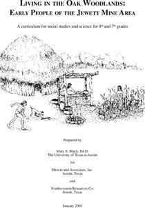
Living in the Oak Woodlands: Early People of the Jewett Mine Area
Students examine the archeology and native peoples of the Jewett Mine area of Texas. Using a map, they explain the economic patterns of the native groups and how the geography of the area affected activities. They compare and contrast...
Curated OER
Living in the Oak Woodlands: Early People of the Jewett Mine Area
Students are introduced to the early peoples living in the Jewett Mine area. After viewing transparencies, they view pictures of the mine today and its main area of production. For each picture, they develop symbols and captions about...
Science Education Resource Center at Carleton College
Serc: Geo Map App Learning Activities: Rules of Contouring
Using GeoMap software, students learn how to read topographic maps, and the rules for using contour lines on a map. Detailed teacher and student handouts are provided. (GeoMap software can be downloaded at: http://www.geomapapp.org/.)
Science Education Resource Center at Carleton College
Serc: Visualizing Topography
This module helps students learn to identify terrain features on topographic maps. Students manipulate animations of hills, valleys, and cliffs to see the terrain from various angles. The module also provides instruction on how to read...
Alabama Learning Exchange
Alex: Let Them Eat Cake! Topography Lesson
Contour lines on topographic maps require visual processing to read and interpret. This hands-on activity helps give a tasty mental image.


