Curated OER
Volcano Contour Models Activity
Young scholars experiment with water levels and plastic topographic volcano models to determine the contour lines that would be used to create a topograpohic map of a volcano. They use the traced lines to actually develop the map.
Curated OER
Orienteering - Lesson 3 - Topographical Maps and Contour Lines
Learn how to read a topographical map and understand what the contour lines mean. Explore longitude and latitude. Find a cliff, a valley, a mountain peak, and more. This is just one of the ten lessons in this unit on oreinteering....
Curated OER
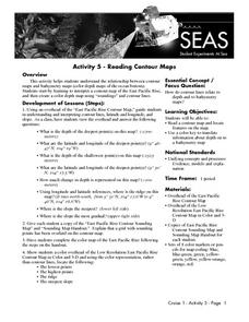
Reading Contour Maps
Young scholars examine contour maps and bathymetry maps and discover how to interpret a contour map of the East Pacific Rise. Students look at a map as a class and answer questions together before working independently on a map of the...
Curated OER
What Do Maps Show?: Lesson 4 How to Read a Topographic Map
Students examine the use of topographic maps as two dimensional representations that show elevations and slopes with contour lines. They read maps of the Salt Lake City, Utah area and complete the associated worksheets that show map...
Curated OER
Topographic Maps
In this topographic map worksheet, students learn how to read a topographic map and create a topographic map of their own using clay or Play-Doh. Students include contour lines by layering the clay. Students answer 6 questions about...
National Geographic
Mapping the Shape of Everest
With Mount Everest as the motivator, your earth science class learns about topographic maps. Begin by showing a film clip from The Wildest Dream: Conquest of Everest, featuring fearsome virtual imagery of a path up world's tallest peak....
Curated OER
Tracing Highs and Lows in San Francisco
On a topographic map, students identify the scale bar, north arrow, and contour interval. They then locate a hill on the map and make note of the contour lines. Students then locate other places with similar contour line patterns....
Cornell University
Constructing and Visualizing Topographic Profiles
Militaries throughout history have used topography information to plan strategies, yet many pupils today don't understand it. Scholars use Legos and a contour gauge to understand how to construct and visualize topographic profiles. This...
Curated OER
Changing Planet: Sea Levels Rising
Begin by showing a six-minute video, Changing Planet: Rising Sea Level as an anticipatory set. Pupils draw a topographic map of a potato continent. Finally, they will visit NOAA's sea levels online map and NASA's carbon dioxide...
Curated OER
Orienteering - Lesson 2 - Topographical Maps
One of the most important skills in orienteering is being able to read a topographical map. Understanding the contour lines and symbols and the scale of the map will make planning your route so much better. In this lesson, partners get...
Curated OER
Understanding Topographic Maps
Underclassmen create a cone-shaped landform and then draw a contour map for it. Then they examine a quadrangle (which was easily located with an online search), and relate it to what they experienced. The accompanying worksheet is...
Curated OER
MAPS AND TOPOGRAPHY
Learners analyze the details of a topographic map and create one of their own by utilyzing a map of elevations.
Curated OER
"Potato Mountain": Reading/Understanding Topographic Maps
Students investigate how to read topographic maps. For this map reading lesson students complete a topographic map activity.
Curated OER
Cookie Topography
Students construct a cross section diagram showing elevation changes on a "cookie island." Using a chocolate chip cookie for an island, they locate the highest point in centimeters on the cookie and create a scale in feet. After tracing...
Curated OER
Volcano Contour Models Activity and Tracing the Highs and Lows in San Francisco
Learners investigate how to draw topographic contours and read topographic maps.They examine the topography of San Francisco and contrast the elevation of different points within San Francisco.
Curated OER
Map Skills
Do you need to practice map skills? Children with a range of abilities will complete a KWL chart about maps, practice important map vocabulary and then read a few pages from their textbook. They will use their vocabulary words and...
Curated OER
Introduction to Topographic Maps
Tenth graders create a topographic map and see how it represents different elevations. In this topographic maps lesson students read and interpret topographic maps.
Curated OER
Lesson Design Archaeology- USGS Maps
Students research USGS maps and identify the major features. In this map skills lesson, students identify low and high elevations on a USGS map and practice finding latitude and longitude.
Curated OER
Put Your Face on the Map
Young scholars investigate topography and contour lines by examining a human face. In this mapping lesson, students create a plaster cast of a face and create a map of the contours of the face one centimeter at a time. Young scholars...
Curated OER
Reading A Weather Map
Ninth graders construct a weather map. For this meteorology lesson, 9th graders construct a weather map using contour lines and temperature.
Curated OER
Making Topographic Maps and Mountain Profiles
Students study how to mark inclines and construct a mountain profile. In this topographic map instructional activity students mark contour intervals and draw mountain profiles.
Curated OER
Working With Electronic Topography Maps
Junior geologists examine topographic maps online and learn how to read them. they answer seven associated follow-up questions. This lesson plan is only a general outline and does not provide the details or the websites that you would...
Curated OER
Introduction To Topographic Map Activities
Students discuss different types of maps, their similarities and differences. Using a Topographical Maps CD-rom program students create their own map.


