Curated OER
Where In the World Are We?
Fifth graders read postcards and find their locations on maps. They use the pictures and text on the postcards to write about imaginary vacations. They compute the mileage and compare it to TripMaker data.
Curated OER
Solar System: The Four Inner Planets and Earth's Moon and Astronauts
Second graders read THe Magic School Bus: Lost in the Solar System. For this language arts and science lesson, 2nd graders explore the four inner planets. Students view the inner planets using Google Earth.
Curated OER
Making Sense Of A Round World On A Flat Surface
Students engage in a lesson that is concerned with the development of geography skills. They take part in a number of activities that center around finding and traveling to different locations. The lesson has resource links that can be...
Curated OER
A Bird's Eye View of our 50 States
Third graders focus on state birds as they learned absolute location (latitude/longitude) of each state, as well as their relative location (bordering states).
Curated OER
Where Oh Where on the Playground, Do I Love To Be?
Students listen to poem, Where Oh Where On the Playground, Do I Love to Be?, and practice reading, interpreting, and making maps, charts, and graphs in surveying classmates and discussing their favorite places to play in school playground.
Curated OER
How Worldly Are You?
Sixth graders locate and map six components to have a working knowledge of maps. In this map skills lesson, 6th graders define the six map components and work in groups to draw a map using the components. Students read a related...
Curated OER
Outlandish Landforms
Seventh graders examine landforms. In this world Geography lesson, 7th graders research and create a physical model of a chosen landform. They then draw a 2-d paper map of that model.
Curated OER
Using a Preview Checklist with Informational Text
Sixth graders identify information from texts by working in pairs using Wikki Stix or highlighting tape to locate, mark, and read items on preview checklist. Students then compare what they marked with what another pair marked.
Curated OER
Mountain Magic: Identifying the Basic Physical Characteristics of Mountains
Learners read about and identify on maps the physical characteristics of mountains. For this mountains lesson plan, students also write about the characteristics using personification.
Curated OER
Between the Rivers
Second graders compare and contrast historical American cultures. In this American history lesson, 2nd graders participate in reading, writing, oral, and hands on activities. Students discuss the similarities and differences...
Curated OER
Wetlands: Pave or Save?
Students discuss the characteristics of wetlands and how to make them more productive. Using a map, they locate the major wetlands in the United States and color them using a key. They read an article and in groups answer discussion...
Curated OER
What is the Population Distribution of Cartoon Characters Living On the Pages of Your Newspaper?
Students read various cartoons in their local newspaper and calculate the population demographics, spatial distribution and grouping of the characters. Using this information, they create a population distribution map and share them with...
Curated OER
Using "Why Mosquitoes Buzz in People's Ears" to Teach Cause and Effect
Learners discuss cause and effect relationships and the chain reaction involved before listening to the story "Why Mosquitoes Buzz in People's Ears". Students create flow charts to show the chain reactions of causes and effects in the...
Curated OER
Lights On ! Lights Off! Exploring Human Settlement Patterns
Third graders write informational paragraphs based on the settlement patterns of the United States. In this settlement lesson plan, 3rd graders read about population and how it affects where people settle next.
Curated OER
Why Not Visit My Country?
Learners research a country using the Travel Languages Web site. Using MS Publisher, they create a travel flyer about the country. Using Inspiration, they develop a concept map of what they learned about their country.
Curated OER
de Soto's Expedition: An Alternate Route
Eighth graders interpret historical evidence presented in primary and secondary resources. In this Exploration Age lesson, 8th graders compare historical maps with new maps focusing on the route of Hernado de Soto.
Curated OER
Landforms And The Oregon Trail
Fourth graders investigate the historical context for the founding of The Oregon Trail. They conduct research to put together the events that led to the geographical route that was taken. The lesson also strengthens geography skills with...
Curated OER
Different Perspectives of Oregon's Forest Economic Geography
Students map data on employment in wood products manufacturing in Oregon counties. In this Oregon forest instructional activity, students discover the percentage of people employed in the forest manufacturing industry. Students create a...
Curated OER
Introduction to Tibet
Students explore Tibet. In this Tibet geography and culture lesson, students work in groups to read and summarize a data set pertaining to a particular cultural aspect of Tibet. Students present information from their data retrieval...
Curated OER
Columbus' Perception of the New World
students investigate readings relating to the voyage of Columbus in 1492 and to make historical connections based on those readings. They form pairs to share insights and answer specific questions, and share information in a final class...
Curated OER
Wet Water, Dry Land
Students observe and examine relationship between landforms and bodies of water, recognizing differences between them. Students then define island, peninsula, isthmus, archipelago, lake, bay, straight, system of lakes, and identify land...
Curated OER
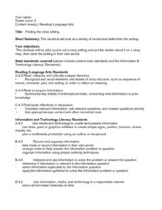
Finding the Story Setting
Second graders discuss important things to know when reading stories, identify setting in variety of stories, create story map to record information as they are reading, state setting in their own words, discuss whether they thought...
Curated OER
Comparison of Snow Cover on Different Continents
Pupils use the Live Access Server (LAS) to form maps and a numerical text file of snow cover for each continent on a particular date. They analyze the data for each map and corresponding text file to determine an estimate of snow cover...
Curated OER
The Woman Who Outshone the Sun
Third graders read the story "The Woman Who Outshone the Sun" from the Scott Foresman reading series. They create puppets and a setting out of a shoebox and retell the story with props. They research the Oaxaca region and the Zapotecs.


