E-learning for Kids
E Learning for Kids: Math: Bus Station: Position on a Map
Help Jamal read maps, describe directions, and identify coordinates in this series of interactive exercises.
US Geological Survey
Usgs: Finding Your Way With Map and Compass
This resource has a topographic map that tells you where things are and how to get to them. Use this site to help you use a map and compass to determine your location.
University of Texas at Austin
The Perry Castaneda Library Map Collection
This collection contains more than 250,000 maps covering all areas of the world, and ranging from political and shaded relief maps to the detailed and the historical. Select from a region of the world or an area of highlighted interest.
Curated OER
University of Texas: Small Map of India
See India's major cities and rivers in this easy-to-read map from the Perry Castaneda Collection.
BBC
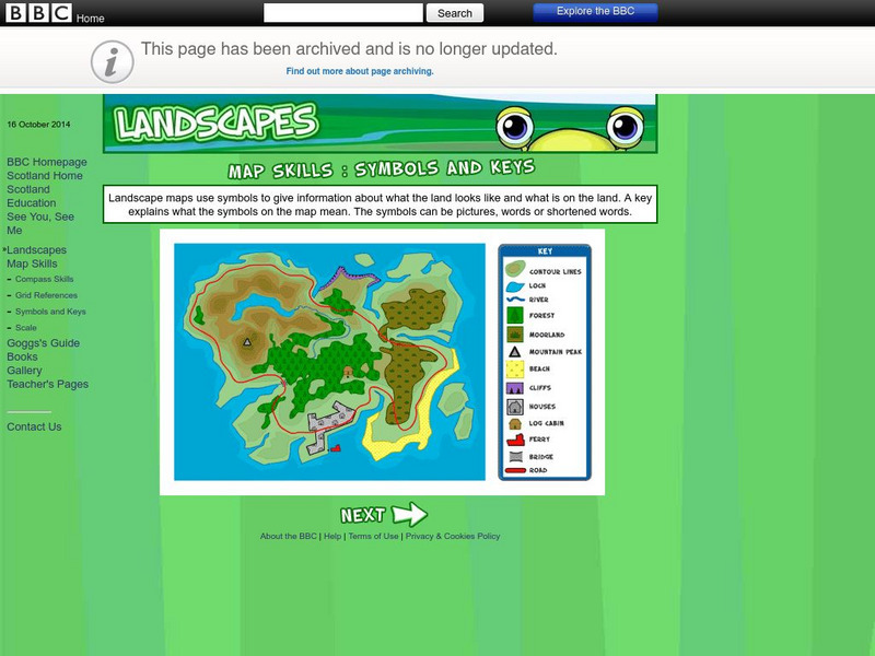
Bbc: Landscapes: Map Skills: Symbols and Keys
A guide for young learners to understand reading maps and their keys.
Curated OER
Burma Political Map
An easy to read political map of Burma. Be sure to scroll down to see a satellite image of Burma from Google Earth. You can also find some facts about Burma at the bottom of the page.
ClassFlow
Class Flow: Map Skills Germany
[Free Registration/Login Required] In this lesson map skills are reinforced by identifying physical features in Germany. Mountains, rivers, lakes, and land elevation are discussed. Political maps identify population and cities.
ClassFlow
Class Flow: Map Key
[Free Registration/Login Required] This flipchart introduces the purpose of a map, map symbols, and the map key or legend. Activote questions reinforce the concepts.
University of California
Us Geological Survey: Cartogram Central
The USGS offers detailed information on Types of Cartograms, Congressional Districts, Software for Cartograms, Publications, and a Carto-Gallery.
Curated OER
Geology.com: Burma Map: Burma Satellite Image
An easy to read political map of Burma. Be sure to scroll down to see a satellite image of Burma from Google Earth. You can also find some facts about Burma at the bottom of the page.
Library of Virginia
Virginia Memory: My County Tis of Thee: Counties of Virginia
A lesson in how to use historical maps to identify Virginia's counties and learn the political geography of Virginia.
Library of Congress
Loc: American Memory: George Washington: Surveyor and Mapmaker
Most Americans know George Washington as the brilliant military and political leader; but as a young man, he was a surveyor by trade. Follow his career through this easy-to-read narrative complete with his early maps and surveys.
Geographyiq
Geography Iq: Bangladesh
Much historical information and current facts about Bangladesh are given in this well organized and detailed site. Quick facts are displayed in easy to read charts.
University of Illinois
University of Illinois: The Legacy of Mc Carthyism
An essay addressing the ramifications of false accusations made against academics, politicians, and cultural figures during the McCarthy Era. Read about the consequences not only for the individuals but for society in general.
Central Intelligence Agency
Cia: World Factbook: Austria
See a map of Austria and read about the country's geography, government. people, economy and more.
Curated OER
Burma Satellite Photo
An easy to read political map of Burma. Be sure to scroll down to see a satellite image of Burma from Google Earth. You can also find some facts about Burma at the bottom of the page.
Other
Escolar: Mapas De Continentes, Mapas Politicos Y Mapas De Paises
Check out this sizable selection of different maps of continents, countries, and states. Each page will give you additional information about the particular country or state.
Curated OER
Link to Map of Battle of Ball's Bluff
Read a description of the relatively minor Battle of Ball's Bluff and find out the political ramifications of the battle. Included is a battle map.
Texas State Library and Archives Commission
Texas State Library and Archives Commission: The Goliad Massacre
Political infighting among Texas politicians doomed military strength. In this Texas Library site read about the Goliad Massacre, which was a result of that confusion. Click on the maps and documents to seen enlargements. Links are...
Independence Hall Association
U.s. History: The Election of 1860
The election of Abraham Lincoln in 1860 was a watershed moment for the union of the country. Read about the political conventions, several candidates, and the votes that were split among them. Find a map that shows how the electoral...
Other
Military History Encyclopedia on the Web: Battle of Ball's Bluff
Read a description of the relatively minor Battle of Ball's Bluff and find out the political ramifications of the battle. Included is a battle map.
