Curated OER
Contour Map Worksheet #3
Earth scientists answer five multiple choice questions about the topographical map atop the worksheet. Use this as a quick assessment of understanding after having taught how to read contour lines and topographic maps.
Curated OER
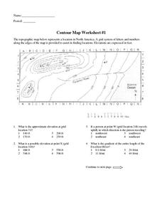
Contour Map Worksheet #1
Being able to read a topographic map is a standard in middle school earth science units and imperative for outdoor enthusiasts. As you introduce learners to this skill, you can assign this as an assessment or reinforcement. Pupils view a...
Curated OER
Put Your Face on the Map
Students investigate topography and contour lines by examining a human face. In this mapping lesson, students create a plaster cast of a face and create a map of the contours of the face one centimeter at a time. Students examine the...
Wind Wise Education
Where is it Windy?
How is the wind up there? The class builds a topography model using materials available in the classroom, then place wind flags in different locations on the landscape. Using a fan as a wind source, pupils collect data about how wind...
Curated OER
Watershed Investigations
Students explore the components of a watershed and the factors that affect it. They read a topographical map and use geometry to determine the area of a watershed. Students estimate the volume of a body of water and perform runoff...
Curated OER
Project Map: Scale Worksheet
In this map reading worksheet, students determine the distance from a plotted treasure on a topographic map. They must adjust for magnetic declination.
Curated OER
Play Doh Map of Your State
Students create a state map using Playdoh. In this hands-on state geography instructional activity, students work in groups to form a three-dimensional map of their state using Playdoh made at home following a (given) recipe. Students...
Curated OER
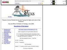
Volcano Contour Models Activity and Tracing the Highs and Lows in San Francisco
Students investigate how to draw topographic contours and read topographic maps.They examine the topography of San Francisco and contrast the elevation of different points within San Francisco.
Curated OER
MAPS AND TOPOGRAPHY
Students analyze the details of a topographic map and create one of their own by utilyzing a map of elevations.
Curated OER
Topo Map Mania!
Seventh graders describe the major features of maps and compasses. They read a topographical map. They take a bearing using a compass. They practice using scales on a map.
NOAA
Into the Deep
Take young scientists into the depths of the world's ocean with the second instructional activity of this three-part earth science series. After first drawing pictures representing how they imagine the bottom of the ocean to appear,...
Curated OER
Making Maps
In this map making worksheet, students learn about the science of making maps, which is cartography. They then answer the 11 questions on the worksheet. The answers are on the last page.
Curated OER
Exploring Earth Through Maps and Technology
In this maps instructional activity, students read 3 pages of detailed information about maps, latitude, longitude, topography, satellites and global positioning. Students then answer 10 questions. There is also a research project...
Mr. E. Science
Introduction to Earth Science
From the layers of Earth's spheres to latitude and longitude to looking at topographic maps, learners discover the elements of Earth's systems.
It's About Time
Volcanic Hazards: Flows
Did you know the largest volcano in our solar system is on Mars? Young scholars measure and experiment with how to predict lava and mud flows. This knowledge leads to better evacuation, safety, and preventative methods.
Alabama Learning Exchange
WATER You Doing to Help?
Auntie Litter is here to educate young scholars about water pollution and environmental stewardship! Although the 15-minute video clip is cheesy, it's an engaging look at the water cycle and conservation. Learners start by illustrating...
Curated OER
Tracing Highs and Lows in San Francisco
On a topographic map, students identify the scale bar, north arrow, and contour interval. They then locate a hill on the map and make note of the contour lines. Students then locate other places with similar contour line patterns....
Curated OER
Listen to the Land
Students discover how we use land. They gain insight into the way we use the land, both for benefit and consequence. Students explore how to 'listen to the land' as they make decisions on how it should be used and the consequences of...
Curated OER
Forest Fun
Students explore orienteering and how to use a compass. They explore the importance of forests and identify some of the trees in a local forest.
Curated OER
Continents and Oceans on the Move
Students create an awareness of the vast percentage of water covering the earth. They relate similarities/differences between topographical maps and other maps of various time periods. Students examine how to use a topographical map.
Curated OER
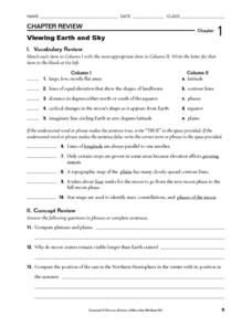
Viewing Earth and Sky
In this earth and sky worksheet, students review terms associated with map reading. Students also review topographic maps and how contour lines represent elevation. This worksheet has 5 matching, 5 true or false, 5 fill in the blank, and...
Curated OER
Where are the Watersheds in San Francisco?
Students create a mental map of San Francisco. They compare it with actual topographical maps of the city. Then they label various locations on the San Francisco Hillshade map and locate watershed boundaries.
Curated OER
Interior of the Earth
Sixth graders identify and describe the composition and physical properties of the layers of the Earth. They also explain how scientists used the scientific process to know about the center of the Earth. Finally, 6th graders read a...
Curated OER
Topo Triangulation
Middle schoolers investigate how to read a topographical map and triangulate with just a map. They convert a compass measurement to a protractor measurement, reverse a bearing direction, and using a worksheet take a bearing of certain...


