Hi, what do you want to do?
Curated OER
Water Management in Florida
Students discuss water management. They examine the water management districts in their area. They complete an experiment in which they role-play a water management manager.
Curated OER
Save Our Soil
Young scholars explore the need for good farm land and reasons for the disappearance of agricultural areas. They brainstorm environmental friendly decisions and soil conservation. In their community, students explore new land...
Curated OER
Minorities in a Cross-Cultural Perspective Debate Simulation Case Study: China's Borderlands
Twelfth graders investigate if minority status is synonymous with powerlessness in China. They examine if minority and majority groups interact with equity and justice in China. Students present their findings in a debate-simulation format.
Curated OER
Bird Banter
Students listen to examples of common bird songs of birds found in Illinois. As a class, they discover the importance between the differences in songs and calls. They practice making their own bird calls and songs to end the lesson.
Curated OER
A Sense of West Virginia
Students consider their perceptions of the world through their 5 senses while visiting the West Virginia State Museum. In this West Virginia history lesson, students discover how knowing about the past helps with their understanding of...
Curated OER
Volcanoes: Mount Vesuvius
Students explain how volcanoes form. In this earth science lesson plan, students identify the different types of volcanoes. They create brochures about Mt. Vesuvius before and after the eruption.
Curated OER
Tooling Around Arizona: Reading Arizona Maps
Students study geography. In this Arizona maps lesson, students develop their map reading skills. They have class discussions and work independently with various copies of Arizona maps to practice those skills. This lesson mentions...
Incorporated Research Institutions for Seismology
Iris: Exploring Patterns of Global & Regional Seismicity
Young scholars use the IRIS Earthquake Browser to investigate well-known examples of some plate boundaries.
Other
Virginia Places: What Determines the Boundaries of a Region in Virginia?
Although this site talks about regions in Virginia, it offers excellent information on regions in general, for example, ways regions might be classified; e.g., by population density, geology, watershed, ecosystem, economy,...
Other
Bc Open Textbooks: Physical Geology: Regional Metamorphism
Discusses the regional metamorphic zones in Nova Scotia, Canada, and the geological processes that caused them to form. Regional metamorphism happens deep within the Earth's crust and eventually, the buried rocks are exposed, usually due...
Wikimedia
Wikipedia: Palestine (Region)
Wikipedia provides detailed information on the history, boundaries and demographics of Palestine, a region in the Middle East.
Curated OER
University of Texas: Mauritania: Political Map
This political map of Mauritania shows its regions' boundaries, major cities and highways, and neighboring countries. Clicking on the map will enlarge it. From the Perry Castaneda Collection.
Curated OER
University of Texas: Somalia: Political Map
A map of Somalia showing its regions' boundaries, neighboring countries, and strategic location on the Horn of Africa. From the Perry Castatneda Collection.
Curated OER
University of Texas: Lesotho: Political Map
A political map of Lesotho showing the region boundaries, major cities and highways, and the surrounding country, South Africa. Clicking on the map will enlarge it. From the Perry-Castaneda Collection.
Curated OER
University of Texas: Malawi: Political Map
A political map of Malawi showing its regions' boundaries, major cities and highways, and neighboring countries. Clicking on the map will enlarge it. From the Perry-Castaneda Collection.
National Geographic
National Geographic: More Physical Geography and Borders
Lesson on the physical features that create borders and boundaries. Small group and whole class activities, background information, worksheets and assessment.
National Geographic
National Geographic: Conflict on the Danube
Lesson in which students use maps and text to explore physical and cultural boundaries and the disputes over control of them. Includes two activities with comprehensive and adaptable materials.
National Geographic
National Geographic: Encyclopedia: Mantle
An in-depth look at the structure and composition of Earth's mantle, with lots of visuals. Covers lithosphere, Mohorovicic discontinuity, asthenosphere, transition zone, lower mantle, the d double-prime region, mantle convection, mantle...
Curated OER
Etc: Maps Etc: The Lake Region of North America, 1911
A map from 1911 showing the lake region of the Laurentian Plateau and adjacent areas, primarily north of the International boundary in the region known as the Canadian Shield. Only the principal lakes are shown. As indicated in the text,...
Texas Instruments
Texas Instruments: Key Curriculum Press Algebra: Project the Mandelbrot Set
Students will choose a small region on the boundary of the Mandelbrot Set and create a graph of that smaller region.
Library of Congress
Loc: Teachers: Geography and Its Impact on Colonial Life
Beginning with a discussion on how people adapt to or relocate to environments, this lesson encourages young scholars to explore why the Colonists settled in specific regions. In groups, students examine primary documents, analyzing...
Other
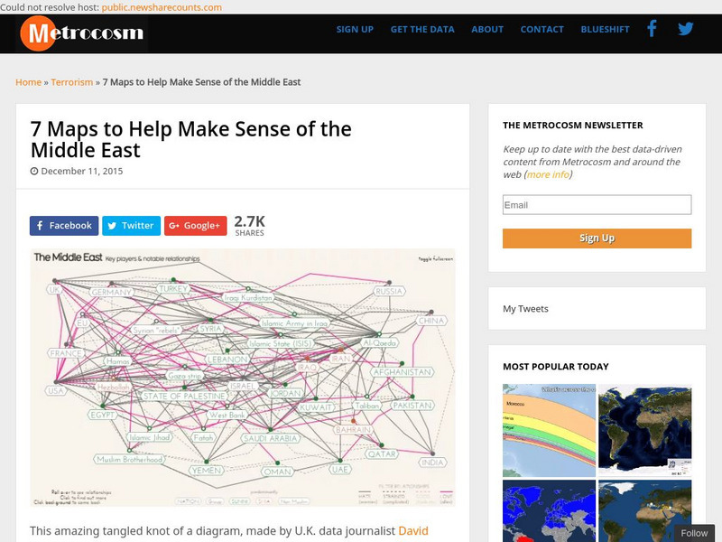
Metrocosm: 7 Maps to Help Make Sense of the Middle East
Keep up to date with the everchanging Middle East Region. The Middle East has been a tangled web of alliances since WWI. These maps attempt to make sense out of the this often confusing area. The 7 maps show the relationships among...
PBS
Pbs Learning Media: South America Interactive Map
This interactive map explores the continent and countries of South America. Through political, physical, population, and climate map layers and individual country views, learn about the boundaries that define the continent's 12 sovereign...


