Space Awareness
Let's Map the Earth
Before maps went mobile, people actually had to learn how to read maps. Pupils look at map elements in order to understand how to read them and locate specific locations. Finally, young cartographers discover how to make aerial maps.
Artisan Global
QuakeFeed Earthquake Map, Alerts and News
Amateur seismologists explore Earth's earthquakes in real time using a variety of map styles and parameter selections.
National Science Teachers Association
Using Concept Maps in the Science Classroom
A good concept map requires high thought processes. This makes it a great tool for teaching and evaluating your pupils. A helpful article describes a great approach for teaching young scholars the art of concept map building and how best...
American Physiological Society
Sticky Adaptations A Lesson on Natural Selection
Now you see it, now you don't! The stick bug exhibits the ability to disappear into a wooded environment. Why does this adaptation manifest in some species, but not in others? Life science students explore animal adaptations in nature...
Curated OER
Regents High School Examination: Physical Setting Earth Science 2006
Test your class on earth science with this extensive resource. This test, created by The University of the State of New York Regents, is made up of 50 multiple choice questions and 32 short answer questions that cover the branches of...
Texas Heart Institute
Anatomy: How Does the Cardiovascular System Work?
How can the circulatory system compare to a city map? Pupils distinguish the "roadways" and "vehicles" of the cardiovascular system, compare the anatomy and function of veins and arteries, and review different types of blood cells with...
Curated OER
Volcanic Environments
A diagram showing a cross-section of Earth points out the location of different plate boundaries and displays the numbers one through five. Beneath the diagram are five photos of different types of volcanoes. The object of the activity...
Centers for Ocean Sciences
Ocean and Great Lakes Literacy: Principle 1
Is your current lesson plan for salt and freshwater literacy leaving you high and dry? If so, dive into part one of a seven-part series that explores the physical features of Earth's salt and freshwater sources. Junior hydrologists...
Curated OER
Geologic Mapping I
Students create a geologic map and cross-section of an area of horizontal sedimentary rocks, exposed in several locations. Map must include a complete key or legend with rock descriptions of the various formations.
Curated OER
This Land Is Your Land, This Land Is My Land
Students review and evaluate the ways land is covered and used in their local community. They consider the environmental effects of the different types of land use. Students act as community planning engineers to determine where to place...
Curated OER
Where in the Latitude Are You? A Longitude Here.
Students distinguish between latitude and longitude on the map. In this mapping lesson, students participate in mapping skills to recognize spatial relationships, and where to find natural resources on the map. Students create...
Curated OER
Volcanoes: Sixth Grade Lesson Plans and Activities
Bring a set of pre-lab, lab, and post-lab lesson plans on volcanoes to your earth science unit. Sixth graders explore the three types of volcanoes found on Earth, plot the specific locations of these volcanoes on a map, and...
Laboratory for Atmospheric and Space Physics
Charting the Progress of New Horizons
In 2006, New Horizons began its mission to fly to Pluto. As it continues its journey, scholars track its progress with the help of an informative website, all the while reinforcing measurement concepts with the construction of a scaled...
Curated OER
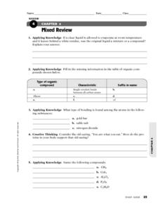
Mixed Review
In this chemistry worksheet, students solve chemical equations and define terminology using previous knowledge. There are 8 review questions.
Curated OER
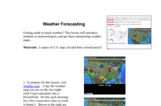
Weather Forecasting
Learners discover how to read a current weather map. In this weather forecasting lesson plan, students view weather maps from three consecutive days and observe how quickly weather moves and changes. Learners review key terms associated...
Curated OER
Rock Cycle Review
In this rock cycle worksheet, learners review major concepts related to rock formation by answering 15 multiple choice questions and matching 15 terms to their definitions. Students identify 7 rocks as metamorphic, sedimentary, or...
Curated OER
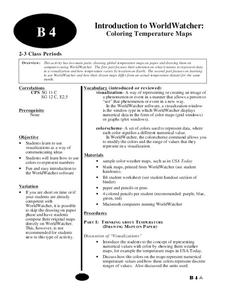
Introduction to WorldWatcher: Coloring Temperature Maps
Young scholars are introduced to the software program WorldWatcher. In groups, they discover the temperature variations throughout the world and color a map according to the temperatures. They also practice using visualization to...
Curated OER
The Earth is an Orange
Students examine and identify the various types of maps. Using two types of maps, they compare the data that can be gathered from each one. They also identify and locate the continents and the oceans. They review the purposes of each...
Curated OER
Landscape Diversity in the Yukon Territory
Students review and analyze a satellite image of the Yukon territory.
Curated OER
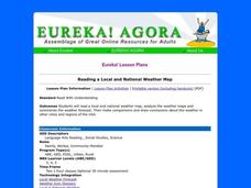
Reading a Local and National Weather Map
Students practice reading a national and local weather map. Using this information, they work together to make predictions about the weather for the next few days. They discuss the use of symbols and maps as a class and discuss how...
Curated OER
Water Contamination Mapping Lab
Students are introduced briefly to the Biscayne Bay Ecosystem, observed microbe distributions and water current maps are introduced. They measure water current speeds to predict the movement of pollutants based on the type of the tidal...
Curated OER
Plate Tectonics: Sixth Grade Lesson Plans and Activities
Here is a set of pre-lab, lab, and post-lab lesson plans on plate tectonics. After completing the previous labs on volcanoes and earthquakes, sixth graders use the gained knowledge to explore plate boundaries and the movement of...
Science Matters
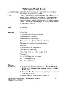
Wattsville and Mercalli Booklet
There has been an earthquake! Can you listen to the description of damage given by callers in order to determine the epicenter? The 11th of 20 lessons has pupils read a script of one emergency caller. The class records the information on...
Curated OER
Butterflies, Butterflies, Butterflies
Transform your class into a butterfly museum! Research different types of butterflies, their habitat, and life cycle. Interactive components such as PowerPoint presentations, Claymation movies, and webpages add pizzaz to the museum...


