Science Matters
Ring of Fire
Over a period of 35 years, earthquakes and volcanoes combined only accounted for 1.5 percent of the deaths from natural disasters in the United States. The 15th lesson in a 20-part series connects the locations of earthquakes and...
Curated OER
Earthquakes and Volcanoes
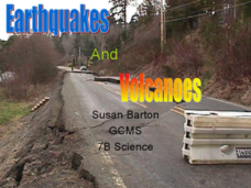
Nice pictures, maps and informative diagrams are incorporated into this PowerPoint about earthquake types and the types of waves carrying energy produced. There are a number of pages explaining scientific terminology and diagrams to...
Curated OER
Ring of Fire
Students locate some of the 1,500 active volcanoes on a world map. Then by comparing their maps with a map of the world's tectonic plates, they discover that volcanoes occur because of the dynamic nature of the Earth's lithosphere.
Curated OER
The Biggest Plates on Earth
The best part about teaching guides is all the great information you can use to inform your class. They infer what type of boundary exists between two tectonic plates. Then, using given information on earthquakes and volcanism they'll...
Curated OER
Natural History of Costa Rica
Students use outline maps to become acquainted with Costa Rica. They see how it was formed and how its origin has created very diverse environments. Students then use atlases and compare their physical maps with maps of climate and the...
Curated OER
The Physical Geography of Australia, Oceania, and Antarctica
Learners access information from the United States Geological Survey's Web site This Dynamic Earth to research the Ring of Fire. They answer four questions and then apply what they have learned to create a bulletin board display.
Curated OER
Japan and The Ring of Fire
Middle schoolers engage in a study of the volcanic forces and earthquakes associated with The Ring of Fire in the Pacific Ocean. The people of Japan are researched in how they have dealt with living in the area. Also students write in...
Curated OER
Current Earthquake Activity
Fifth graders record any earthquake activity throughout the school year on various maps. In groups, they identify a map locating the points given to them by their teacher. To end the lesson, they add the date, strength and damage to each...
Curated OER
Plotting Earthquakes
Learners explore earthquakes. Using the National Earthquake Information Center website, students plot daily earthquakes on a map. They observe the magnitude of each earthquake. Learners identify the pattern of earthquake locations and...
National Geographic
Types of Volcanic Eruptions
Blow the roof off your classroom with this multimedia science lesson on volcanic eruptions. A short online video teaches young geologists about shield and composite volcanoes and explores the examples of Kilauea and Mt. Vesuvius, before...
Channel Islands Film
Island Rotation: Lesson Plan 3
How far have California's Channel islands moved? What was the rate of this movement? Class members first examine data that shows the age of the Hawaiian island chain and the average speed of the Pacific Plate. They then watch West of the...
Curated OER
Plate Tectonic - Volcanoes Post Lab
Second graders discover volcanoes that occur around the world. They identifying volcano parts.
Curated OER
Earthquakes & Volcanoes I: What Causes Them and Where They Are
Students study the properties of volcanoes and earthquakes. In this earthquakes and volcanoes lesson plan students write a story on what they did during their experiment.
Curated OER
Did You Feel That? Earthquake Data Chart
Students plot earthquakes on the world map using coordinates of longitude and latitude. They designate the earthquakes magnitude with a symbol which they include in the map key.
Curated OER
Volcanoes In Japan
Sixth graders study the characteristics of volcanoes in this unit. They apply the research to the study of three volcanoes in Japan. They complete mapwork, identify indicators of impending volcanic activity, and describe the dangers...
Ocean Explorer
The Volcano Factory
The tectonic processes that have resulted in the formation of the Marianas Arc, and the Marianas Trench are explored. Groups of pupils access websites that give them a wealth of information about these formations. Each group must prepare...
Curated OER
Plotting Earthquakes
Students, after plotting earthquake locations on the map, should correctly; identify the pattern of earthquake locations and identify the ring of fire.
Curated OER
Plate Patterns
Students read about a volcano and use the latitude and longitude information to plot and describe the volcano on the map. They discuss patterns seen on the map. In addition, they color code a map according to zones, plates, etc.
Curated OER
"Tsunamis"
High schoolers visit a PBS Website about tsunamis to consider their causes, effects and steps countries have taken to try to defend against them. They answer questions and create a brochure explaining tsunami facts and procedures to...
Curated OER
Plate Patterns
Students review the patterns they discovered from a previous activity. In this investigative lesson students plot data as a class and color a map.
Curated OER
Volcano Research
Student demonstrates the ability to select and evaluate media. They access and organize information about volcanoes. Each student locates on a map a currently erupting volcano.
Science Matters
Seismic Activity and California Landforms
By the 19th lesson in the 20-part series, scholars realize volcanoes and earthquakes are related to plate boundaries. The lesson extends and applies the knowledge by having individuals create a bumper sticker for one specific area of...
Curated OER
Tectonic Plates, Earthquakes, and Volcanoes
Challenge geography classes to locate the major volcanoes and earthquake faults on a world map. In groups, they identify the pattern made and examine the relationship between the locations of the faults and volcanoes and tectonic plates....
Curated OER
Volcano! Is That a Volcano on Your Plate?
Learners investigate where volcanos come from. In this volcano lesson, students watch videos do Internet research and participate in experiments to discover the cause of volcanos.


