Curated OER
The Birmingham River System
After a lesson on geography and the features of a river, students view a map of the Birmingham river system, which is in England. They are then asked to label 4 features on the map.
Curated OER
Climb a Mountain, Raft a River on Your Own Land
Students are introduced to the characteristics of a map. As a class, they discuss the uses of public lands in their community and develop symbols for each feature. They use the symbols to create a map showing the recreational uses of...
Curated OER
United States Map- Rivers
Students identify major rivers on a map of the United States. In this geography activity, students discuss what a river is and use a map marker to identify the symbol of a river on a map.
Curated OER
Rivers of Change
Third graders examine rivers and how they affect the people living around them. They read a chapter in their science text, take a virtual river tour online, read a background information story, and in pairs describe the changes in the...
Curated OER
Rivers, Maps, and Math
Students use maps to locate and label the major rivers of North and South America. Using the internet, they identify forests, grasslands, mountain ranges and other landforms on the continents as well. They compare and contrast the...
Curated OER
From Lazy River To Deep Water
Student investigate the lock and dam system of the Mississippi River by creating one for the class to observe. The experiment is completed in conjunction with research bring compiled from different resources for a research project.
Curated OER
The Rivers and Lakes of Alberta
Students are introduced to the online Atlas of Canada and they identify the lakes and major rivers of Alberta.
Curated OER
Rivers: Short In-class Activity
Students make observations, estimates, and interpretations. They view Images of the James River at Belle Island, Virginia, including one at flood stage, a plot of peak stream flow since 1935, and an image of potholes in the Petersburg...
Curated OER
Invasives and Macroinvertebrates
High schoolers view macroinvertebrates, or discuss previous collection activity. They graph data on macroinvertebrates in the Hudson River. Students discuss the relationship between habitat, environmental changes, and invertebrate...
Curated OER
Geography With Dr. Seuss
Students read the book, The King's Stilts by Dr. Seuss and discuss the geographical information given in the book. Then they discuss and locate on a map the physical features that make up the continent of Africa. They create an original...
Curated OER
Geographic Landforms
Each slide is a simple notebook page with one landform in blue and its definition in red. There are 26 vocabulary terms in all, some you may want to use, and others easily hidden. It is recommended that you add photos or other graphic...
Curated OER
Ancient River Valley Civilizations
Ziggurats, cuneiform writing, the Tower of Babel, hieroglyphics, pyramids, the Great Wall. Launch a unit on ancient cultures, with a presentation that introduces viewers to ancient Mesopotamia, Babylonia, Sumer, Egypt, Indus, and China....
Curated OER
Water Features - Lesson 2 - U.S. Political Map Grade 4-5
Students locate water features on maps. In this geography lesson plan, students complete worksheets that require them to identify water features on a U. S. political map.
Curated OER
Natural Features
Students identify natural features on a map. In this map skill lesson, students use a landscape picture map to identify mountains, hills, islands, lakes, and rivers. Students use post-it notes to demonstrate their location.
Curated OER
Spirit Mask Ashira/Bapunu, Ogowe River, Gabon
Explore the concept of beauty as it has been seen through the eyes of various African tribal groups. Learners create masks of beauty as they see it, taking the African concept of inner beauty into consideration. This lesson is great for...
Curated OER
Take Me to the River! Using the Black River for Earth Science Review
Ninth graders use maps to identify landscape regions and drainage patterns producing the Black River. They create PowerPoint presentations pertaining to the Black River watershed, its geologic history and highlighting safe rafting...
Curated OER
Salmon vs. Dams: The Dam Removal Debate on the Elwha River
Students use roll playing to discuss the merits of tearing down these dams so that the Elwha River can run free. The activity is presented in the form of a council meeting to encourage students to try to build consensus in finding...
Curated OER
Take Me to the River
Students learn about a different way of life. For this river and dams lesson, students discuss the Hoover Dam. Students then view pictures of the Hoover Dam, discuss the impact of dams, and compare life before and after building a dam.
Curated OER
Guided Reading: " A River Ran Wild"
Students answer "essential questions" to establish background and prior knowledge of the book, "A River Ran Wild." In this language arts lesson, 3rd graders complete a graphic organizer of vocabulary words and read and take notes at...
Curated OER
"Egypt, Gift of Nile"
Sixth graders are introduced to the basics of ancient Egypt focusing on the Nile River and the necessity of the river. The students work in small groups and
become "experts" on the given topic and then present the information that
was...
Curated OER
Create a Country
Students work in small groups to list features and elements found on a variety of grade- appropriate maps. They develop a class list of map features and elements to draw from as they create a map of an imaginary country.
National Park Service
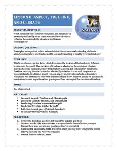
Aspect, Treeline, and Climate
Head to the treeline and beyond to examine how this feature of the landscape affects weather and climate, which gives scientists clues about its health. Class members' observations of photographs provide the data that drives the...
ESL Kid Stuff
Our World
There's a beautiful world all around us! Learn about the features of our planet with a series of activities designed for English learners. Kids sing, dance, and read about nature with fun lessons and interactive play.
Annenberg Foundation
Teaching Geography: Workshop 4—North Africa/Southwest Asia
Can Jerusalem be equitably organized? Can Israel and Palestine be successfully partitioned? Part one of a two-part workshop looks at the geo-political history of Jerusalem while Part two investigates Egypt's dependence of the Nile River...


