Curated OER
Texture - Bumpy, Wrinkled, Smooth?
Students study textures and identify textures using satellite images. In this texture lesson, students study various objects and define their textures. Students feel crayon rubbings and sort them into groups. Students use a book with...
Curated OER
Interpreting Satellite Images
Young scholars identify differences between photography and satellite imagery space.
Curated OER
Sea Ice and Satellites
Students study satellites and satellite images using Google Earth. In this satellite lesson, students discuss satellites and how they work. Students watch a demonstration of how satellites work and learn what they are used for. Students...
NASA
Speaking in Phases
Hear from deep space. Pupils learn how satellites transfer information back to Earth. They learn about three different ways to modulate radio waves and how a satellite sends information with only 0s and 1s. Using sound, class members...
Curated OER
Satellite Mobiles K-2
Students explore satellites and their function. They view a photo essay about the many kinds of satellites and the jobs they do. Afterwards, they construct satellite mobiles, discuss the various features of their satellites, as well as...
Curated OER
Measuring Distance and Area in Satellite Images (College Level)
Students are able to download, install, and use Image J image analysis software to quantify change over time in satellite images. They access and download satellite images for specific locations and times. Students set a scale (spatial...
Curated OER
The Global Precipitation Measurement Mission (GPM) Lesson
Introduce your class to one of the ways that technology is benefiting humanity. The Global Precipitation Measurement Mission involves the data collected by nine satellites from different countries with a united focus on studying world...
Curated OER
Annotating Change in Satellite Images
Young scholars compare a series of satellite images taken 3-4 years apart to investigate the effects of human land use. They annotate the images using ImageJ software and use the annotated images to explain their findings.
Curated OER
A Bird's Eye View Of Your Community
Learners locate and identify their community by using a satellite image from the Internet. Students locate and identify common land structures within their community. You may want to include structures such as roads/streets, houses and...
Curated OER
Get the Picture!
Astronomers practice downloading data from a high-energy satellite and translate the data into colored or shaded pixels. As a hands-on activity, they use pennies to simulate high-energy satellite data and they convert their penny...
Curated OER
Reflections on Earth: Exploring Planet Earth from Space
Students examine satellite images of Earth and contrast images at different scales. In this exploring Earth from space lesson plan, students use satellite images to contrast images at different scales, calculate distances from the scale...
Curated OER
Keeping Watch on Coral Reefs
Students investigate the dangers Coral Reefs face by investigating satellite images. In this environmental protection lesson, students utilize the Internet to discover the types of satellites and sensors used to provide...
Curated OER
Orbital path of Landsat
Students comprehend how Landsat satellites orbit teh Earth to produce images. They comprehend the elliptical path of satellites. Students recognize that a different orbital path is needed for different satellites to perform their tasks....
Curated OER
Processing Satellite Images
Middle schoolers comprehend the meaning of "pixel." They recognize patterns using pixels. Students observe how land use can be determined from a pixel. They measure off a 30 x 30-meter area to show the size of the surface area of one...
Curated OER
Satellites and the Radiation Budget
Students engage in a prelab discussion about the earth's radiation budget and global warming. They use "trading cards" to find specific websites to research radiation budget questions.
Curated OER
Cities and Seasons
Students explore how satellite images show seasonal changes in seven cities in North and South America. Through a sequence of images, they study the green-up and brown-down of the seasons and how seasons change over time. Afterwards,...
NASA
Down to Earth
There are only 10 types of people in the world: those who understand binary and those who don't. The lesson includes four activities in which students learn binary, convert binary to images, understand CCD arrays, and interpret...
Curated OER
Message in a Bottle - A Satellite Journey through the Gulf Stream
The Gulf Stream has historically provided humans with a faster trade route because of its swift-moving waters. It continues to be a source of information and fascination for oceanographers today. As your class views this collection of...
PBS
Mountains and Rain Shadows
Scholars use an online interactive to learn just how different the other side of the mountain actually appears. They use satellite images, graphics, and videos to compare the impact of winds, oceans, clouds, precipitation, and more on...
NASA
Exploring the Colors of Mars
Minerals on Mars are not that different than those on Earth. Using mineralogy concepts and satellite images, individuals use color to highlight the different surface minerals on Mars when creating a model of the planet. They enhance...
Las Cumbres Observatory
Calculating the Age of Solar System Objects
The number of craters on the surface of solar system objects has a direct correlation to its age. Learners use the concept to determine the age of several objects in the solar system. Using satellite images, they count craters within a...
Midnight Martian
Moon Globe
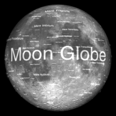
Not just a simple globe of the moon, this interactive version allows you to choose lighting according to the location of the sun, views from different positions on Earth, and more! Satellite images and topographic data have been combined...
Curated OER
Satellites and Solar Cells
For this satellite and solar cells worksheet, students determine the electrical power generated by the solar cells on the IMAGE satellite. Students solve 3 problems including finding the usable area of the satellite, determining the...
Other popular searches
- Satellite Imagery
- Hurricane Satellite Images
- Infrared Satellite Imagery
- Image Satellite
- Aerial and Satellite Imagery
- Satellite Images of Erosion
- Science Satellite Imagery
- Satellite Imagery Weather Maps
- Octagonal Image Satellite


