Curated OER
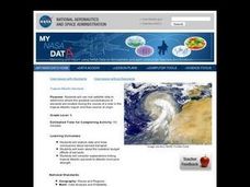
Troical Atlantic Aerosols
Young scholars explore the effect aerosols have upon he weather and climate. They observe NASA satellite images to explore and draw conclusions about aerosol transport. From studying the images, students track the path of aerosols. They...
Curated OER
How Much Water is Available in the Atmosphere for Precipitation?
Students explore the relationship between the amount of water in the atmosphere available for precipitation and the actual precipitation observed by satellite. They examine seasonal changes in precipitation. They practice using Internet...
NASA
Space-Based Astronomy on the Internet
Young scientists compile everything they have learned into a report in the fifth and final lesson in a unit on the visible light spectrum. Access to photos from observatories, telescopes, and satellites allows learners to compare...
Curated OER
Coral Bleaching in the Caribbean
Students practice analyzing images, maps and graphs from Internet-based educational resources. They explore the correlation between sea surface temperature and coral bleaching. Students comprehend that coral reefs are collections of tiny...
Curated OER
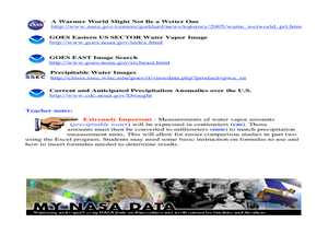
A Comparison Study of Water Vapor Data to Precipitation over North America
Learners use NASA satellite data to compare water vapor over the United States. For this data analysis lesson students use an Excel spreadsheet to map their data.
American Museum of Natural History
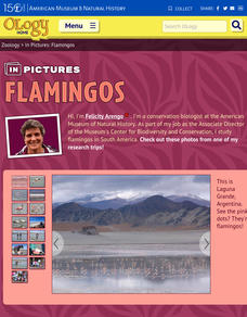
In Pictures: Flamingo
Fifteen photos take scholars on a journey to Laguna Grande, Argentina to observe how a group of scientists work with native flamingos. Stunning images showoff the flamingo, its environment, scientists in the wild, and the impact the...
Las Cumbres Observatory
Agent Exoplanet
Not everything revolves around the sun! Believe it or not, there are planets, called exoplanets, that orbit stars other than our sun. Learners use an interactive online resource to research several of these planets. They learn about the...
Curated OER
Tracking the Movement of Sunspots
Young scholars examine how the development of new technology has increased our knowledge of how the sun works. Students study sunspots through the use of solar imaging from satellite instruments.
Curated OER
STEREO Watches the Sun Kick up a Storm!
In this solar storm worksheet, students use images of a solar tsunami to determine the size and speed of the wave. This worksheet has 5 problems to solve.
Curated OER
Roaming Biomes
Students use the Internet to research the capabilities of earth-observation satellites. Using the information, they write a report on how remote-sensing technology is used to measure the impact of climate change. They identify the...
Curated OER
Altimetry
Fifth graders accurately measure the distance to eight points on an uneven surface by conducting a simulation of sattelite altimetry. They create a two-dimensional model of the simulated ocean surface by graphing data from the Radar Run...
Curated OER
Tropical Atlantic Aerosols
Students analyze NASA data from the Multi-angle Imaging Spectroradiometer. In this NASA data lesson, students access an assigned website to examine information from the MISR on the Terra Satellite. They determine how desert dust travels...
Curated OER
Richard Misrach
Students analyze the Great Salt Lake as a resource for artistic work and other studies. In this art analysis lesson, students view maps that show the location of the Great Salt Lake including a satellite image. Students can also study...
Curated OER
Volcanoes and Urban Planning
Students analyze satellite image data of Volcan Villarica. In this earth science lesson, students identify dangerous areas surrounding the volcano. They propose a new safe location for the town.
Curated OER
Sunspots 3: Tracking the Movement of Sunspots
Students analyze sunspots through the use of solar imaging from satellite instruments. They collect two types of images, and track the movement of sunspots using a latitude/longitude grid.
Curated OER
The Ancient Middle East
King Tutankhamon, Queen Nefertiti, and many other names literally written in stone are featured in these slides about the culture of Ancient Egypt. Whether used as an introduction to a unit on Egypt, or as a tool to elaborate on the...
Curated OER
The Most Important Equation in Astronomy!
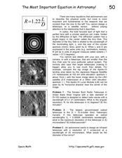
In this astronomy optics instructional activity, students calculate the angular resolution and maximum resolution for given telescope specifics. This instructional activity has 3 problems to solve.
Curated OER
Village Children in Northern Pakistan
Student use maps to answer geographic questions. They analyze Earth's surface by using a map to identify physical features that lead to different transportation routes. Student create a collage to show geographic insight into the topic...
Curated OER
Clouds and Solar Radiation
Students use satellite imaging and Mesonet solar radiation maps to answer questions given to them by the teacher and look for differences and similiarities in the data.
Curated OER
Patchwork of the Planet
Students are taught how satellite images can be joined to make a picture mosaic. They use actual satellite images to make satellite mosaics regions of the United States. Students use a camera to photograph portions of a globe in the...
Curated OER
Deer Tracks
Students use satellite images to track to movement patterns of deer and examine deer behavior. They write stories about a day in the life of a field scientist.
Curated OER
Using Maps To Make Public Health Decisions Case Study: Wildfires in Mexico 2000
Learners study environmental health. Using actual NOAA satellite imagery, students investigate the basic concepts of mapping. They explore the relationship between monitoring satellite images and public health decision making.
Curated OER
Give Me Some Air!
Third graders examine how trees produce oxygen. They examine satellite images of the reservation they examining and interpret the number of trees on the land. They determine how natural resources should be used wisely.
Curated OER
Two Ways About It
Students take an imaginary hike in two opposite directions along a lake. They view and interpret satellite images and discuss the pros and cons of hydroelectric dams.
Other popular searches
- Satellite Imagery
- Hurricane Satellite Images
- Infrared Satellite Imagery
- Image Satellite
- Aerial and Satellite Imagery
- Satellite Images of Erosion
- Science Satellite Imagery
- Satellite Imagery Weather Maps
- Octagonal Image Satellite
