Curated OER
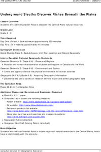
Underground Sleuths Discover Riches Beneath the Plains
Students identify Alberta, Saskatchewan, and Manitoba on map, and use Canadian Atlas to locate regions of natural resources in Central Plains, which have vital impact upon the economy. Students then complete scavenger hunt worksheet.
Curated OER
What Do Plants Need to Grow?
Fourth graders control variables to determine the effect on plant growth. They collect information by observing and measuring and construct simple graphs, tables, maps and charts to organize, examine and evaluate information.
Curated OER
TE Activity: Nidy-Gridy
Learners make a grid and coordinate system map of their classroom as they investigate why it is important to have a common map making system. They look at how landmarks are used for navigating an area.
Curated OER
Learning About Japan Through Its Kites--Intermediate
Students read various readings on two kit making sessions. They locate places and human spatial patterns using a map. Students design in two dimensions using line to create details.
Curated OER
Storm Busters
Students investigate hurricanes and invent a way to diffuse or redirect a hurricane before it becomes destructive in this technology-based science project. Cooperative learning groups are emphasized.
Curated OER
The Accuracy of Climate Data
Students use maps to determine how accurate climate data really is. They also answer questions using a table of data.
Curated OER
Animals, Animals, Everywhere
Fourth graders participate in a variety of activities dealing with animal characteristics and classifications in this multi-task activity. They use graphic organizers, make booklets, and make models.
Curated OER
Natural Resource Management Course Outline
Gain skills in ecosystem evaluation including chemical, biological, and physical qualities. Students write a report on a local ecosystem.
Curated OER
Repopulating Michigan's Waterways
Eleventh graders identify the parts of an ecosystem and how communities change over time. In this ecology lesson plan students formulate a habitat restoration plan.
Curated OER
The American Trail System
Students research a trail system. They create a display board of the trail system, generate a map of the trail system, and develop a commercial advertising of the trail system. They design a display board featuring facts about the...
Curated OER
Getting to the Point
Students determine location by using the technique of triangulation. They imagine that they are out in the wilderness and have come to the top of a ridge. How can one identify the ridge on the topo map? How can one figure out where you...
Curated OER
Postcards from Somewhere
Young scholars correspond with e-pals about their community. In this cross curriculum geography, technology, and literacy lesson, students complete a postcard webquest about their home location including local photographs. Young scholars...
Curated OER
Topos, Compasses, and Triangles, Oh My!
Students triangulate using a compass, topographical (topo) map and a view of outside landmarks. They take a field trip to another location away from school and mark discernible landmarks (like mountains or radio towers) and changes in...
Curated OER
How Has Math Evolved?
Eighth graders pick a topic or person to research related to the history of mathematics. They brainstorm and create a concept map, using the multimedia software inspiration, about what they are researching and want to examine. They then...
Curated OER
A World of Taste--Louisiana Gumbo
Students discover the multicultural contributions to New Orleans gumbo through participation in cross curriculum activities. In this multicultural diversity and New Orleans history lesson, students shade regions of a map according to a...
Curated OER
The Solution to Pollution is Dilution
Young scholars consider what happens to herbicides or insecticides that are used in agricultural practices, especially herbicides that are used to control noxious weeds. They become acquaint with a chemical assessment method known as...
Curated OER
The High and the Flighty
Young scholars study women aviators and act out a talk show-style interview with one of them. They plot Amelia Earhart's flights on a map.
Curated OER
Spin Me a Story
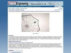
Students examine the motif of spinning and weaving in myths and folktales. They read various myths, complete a WebQuest, develop a mind map of story elements, and write an original "spider" story.
Curated OER
A Question, Mr. Lincoln!
Students discuss Abraham Lincoln. In this social science lesson, students describe key events in Lincoln's life. Students practice using interviewing skills to gather information pretending to be Lincoln.
Curated OER
How Far Can a Butterfly Fly
Pupils draw a picture of their favorite insect and describe. Students make a paper art project ladybug and write a story about it. Pupils map areas where certain insects are more prevalent. Students count dots on ladybugs and record.
California Polytechnic State University
Australian Geography Unit
At the heart of this resource is a beautifully detailed PowerPoint presentation (provided in PDF form) on the overall physical geography of Australia, basic facts about the country, Aboriginal history, and Australia culture and lifestyle.
Teach Engineering
Searching for Bigfoot and Others Like Him
Individuals create a GIS data layer in Google Earth that displays information about where one might find seven different cryptids. The class members research to find data on cryptid sightings they can include in their data...
Teach Engineering
Earthquakes Living Lab: Locating Earthquakes
There are patterns in nearly everything — even earthquakes. Pairs research current earthquakes to see if there are any patterns. They determine the mean, median, and mode of the earthquake data, along with the maximum and...
Curated OER
What makes agriculture "sustainable"?
Students define terms and distinguish between the goals and practices used to achieve sustainable agriculture. In this sustainable agriculture lesson students demonstrate awareness of the different impacts of agriculture.
