Curated OER
Ride the Rock Cycle
Students identify the steps in the rock cycle. They complete a K-W-L chart before the instructional activity begins. They answer questions about the stages to complete the instructional activity.
Curated OER
Snack Tectonics
Yum! Using graham crackers, dried fruit sheets, and frosting, tectonics technicians demonstrate the different types of plate boundaries. If you want to encourage youngsters with an activity that is both educational and edible, then this...
American Museum of Natural History
What is Marine Biology?
A marine environment covers the majority of the earth but is arguably the least understood. Teach young scientists about the characteristics of oceans and ocean species using an interactive online lesson. The in-person or remote learning...
Montana State University
Climb into Action!
Climate change affects even the largest and intimidating of landforms—even Mount Everest! A resource helps teach learners the connection between global climate change and its effects on Earth. Activities include videos, class discussion,...
Curated OER
Fascinating Geography Facts
In this geography worksheet, students will read 4 interesting United States geography facts and 19 fascinating world geography facts.
Curated OER
Mapping the Canyon
Students compare and contrast topographic maps and bathymetric maps. They investigate how bathymetric maps are made and how to interpret one.
Curated OER
Invertebrate Vocabulary-- Marine Invertebrate Match
In this science worksheet, young scholars study 12 vocabulary words which pertain to marine invertebrates. Students read the definitions which include pronunciation, part of speech and meaning of the name. Young scholars then look at 16...
Curated OER
A Bit of Engineering
Students discuss the drilling process. In this engineering lesson, students get into small groups and drill their own core samples in a sandwich using a plastic tubing, a jumbo straw, a slim straw and a offee stirrer predicting...
Curated OER
How Tsunamis Form
In this earth science worksheet, students read and study facts about tsunami and earthquakes to complete 8 short answer questions that follow.
Curated OER
Living Light
Students explain bioluminescence. In this life science lesson, students discuss bioluminescence and conjure examples of organisms that carry this trait and how it is useful in their environment.
Curated OER
Oceans
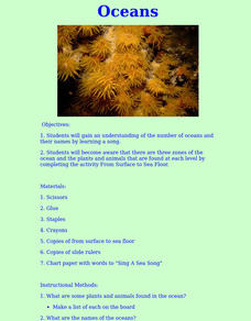
Students gain an understanding of the number of oceans and their names by learning a song. They become aware that there are three zones of the ocean and explore the plants and animals that are found at each level.
Curated OER
How to Hide in the Ocean
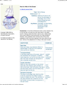
Learners observe the advantages of camouflage. They design a well camouflaged fish of their own.
Curated OER
Tides & Lunar Cycles
Students demonstrate how the moon affects the tides, a neap tide, and spring tides by using their bodies as models. After students observe the model they created, they draw and label the diagram on a provided worksheet. They then log...
Curated OER
Cruising the Mantle
Students explore the plate boundaries of the earth. Through the use of video, internet and hands-on activities, students examine the types of plate boundaries. They create a model to illustrate the movement and interaction of the...
Curated OER
TE Lesson: Tsunami Attack!
Students examine how earthquakes, volcanoes, and landslides can trigger tsunami waves. They determine how engineers use sensors to detect the dangerous wave, and how they help design building that will survive the wave force and water.
Curated OER
Pangaea Puzzle Pieces
Learners i examine 10 pieces of evidence for the Pangaea theory and use them to reconstruct the super continent. They determine that land masses on Earth are slowly changing shape as a result of moving for millions of years.
Curated OER
Coral Reef Center: Adjectives
In this using adjectives worksheet, students use adjectives in a word bank to complete sentences about a Coral Reef. Students fill in five blank answers.
Curated OER
Estuarine Currents
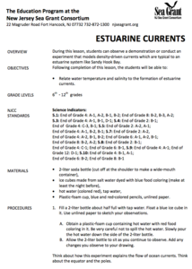
Students experiment observing a demonstration on models of density-driven currents which are typically found in an estuarine system of water flow. They compare/contrast water temperature and salinity to the formations of estuarine currents.
Curated OER
Fishy Fish
In this fishy fish comprehension worksheet, students read and assess understanding. In this true and false, fill in the blank, short answer, and multiple choice worksheet, students answer ten question.
Curated OER
Bacteria Aren't All Bad!
Teaching students about the diversity of the Bacteria Kingdoms and their importance to humans
Curated OER
The Rocks Under Illinois
The goal of this fine geology lesson is to have learners create a map that shows how the rock layers are arranged far underground where they can't be seen. The ambitious lesson plan requires high schoolers to learn the law of...
Curated OER
Mt. Whitney to Death Valley
This is an intriguing problem that brings together real-world data, technology, and mathematical problem solving. If visibility wasn't an issue, could you see from the highest point in the lower 48 states, Mt. Whitney, to the lowest...
National Energy Education Development Project
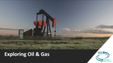
Exploring Oil and Gas
The United States consumes more oil than any other country, about 1.85 billion barrels (or 77 billion gallons) a day. Viewers learn about the history of fossil fuel exploration and how they are formed in an informative presentation. They...
NOAA
What's the Difference?
Due to the isolation of seamounts, their biodiversity offers a great deal of information on the development of biological and physical processes. Pupils use simple cluster analysis to rate the similarity and differences in biological...
Other popular searches
- Sea Floor Topography
- Sea Floor Diagram
- Sea Floor Mapping
- Sea Floor Sediment
- Sea Floor Features
- Sea Floor Bathymetry
- Sea Floor Drilling
- Sea Floor Bathmat
- Sea Floor Spread
- Convection Current Sea Floor
- Mapping the Sea Floor
- Sea Floor Mappng


