Curated OER
Canada Map Quiz
For this online interactive geography quiz worksheet, students respond to 12 multiple choice questions regarding Canadian countries.
Curated OER
Latitude/Longitude Activity
Youngsters work in groups to solve clues involving latitude and longitude coordinates in order to decipher mystery animals in this fun learning experience!
PBS
Make a Balloon Globe
"We've got the whole world in our hands," is what your students will be singing after completing this fun geography activity. Using the included templates for the seven continents and a balloon, they create their very own globes.
Curated OER
From the Heights to the Depths
Students create a relief map of Asia and Australia. They work in small groups on sections of the map to make one complete map of the continents.
Curated OER
Where in the World? Oceans & Continents
In this geography worksheet, young scholars answer 6 questions using a coded map as a reference, then students identify labeled geographic features.
Curated OER
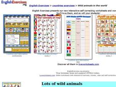
Wild Animals in the World
For this wild animals worksheet, students answer multiple choice map questions, choose the correct animal names for the pictures, and more. Students complete 4 activities.
Curated OER
Getting to Know My World
Students participate in hands-on activities using maps and globes to identify geographical features. Students use map legends to identify direction. Students locate oceans, continents, countries, states and cities. Handouts and...
Curated OER
World Map and Globe - Lesson 15 (K-3)
Students discover mountain ranges and their locations in the world. In this physical map lesson, students locate and identify major mountain ranges of the world on a large physical map.
Curated OER
Introduction to the World Globe
Learners examine a globe and the world map to see what constitutes the differences. In this world map introductory lesson plan, students discuss what they see when they view the globe. Learners then, look at a world map and compare the...
Curated OER
Africa - Not Just One Big Safari
Students draw a picture of an African city that is similar to a U.S. city and discover how other parts of the world have the same types of buildings. In this global similarities instructional activity, students create a map of...
Curated OER
Traveling Through North America
Students identify places and landmarks in North America, specifically Canada and the United States, by using and constructing maps. Six lessons on one page; includes test.
Curated OER
Identifying Reasons for World Trade
Students examine the advantages and disadvantages of world trade. They participate in a class discussion of international trade, read a handout about a specific country, and in small groups label a map with agricultural commodity...
Curated OER
Ancient Mesopotamia
In this geography worksheet, high schoolers read about ancient Mesopotamia and respond to five short answer questions that follow. They identify what part of the country was the heart of Mesopotamia. Then students compare the given map...
Curated OER
How to Work With Time Zones
Learners solve time zone problems. In this time zone lesson, students view a time zone map and learn about the 24 time zones. Learners are given a worksheet where they compute the time in different areas.
Curated OER
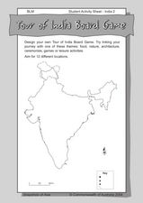
Tour of India Board Game
In this India board game activity worksheet, students use the outline map of India to create their own board games that feature the culture and locations of the country.
BBC
Eu, Un, and Commonwealth: Keeping Peace
What are the UN, the EU, and Commonwealth? Have the class brainstorm all they know about these powerful international organizations. Then have them compare and contrast the ways in which different countries or political groups...
Curated OER
Create a World
Learners combine imaginative powers with known map-making techniques to create a whole new world.
Curated OER
Australian Travel Adventure
Seventh graders are introduced to the states and territories within Australia. Using the internet, they bookmark sites and take notes on what they want to share with their classmates. They also complete a map study on the country to...
Curated OER
Expanding Children's Geographic and Economic Worlds
Students learn their addresses and gain a sense of connection between their neighborhood and the rest of the world and the universe.
Curated OER
The Olympics
Students will research the geography and designa route form Columbia SC to an olympic competition, then follow local news and current events to track team perfomance.
Curated OER
Understanding Time Zones
Students investigate the times zones around the world. They discuss situations when it is important to know the time in different parts of the world and how to find it.
Curated OER
African Safari
Seventh graders examine different countries in Africa to research. They choose one to concentrate their research on using the five themes of geography. They design a multimedia presentation that will make up the African safari.
Curated OER
The End of United States' Occupation of Japan
Ninth graders examine and discuss reasons for end of U.S. occupation of Japan in 1952, locate surrounding Asian countries on map, explore changes to Japan after World War II, and discuss how changes in Japan impacted other countries.
Curated OER
Landforms All Around
Students create a "Landform Dictionary". They develop an overlay map and participate in hands-on activities to identify the key characteristics of landforms. They discuss the plant and animal life of these areas. Handouts for the lessons...


