Curated OER
Come One, Come All
Students analyze information from core map and other sources and construct routes from New York and Boston to Cincinnati as they might have existed in 1835.
Prince William Network
Migration Math Madness
A great way to incorporate math into life science, this instructional activity has learners measure migratory routes on a map and calculate the actual distance that shorebirds on the routes would cover. Learners compute the distance...
Curated OER
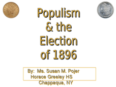
Populism & the Election of 1896
Populism and the rise and fall of the Populist Party are the topics of this presentation, which details the Presidential Election of 1896 and the role of silver. Detailing main points with clever political cartoons and informative maps,...
Curated OER
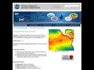
Comparing the Effects of El Nino and La Nina
Students examine the differences between an El Nino and La Nina year. In this investigative lesson students create maps and graphs of the data they obtained.
Curated OER
United States Climates
Students identify regional climates by using weather maps. They, in groups, locate and mark their city on the small map, then go to the larger map to locate and mark their city when they are called upon by teacher.
Curated OER
Food Detectives
Students investigate the regions in which particular grains are grown. Using the packaging from a variety of foods, grains are identified and the general locations where they are grown are plotted on a map.
Curated OER
Nina Bonita: Culture and Beauty
Pupils read Nina Bonita by Ana Maria Machado. In this reading comprehension/ geography lesson, students recall various parts of the story and create a map of where the rabbit traveled throughout the story. They participate in group...
Curated OER
Geographical Background on the Valley of Virginia
In this social studies worksheet, learners learn the geography of the Valley of Virginia (Shenandoah Valley) by reading the information and using the word bank of place names to label a detailed map.
Curated OER
Civil War Naval Strategy
Students apply critical thinking skills to war strategy. In this Civil War map lesson, students use their knowledge of latitude and longitude as well as scale to respond to questions regarding Civil War battle strategies.
Curated OER
Charting Neptune's Realm: Profiles
Students identify and describe the importance of nautical profiles in early navigation. They draw a profile of a street or mall and explore the effectiveness of different types of directions.
Curated OER
A Tale of Two Frogs
Second graders locate Russia on a map or globe and work in pairs to complete the Map worksheet. They read the book, A Tale of Two Frogs stopping after page 15. They write an ending to the story and then read more of the book stopping...
Indian Land Tenure Foundation
Indian Trust Lands
An important aspect of studying Native American history is understanding the nature of trust lands. Budding historians will learn that as Native Americans were removed from their home lands, trust lands were provided in the form of...
Curated OER
Colonial America and Roots of Government
Students identify 50 States and the major geographic features, regions, and political representation of each. In connection, they investigate the causes and effects of European colonization on North America. They identify the formation...
Curated OER
The Great Migration
Students explore how migration to Harlem created a new life for African Americans. In this cross curricular lesson, students illustrate maps showing the migration, paint murals representing African American life in the South and...
Curated OER
Marine Protected Areas (MPA)
Ninth graders explain the purpose of MPA's. In this biology lesson, 9th graders identify MPA's in Southern California. They simulate coastal sampling using candy from two buckets. Students analyze their results and share it with the class.
Curated OER
Rice Farming in Texas
Third graders explore how rice farming came to Texas. In this rice farming lesson, 3rd graders discover the history of how farmers began to grow rice in the United States. Students color code maps and create a timeline for rice farming...
Curated OER
Desertification
Learners investigate the process of desertification in the Sahel region of Africa. They discuss photos from a National Geographic magazine, analyze the physical/political map of the Sahara, identify the causes and effects of...
Curated OER
Mapwork: A Place In the News
Students determine how to find geographic information about places they read about in the news. In this geography lesson, students look at political and physical maps to determine the difference. They access maps online to find the...
Curated OER
Water: The Flow of Women's Work
Students view photographs, read, and reflect on their own environments to gather information about gender roles in Lesotho and the United States. Students role-play gender role related scenarios and write about their reflections on the...
Curated OER
Coming to America: U.S. Immigration
Students study immigration in the late 19th and early 20th century. In this immigration lesson plan, students participate in activities including creating maps, responding to non fiction text, memorizing and analyzing poetry, and...
Curated OER
The Call of the Wild
Students read The Call of the Wild, noting its theme of survival. They investigate the book's concepts with word webs, spider maps, or graphic organizers. They conduct a panel discussion on dogs and wolves. They write a letter to the...
Curated OER
G'Day Mate
Students understand that Australia is the smallest continent, locate it on a map and sing about the continents. In this Australia lesson, students listen to facts about Australia and complete a book about information they have learned.
Curated OER
Causes and Effects of ENSO
Young scholars analyze monthly sea surface temperature data from the Pacific Ocean to determine if the period is an El Nino or a normal year. They recognize signs to see if there are any patterns that signal either occurrence. Satellite...
Curated OER
New Food Saves Lives, Could End Hunger
Students locate the country of Niger, then read a news article about a new type of food that is being used to fight childhood hunger in Africa. In this current events instructional activity, the teacher introduces the article with map...


