Curated OER
Creating Climographs
Students chart statistical information on graphs, interpret the information and use it to explain spatial relationships, and identify the relationship between climate and vegetation.
Curated OER
America Grows - Trailblazers Pave the Way
Students study the time period after the Revolutionary War when people were striving to move away from the coastal areas and look for pathways to the west. Westerward expansion is a central theme and students use a variety of resources...
Curated OER
What's For Dinner?
Eighth graders discover how the location of restaurants affects the future location of different restaurants. Using a fictionous town, they map the locations of all current restaurants and analyze the data to determine what type of...
Curated OER
Trembling, Spewing Earth: Impacts on Human Activity
Seventh graders study to identify patterns in earthquake activity and impacts on human behavior. They also develop plans to cope with such natural disasters.
Curated OER
Canada, O Canada
Students study the similarities and differences between Canada and the United State in this unit. They examine geography, government and culture as they "travel" through Canada.
Curated OER
Africa: Introduction, Geography and Mapping
Students study the geography of Africa through the use of maps. They locate, distinguish, and describe the relationships among varying regional and global patterns of geographic phenomena such as landforms, climate, and natural resources.
Curated OER
What Do Maps Show?: Lesson 1 Introduction to Maps
Students brainstorm a list of the different types of maps they have seen or used. Using the activity sheet, they look through a social studies book to find all the maps and to determine what they are used for. Using a poster, they review...
Curated OER
Puerto Rico: The 51st State?
Students examine the political status of Puerto Rico. In this global studies lesson, students explore Puerto Rico and consider the feelings of Puerto Ricans regarding their unique political status.
Curated OER
Carnavals and Colonialization
Ninth graders compare and contrast different Carnavals throughout Latin America. In this Latin American lesson, 9th graders study the geography and colonial history of Latin America.
Curated OER
Africa Map Spatial Analysis
For this map skills worksheet, students complete a graphic organizer that requires them to examine what is represented on different types of maps of Africa.
Curated OER
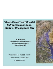
"Dead-Zones" and Coastal Eutrophication: Case-Study of Chesapeake Bay
Take an in-depth look at nutrient loading, eutrophication, and hypoxia using data on The Chesapeake Bay as an example. This comprehensive presentation includes detailed graphs, photos, and details about the changes in marine organism...
World History Digital Education Foundation, Inc.
COVID-19: Geographic Diffusion
An intriguing instructional activity provides information to help academics understand the role of geography in the diffusion of the COVID-19 illness. Academics interpret charts and make predictions for the future. The timely resource...
Curated OER
Two-Dimensional Drawings from Three Dimensional Objects
Sixth graders identify and replicate two dimensional illustrations of three dimensional objects. In this spatial visualization instructional activity, 6th graders practice viewing objects from various sides. Student participate in...
Curated OER
Snowflake Curve
Students develop an appreciation for complex structures in nature. They observe patterns in nature in relationship to the Real World. Students use observation skills to assist in problem solving. They show comprehension of the concepts...
Curated OER
Spatial Relationships
Students investigate the geometry concept of spatial relationships. They draw a replica of a cube. Students list the planes on the cube and go into further depth with identifying the parallel line in segments of the cube. The...
Curated OER
Internal Spatial Structure of Cities
Students examine the internal spatial structure of cities. In groups, they analyze patterns of functions, structure and characteristics of settlement patterns. They also identify the population densities of land value of business...
Curated OER
Immigration Unit
Third graders develop an appreciate for the various cultures that are present in their local community. Through reading and research, they explain how various culture came to live in their area. At the conclusion of the unit, 3rd...
Curated OER
Absolute Location Using GPS Technology
GPS is great for identifying your position, but is it finding your relative or absolute location? Ninth graders explore the difference between absolute and relative location, use the standard grid system coordinate system, and use GPS to...
Curated OER
THE GAM SAAN ADVENTURE ARE YOU WILLING TO RISK IT?
Fourth graders study the lasting influence of the Pony Express, Overland Mail Service, Western Union, and the building of the transcontinental railroad, including the contributions of Chinese workers to its construction. They explore the...
Curated OER
Investigating Our Place in the World
Students study the concept of geography in a year long unit. In this geography unit, students participate in different activities that explain the spatial sense of the world, the physical landmasses and bodies of water, geographic...
Curated OER
Lesson 1: Map Data and the Census
Students learn about the history of the census. In this U. S. Census lesson plan, students develop an understanding about how the United States Constitution grants and distributes power and discover how the spatial organization of...
Curated OER
School Redesign and Multiple Intelligences
Students examine their own intelligence to find areas of strength after studying the multiple intelligences. In this diverse learning styles lesson, students analyze how the school environment fosters or fails students of diverse...
Curated OER
Cardinal Directions
First graders study cardinal directions on maps. In this geography instructional activity, 1st graders determine and show where North, South, East, and West are on various maps.
Curated OER
Populists and Progressives
Students study the Gilded Age in American History. They present a speech demonstrating knowledge of the platforms of the Progressives and Populists.


