Curated OER
My Life Timeline
Second graders investigate their own lives by creating a timeline. In this personal history lesson, 2nd graders define the important events in their lives and how they have influenced their time afterwards. Students create a timeline...
Curated OER
"All About Me" Posters
Third graders discover themselves by creating a poster to present the class. In this personal habits instructional activity, 3rd graders identify characteristics that make them unique and explore goals they wish to accomplish. Students...
Curated OER
The Minimal Distance Point from the Vertices of a Triangle
Students calculate the distance from the vertex of a triangle to the center. In this geometry lesson, students find the shortest distance between a point and the vertex of a triangle. They relate this concept of distance to the real world.
Curated OER
Compound Locus
Students investigate circles and compound locus. In this geometry lesson, students identify the distance from a point to a line. They use Cabri software to create lines and circles.
Curated OER
Lines of Symmetry
Fourth graders identify lines of symmetry using reflections and then construct figures that have one or more lines of symmetry. In this symmetry lesson plan, 4th graders use sets of shapes, pattern blocks, a mirror, and more.
Curated OER
Learning to Measure with Ladybug
Students practice measuring items with non standard units. In this units lesson plan, students measure shapes, lengths, and classroom objects.
Curated OER
"First Day of School - Make a Puzzle"
Third graders create a puzzle piece to be included in a class puzzle. They are given one puzzle piece, and they decorate it using symbols/drawings which are personal to them such as hobbies, interests, or self-portrait. The pieces are...
Curated OER
Quick-Sketch Artist Tips on Mind Mapping the Urban Landscape
Students interpret maps. They also create mental maps of regions in which they are studying. Students then explain the historical or cultural significance of map features orally or in written form. Students take a walking field trip...
Curated OER
Tooling Around Arizona: Reading Arizona Maps
Students study geography. In this Arizona maps lesson plan, students develop their map reading skills. They have class discussions and work independently with various copies of Arizona maps to practice those skills. This lesson plan...
Curated OER
Where, Oh Where, Has That Water Gone?
Young scholars study the benefits of reservoirs while locating and identifying water sources that flow into Tuttle Creek Reservior.
Curated OER
Regions of South America
Students explore facts about South America in the four lessons of this unit. Booklets are created from the materials produced as the class delves into the topic.
Curated OER
"Across Oregon On The 45th N Parallel" A Transect of Oregon
Students explore the physical geography of Oregon. In groups, students collect weather and elevation information on Oregon. They organize the data and create maps and graphs of the information. Afterward, students compare the...
Curated OER
Identifying Continents and Oceans
Students locate and identify the four major oceans and the seven continents on a world map. They use an unlabeled world map and compass rose to describe relative locations of the continents and oceans.
Curated OER
The Aral Sea: A Time for Change
Ninth graders investigate the physical changes in the Aral Sea from the year of 1960. They conduct research to find information. Students compare and contrast the changes caused by human activity over the years. They create their own...
Curated OER
The Russian View of Territorial Encroachment
Twelfth graders produce a map illustrating the current NATO members, future nations, and nations that have applied for membership. They research current information regarding NATO, and the Russian viewpoint about the expansion of NATO....
Curated OER
America the Beautiful
Students listen to a read-aloud discussing the landmarks of the United States. In pairs, they use the internet to research a landmark of their choice. They create a visual aid to be given with a presentation sharing the information...
Curated OER
From the Sea to the Summit, Land Use on Maui
Fourth graders examine the how the land is used on the islands of Hawaii. Using this information, they discover how elevation affects how the land is used and represent this data in a visual form. They describe existing and alternative...
Curated OER
Lewis and Clark
Fourth graders research the Lewis and Clark expedition and the Corps of Discovery. They explore a variety of websites and complete a WebQuest, analyze maps, and answer comprehension questions. Students also write journal entries and...
Curated OER
Hachimaki/Shibori Lesson Plan
Sixth graders are introduced to the technique of Arashi Shibori and its history. In groups, they discover how to perform this process and examine how to do hachimaki. To end the activity, they make their own hachimaki to wear and share...
Curated OER
From Home to School, GPS Style
Students are introduced and increase proficiency in the use of the hand held GPS system. They explore the meaning of longitude and latitude lines, then identify the parts of the map.
Curated OER
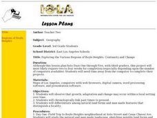
Exploring the Various Regions of Boyle Heights: Continuity and Change
Student study the local landscape of Boyle Heights, California and draw a sketch of the area. Students use map making skills in this activity. Studient make a portfolio of information and photographs they accumulate over time on the area.
Curated OER
Draw A Coastline
Pupils identify, locate and draw at least ten different geographical features on a map. Using the map, they must make it to scale and include their own legend and compass rose. They share their map with the class and answer questions.
Curated OER
How to Celebrate the 800th Anniversary of the Mogol Empire
Students research information on the Mongolian Empire from various readings and online videos of primary sources and create a poster for oral presentation. Students connect history with the current day, while incorporating geographical,...
Curated OER
Landforms All Around
Students create a "Landform Dictionary". They develop an overlay map and participate in hands-on activities to identify the key characteristics of landforms. They discuss the plant and animal life of these areas. Handouts for the lessons...


