Curated OER
The Civil War: Through the Eyes of Hoosier Women-
Fourth graders explain and analyze changes and interactions of Hoosier women in major social and work roles during the Civil War. They recognize and compare the contributions of both women on the home and war fronts.
Curated OER
Contemporary Afghanistan
High schoolers research the situational dynamics that have resulted in a civil war.
In small groups, they research the geography and culture of Afghanistan.
Groups analyze the political and cultural impact on people living in...
Curated OER
Route 66 And Population Patterns
Students investigate the geography located along Route 66. They research how the population patterns change in certain areas along the highway. Students use the information in order to form hypotheses about how and why the population...
Curated OER
Ecosystems
Students work together to identify the characteristics of their local ecosystem and another one nearby. In groups, they use a Venn Diagram to compare and contrast the two. They use this information to create a collage of both...
Curated OER
Investigate Non-native Neighborhood Invasion Species
Learners investigate non-native species that are invading local or state environments. They choose one species to research and report on.
Curated OER
Virginia In the World: The Geography of Commerce
Students examine how Virginia connects with the world through export trade. Using a map, they use symbols to depict the value of trade and the direction of the flow of goods. They complete a scavenger hunt using electronic almanacs and...
Curated OER
Creating a National Park
Learners explore how national parks are created, operate and benefit society by creating a new national park for their state.
Curated OER
Trout Fishing in the Connoquenessing Watershed
Students create a tri-fold brochure to be used with their local Tourism Bureau that includes information and photos of local streams and lakes and trout fishing areas. Students write a description of the area and include a map of the...
Curated OER
Science: Rock On!
Fourth graders explore the traits of rocks and minerals in their local area. After creating a rock and mineral legend, they color maps based on their legends. Once students examine rock and mineral specimens, they draw pictures of them.
Curated OER
Community Improvement
Young scholars examine a local body of water to determinet the health of its ecosystem and monitor it during the year. If needed they write a report on any conditions that need improvement including photographs and relevant data.
Curated OER
Oink, Moo, Peep What Is A Farm?
Students explore the workings of a farm. After reading "Charlotte's Web," students visit a farm. They discuss their observations of the real farm to the one described in the book. Students create a map of the farm they visited. They...
Curated OER
Waterworks In Braintree
Students examine how water affects the community of Braintree. Using a map, they locate main resevoirs and rivers in the area and research the history of one of the resevoirs. They use charts and graphs to show how land use has changed...
Curated OER
Exploring and Comparing Other Communities
Third graders search TDC database for images of physical geography maps, weather maps, natural resources maps, and old travel brochures. They create a new travel brochure of an area of their choice using the information they gathered.
Curated OER
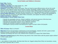
Social Studies and Children's Literature
Pupils write a journal in response to literature. The story that is read is about prairies. The subject of prairies becomes an object for research. The culminating activity is the making of a map where prairies exist in the United States.
Curated OER
Our Way of Life
Learners interview Native American Elders about animal migration, traditional food gathering, and subsistence. They research endangered animals, draw a game cycle, and create maps of local migration of animals.
Curated OER
Cartographer and Journalish as Storytellers
Students collaborate in groups of four students to create a written description of their community during a specific year. They analyze data provided by maps and newspaper articles. They meet as a whole class to discuss their conclusions.
Curated OER
Weather... Or Not
Students observe and discuss the local weather patterns, researching cloud types and weather patterns for cities on the same latitude on the Internet. They record the data for 6-8 weeks on a graph, and make weather predictions for their...
Curated OER
Discovering the Oasis
Students focus on the types of vegetation and animal life living around local water sources. This lesson can be adapted to any local water source, whether it be a lake, a river, stream or ocean. It has a particular focus on the bird...
Curated OER
Knowing Where You Are
Fifth graders research place names of one section of their state and create a chart to show their findings.
Curated OER
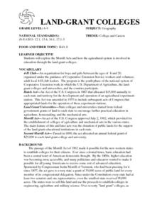
Land Grant Colleges
Students are introduced to the concept of land grant colleges which allowed agriculture to be brought into education. As a class, they create a timeline and compare and contrast the land grant colleges of 1890 and 1892. They use maps...
Curated OER
Watermelons
Middle schoolers discover the origins and different uses of watermelons. Using the internet, they find photographs of the fruit and reading about them in primary source documents. As a class, they plan a community activity in which...
Curated OER
How We Get From Here to There
Students recognize various types of movement people rely on to get from one place to another, locate the forms of movement on a map and choose one form of movement and research its path.
Curated OER
Montana Reservation Governments
Third graders examine the types of governments on Indian reservations. In groups, they research the responsibilities of local and tribal governments. As a class, they discuss how the state of Montana meets the needs of its citizens...
Curated OER
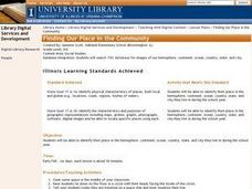
Finding Our Place in the Community
Third graders search TDC database for images of our hemisphere, continent, ocean, country, state, and city. They identify their place in the hemisphere, continent, ocean, country, state, and city.


