Curated OER
Egg Hunt: Review of States and Capitals
Fourth graders participate in an Easter egg hunt that gives them clues to states and their capitals. In this states and capitals lesson plan, 4th graders use clues to figure out the states described.
Curated OER
Settlement Patterns of the United States
Pupils examine the conditions that affected the way people settled in the United States. Using maps, they examine the topography and climate of different locations and determine the factors that do and do not allow settlement to occur....
Curated OER
Geography: Intro to Canada
Students investigate the geography of Canada by analyzing a map of the country. In this North American geography instructional activity, students identify the 13 provinces of Canada and their locations by examining a Canadian...
Curated OER
The United States in 1790
In this geography skills worksheet, students study the provided map of the United States in 1790 and then complete the provided quiz over the 17 states and territories.
Curated OER
State to State Scavenger Hunt
In this states worksheet, students utilize the Internet to access one specific website to locate the answers to five fill in the blank statements about the states found on a United States map.
Curated OER
United States Map- State Capitals
Students explore the state capitals. In this geography lesson plan, students use a political map to identify the state capitals and place post-it notes on various capitals.
Curated OER
Naming the States of the U.S
Fifth graders study the 50 states on a map. In this social studies lesson, 5th graders identify the names of the states and location. Additionally, students work in small groups to name and locate as many states as they can on a blank...
Curated OER
Fifty States In Rhyme
Students perform "Fifty States in Rhyme" with correct posture, correct rhythms, and accurate pitches. They also identify and perform such musical terms as tone color, tempo, dynamics, phrases, and accents. Emphasis is placed on the...
Curated OER
U.S. State Reports
Students conduct Internet research on a chosen U.S. state. They include information about the history, climate, geography, symbols, and tourist attractions of their state, and write an original poem.
Curated OER
Illinois State Map
In this Illinois geography worksheet, students color and label a map of Illinois. Students study the location of the capital and where Illinois is situated in the United States. There is a black line map of the state with a grey US map...
Curated OER
Virginia State Map
For this geography of Virginia worksheet, students color the map and label major cities and physical features. Students also study a second map showing the location of the state of Virginia in the United States.
Curated OER
Georgia State Map
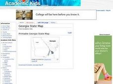
For this geography of Georgia worksheet, students color the map and label major cities and physical features. Students also study a second map showing the location of the state of Georgia in the United States.
Curated OER
Florida State Map
In this geography of Florida worksheet, students color the map and label major cities and physical features. Students also study a second map showing the location of the state of Florida in the United States.
Curated OER
Pennsylvania State Map
In this geography of Pennsylvania learning exercise, students color and label a map of the state. Students also study the location of Pennsylvania on a grey background map of the entire 50 states.
Curated OER
California State Map
In this geography of California activity, students color the map and label major cities and physical features. Students also study a second map showing the location of the state of California in the United States.
Curated OER
Arkansas History Lesson Plan
Students discover the history of their state by working in a group. In this U.S. history lesson, students investigate the state of Arkansas by reading their textbook and participating in art activities. Students discover the...
Curated OER
US Immigration
Learners examine the history of immigration in the United States. Using primary source documents, they identify the areas of origin for people settling in Minnesota and describe the push and pull factors that brought them there. They...
Curated OER
Tibet and the U.S.
Students examine the relationship between Tibet and the United States. They explore the political relationship between the two countries. Students identify geographical features and political boundaries of the Tibetan and Chinese regions.
Curated OER
Exploring South Carolina
If you are having your students conduct a State study this presentation could be a nice example to show them. This resource provides general information about the geography, animals, and city life one may find in South Carolina. Web...
Curated OER
The Soviet Union: Flashcards
Kids can use these question-style flashcards to practice memorizing states and capitals. There are 10 cards, each includes a question and answer related to the states and capitals of the Soviet Union.
Curated OER
What's In a Name?
Students examine the origins of the names of U.S. states, focusing on names that were derived from Native American words. They are provided with lists of the names of the 50 states, and then research online or in library resources the...
Curated OER
Along the Banks of the Mississippi
Students write a report about one of the states along the Mississippi River.
Curated OER
Food on the Map
Students work together to examine the tastiest towns in the United States. After discovering the names of the equipment, they identify the seven continents. They take a survey and locate the cities and states of the foods mentioned.
Curated OER
The Crash Scene
Fifth graders explore geography by participating in a mapping activity. In this engineering instructional activity, 5th graders identify the differences between latitude and longitude and practice locating precise points on a globe or...
Other popular searches
- State Political Maps
- State of Georgia Maps
- State Outline Maps
- State and Local Maps
- State Outlines Maps


