Curated OER
Weather Lesson Five
Students define a weather forecast, make a forecast using a weather map, identify three prediction guidelines, and explain how computers help to make forecasts. Students make a 24-hour forecast for each of the thirteen states targeted.
Curated OER
Working With Electronic Topography Maps
Junior geologists examine topographic maps online and learn how to read them. they answer seven associated follow-up questions. This lesson plan is only a general outline and does not provide the details or the websites that you...
Curated OER
Weather Maps
Students interpret information on a weather map in order to construct a graph, and discuss how the weather impacts their lives.
Curated OER
What's Your Temperature?
Learners take a look at the local newspaper and focus on the weather section. They get into small groups, and each one looks at the same map, but of a different part of the country. They must prepare a presentation that shows how...
Curated OER
Will There Be a White Christmas This Year?
Students examine historical weather data, and create map and color key that illustrates the likelihood of a white Christmas in different locations across the United States.
Curated OER
How Much Water is in That River?
Students practice measurement using the Hudson River. They calculate the discharge measurement at a location on the Hudson River using ingenuity and a topographic map.
Curated OER
Arbor Day Across the United States
Students perform research about hardiness zones used to guide planting. They read a hardiness zone color-key map and create their own color-key maps to show when different states celebrate Arbor Day.
Curated OER
Geography: African Floor Maps
Students explore the African continent and identify the various countries there. They examine the history, geography, environment, and inhabitants of the countries. Students create maps of Africa using a variety of materials.
Curated OER
Weather Watchers
Students are introduced to an Underground Weather Stations. In groups, they use the internet to research the weather in different parts of the United States locating each city. To end the lesson, they summarize the information they...
Curated OER
Invasives and Marsh Birds
Young scholars are taught that invasive plant removal can have a variety of impacts. They are shown this by using graphs. Students view maps of vegetation change on Iona Island. They discuss implications of changes on marsh birds using...
Curated OER
Science: Matter and Energy
Designed to use when teaching adults preparing for their high school equivalency exam, the resource integrates reading practice, writing, and analytical thinking in every lesson. The unit covers 23 topics, but it only includes three...
Curated OER
Law of Superposition
Students identify the law of superposition and it states that beds of rock in a series are laid down with the oldest at the bottom and younger layers on the top. They construct a legen for a block diagram and construct a block diagram...
Curated OER
Pennsylvania Watersheds
Learners identify the major watersheds of Pennsylvania. In this forestry lesson, students learn what a watershed is and are assigned one of the major watersheds of Pennsylvania. Groups then need to determine the boundaries of the...
Curated OER
The Sonoran Desert
Little learners examine a map of the southwestern United States and identify the Sonoran Desert. They locate different cities and rivers, determining whether or not each is found within this special ecosystem. A student handout is...
Curated OER
Birds on Wade Islands
In this birds on Wade Islands instructional activity, students read a 1 page passage about the state of the birds on Wade Islands and answer 1 short answer questions about it. Students answer "What actions should the wildlife agencies...
Curated OER
Plotting Earthquakes
Students, after plotting earthquake locations on the map, should correctly; identify the pattern of earthquake locations and identify the ring of fire.
Curated OER
Creating a Coastal Area
Students design and lay out a map of a coastal area that includes a bay, an estuary, an ocean entrance, and prime beach lands. They write a plan outlining solutions to the economic problems of their community and present their map and...
Curated OER
Local Area - What Is a Region?
Students examine the physical characteristics of the Connecticut River Valley. They analyze maps and pictures, identify physical characteristics of the region, and color in the Connecticut River on a map.
Curated OER
Tailoring Two Cultures to Adapt to Wisconsin's Biotic Zones
Middle schoolers examine the effect of the various ice ages on Wisconsin. In groups, they create a map representing the five geographic regions of Wisconsin. They must write out a description of each region to be placed on a poster...
Curated OER
Ways We Use Water
Fourth graders write a persuasive paper after a demonstration about the properties of water and how they work. The instructional activity also uses a mind map to outline the paper.
Curated OER
Is Your Spot Hot?
Eighth graders explore global warming. In this Earth Science lesson plan, 8th graders will look for Harbingers and fingerprints for different areas. The students will identify an area at risk and they will then create a...
Curated OER
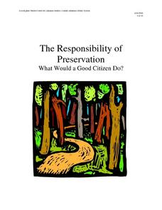
The Responsibility of Preservation
Upper elementary and middle schoolers study the case of the ivory-billed woodpecker, a bird that was once-thought to be extinct. Learners explore the responsibility of people to preserve habitats, and take care of the animals who live in...
Curated OER
Where is Shirley the Elephant?
Young animal lovers engage in a lesson that's all about elephants. They access an elephant sanctuary website and read a story about Shirley the elephant. They perform a series of activities based upon that story, and also study about the...
Curated OER
Natural Disaster Blooms Taxonomy
Pupils complete activities that lead to greater understanding of the variety of natural disasters that occur all over the world.


