Curated OER
Geographic Regions and Backyard Geology with the USGS Tapestry Map
A beautiful tapestry map of North America is examined by geology masters. The map incorporates the topography and geology of different regions. You can purchase printed copies or a large poster of the map, or if you have a computer lab...
Curated OER
Fossil Fuels (Part I), The Geology of Oil
Junior geologists work through three mini-lessons that familiarize them with the formation and location of fossil fuels. Part one involves reading about petroleum and where it comes from via a thorough set of handouts. A lab activity...
Curated OER
N is for Natural State
For any pupils who live in the state of Arkansas, this would be a fabulous educational experience to help them get to know their state better. Through the use of activities in literature, art, mathematics, science, social studies, and...
Baylor College
Mapping the Spread of HIV/AIDS
Where is HIV/AIDS most prevalent and what are the current trends regarding HIV? Have groups work together to map the world's HIV/AIDS rates, then create a class map with all the data. Lesson includes cross-disciplinary concepts including...
Curated OER
Mapping Where Animals Live
What type of reptiles live in New York State? This lesson gets the class thinking about what factors determine where particular animals live. They analyze the Hudson Valley environment, identify specific reptile and amphibian...
Curated OER
A world of oil
Learners practice in analyzing spatial data in maps and graphic presentations while studying the distribution of fossil fuel resources. They study, analyze, and map the distribution of fossil fuels on blank maps. Students discuss gas...
Curated OER
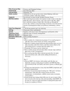
Forestry and Changing Feelings
Students investigate how the forest affects their daily lives by creating a concept map. In this ecological lesson, students create a concept map linking the forest to the many things they use each day. Students take a field...
Curated OER
These Maps are for the Birds
Students identify and study New York State Breeding Bird Atlas maps to learn where different bird species nest and how their distributions have changed over time. They also identify how maps serve as representations of a geographic...
Curated OER
The Asian American Experience in the United States: A Chronological History
Eleventh graders understand push-pull factor in Asian Amencan immigration. They identify patterns of Asian immigration to the United States and recognize their correlation to the concurrent socio-economic and political conditions of that...
EngageNY
TASC Transition Curriculum: Workshop 12
How can opinions slant facts? Workshop participants learn how to examine primary and secondary sources and identify the author's point of view. They also examine how visual art impacts the meaning and rhetoric of sources. Full of...
Curated OER
The New Madrid Earthquakes of 1811-1812: Shaking Our Misconceptions about Earthquakes in United States History
Young scholars Examine how earthquakes work and what plate tectonics and fault lines are. In this earthquake lesson students complete an earthquake scavenger hunt.
Curated OER
Chart Making for Navigators
Students discuss the importance and function of nautical maps for sailors. They, in groups, take soundings of a simulated bay in a shoebox and develop a nautical chart that enable them to navigate the shoebox safely.
Curated OER
The 1927 Flood
Upper elementary and middle schoolers examine the Great Flood of 1927 in the state of Arkansas. They each prepare an oral report about this flood and the huge impact it had on the economics of that time. Additionally, learners research...
Curated OER
U.S. And Global Deforestation
Students analyze graph showing global deforestation, view photograph of deforestation in Brazil's interior rain forest and examine three maps showing deforestation within the United States, describe political, economic, and social...
Curated OER
Identifying Your Watershed
High schoolers identify the watershed where they live and how it is related to their own water consumption. In this watershed lesson students locate their watershed on their town map. The high schoolers find the source of their water...
Curated OER
Coasts
Young scholars explain the different types of marine coasts and where they are located in the United States and its territories. They explain and identify some of the life forms that inhabit different marine coastal regions.
Curated OER
Siting Wind Power
Students analyze a variety of curves that describe the power extracted from the wind by a variety of commercially produced wind turbines. They utilize site specific topographic maps and political boundary data to evaluate and make...
Curated OER
Rollin' on The River - the Hudson River!
Students examine how the Hudson River was important to the development of the United States. They examine the role of steamboats played in the development of the Hudson River Valley.
Curated OER
The Sonoran Desert
Little learners examine a map of the southwestern United States and identify the Sonoran Desert. They locate different cities and rivers, determining whether or not each is found within this special ecosystem. A student handout is...
Curated OER
Scientists and Statesmen in Early America
Explore the historic and cultural context of the foundations of the United States of America. They identify the political and scientific contributions of early American scientists.
Curated OER
No magic borders
Middle schoolers discuss what they have heard about pollution. They explore the purposes and limitations of political boundaries and borders and identify some of the causes and effects of pollution.
Curated OER
Native Americans and Topography at Rose Bay
Students visit a wetland ecosystem. While they are there, students explore how to read topography maps of Rose Bay.
Howard Hughes Medical Institute
BiomeViewer
Which holds more influence, the environment over humans or humans over the environment? Young scientists explore an online interactive that addresses this discussion. They observe changes in the natural world over time and see which...
Curated OER
Rivers And Capitals
Students become familiar with the use of GIS for research and become aware of the importance of rivers to cities. They also analyze the placement of cities and learn the names of rivers in the United States.


