Curated OER
Tracking Ocean Ecology
Students look at the data maps given to them about how chlorophyll affects the algae blooms and make predictions about the harm they will cause. In this data maps lesson plan, students manipulate data sets from the website.
Curated OER
USH Industrialization: The effects of the railroads
Eleventh graders interpret a time zone map and describe the effects of the railroads. They discuss what a continent is, what you think it means if something is transcontinental and offer descriptions about some different inventions from...
Curated OER
Scrambled States
Students read or are read the story "Scrambled States". Using a map, they identify their states and time zones. They predict their states representation in the book and discuss it after the book is finished. They discvor the differences...
Curated OER
'Tis a Long, Long Way to Tipperary!
Students practice finding the location of cities across the world by using an interactive Web site, and figure out the world's time and the value of time zones the world over.
Curated OER
Mapping The Ocean Floor
Young scholars explore and analyze the bottom structure of underwater habitats. They describe and explain what can't see through the collection and correlation of accurate data. Learners assess that technology is utilized as a tool for...
Curated OER
Lesson Design Archaeology- World Map
Students practice locating positions on the world map. In this map skills lesson, students explore the world map and items such as the compass rose, Equator, mountains, cities, etc. The students practice locating positions on the world...
Curated OER
Latitude and Longitude
Learners find latitude and longitude on a map or atlas. They create maps with a cruise route. They practice plotting locations given latitiude and longitude.
Curated OER
Geomnemonics: Facilitating the Teaching of Social Studies Content with Geography Skills
Students explore how to draw a world map by hand and how to locate countries.
Curated OER
Traveling Through Literature
Integrate geography with literature in this interdisciplinary lesson. Begin by reading a poem such as The Time We Climbed Snake Mountain by Leslie Marmon Silko. On a large map, place push pins in the cities or states mentioned. An...
Curated OER
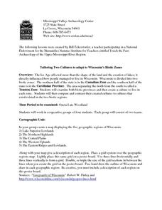
Tailoring Two Cultures to Adapt to Wisconsin's Biotic Zones
Students examine the effect of the various ice ages on Wisconsin. In groups, they create a map representing the five geographic regions of Wisconsin. They must write out a description of each region to be placed on a poster board. ...
Curated OER
Radon Gas in the Basement: A Radiation Hazard
In this radon gas worksheet, students read about the harmful effects of radon exposure over time. They use a map that shows radon gas zones to answer 3 questions about exposure to the gas and the amount of radiation that humans get from...
Curated OER
Viewpoints
In this latitude and longitude worksheet, students complete 10 matching questions identifying key features or locations on a map. Students also use lines of latitude and longitude to identify the time in 4 different places.
Curated OER
Canada's Geographic Position
Ninth graders investigate the characteristics of the geographic position of Quebec and Canada in the World. They study Canada's land and water boundaries, surface area and time zones.
Curated OER
Early Russian History
While not heavy in text, the vivid images, maps, and key information in this slide show, are sure to hold an audience. They'll view images of geography, buildings, and people who are apart of early Russian History. Use the presentation...
Curated OER
Mapping My Community
Ninth graders are introduced to GPS technology. They complete fieldwork as they visit a specific area of their community to identify and map types of land use in the surveyed area. They use the collected data to create a digital map.
National Wildlife Federation
It's All in the Name: Weather Versus Climate
What goes up when rain comes down? An umbrella! Activity eight in the series of 12 explores weather and climate. In pairs, participants analyze maps, watch a short video, create a weather forecast, and complete a reading to determine the...
It's About Time
Present-Day Climate in Your Community
So what exactly is climate? This first installment of a six-part series introduces the concept of climate using real-world data tables and topographic maps. The timely lesson includes a comprehensive overview of climate, as well as...
Curated OER
Where is Sophie?
Students use GPS to scrutinize the movements of a grizzly bear named Sophie. They answer a series of questions like; where she forages, her zone of influence, and human interaction. They read the story of Sophie, the collared bear in...
Science Matters
A Model of Plate Faults
The San Andreas fault is one of the longest fault zones in the world. In a series of 20 lessons, the fourth lesson has pupils use a paper model to recreate various types of plate faults. Each is held in position then drawn into a science...
Curated OER
A Place Called Fairfax
Students are introduced to the various types of maps of Fairfax County, Virginia. Using the maps, they explain the relative and absolute locations of the county and discuss the importance of both. They also discover how the county is...
Curated OER
Natural History of Costa Rica
Students use outline maps to become acquainted with Costa Rica. They see how it was formed and how its origin has created very diverse environments. Students then use atlases and compare their physical maps with maps of climate and the...
Curated OER
A Tale of Two Frogs
Second graders locate Russia on a map or globe and work in pairs to complete the Map worksheet. They read the book, A Tale of Two Frogs stopping after page 15. They write an ending to the story and then read more of the book stopping...
Curated OER
Lesson 1 Activity 1: Tools of the Ancients
Students examine how Christopher Columbus determined his latitude.
Other popular searches
- Time Zone Map Questions
- Geography Time Zones Map
- World Time Zone Map
- Time Zone Map Reading
- Reading Time Zone Maps


