Curated OER
The Geography of Africa
Hop a flight to Africa in this presentation, which includes brilliant and appealing photographs of the continent as well as maps and graphs about its geography, topography, and climate. Those who are researching Africa for a project or...
Curated OER
A Garden in the Mailbox
Students study seed catalogs to find information about plants and growing seasons. They write letters requesting a seed catalog after using online resources. They use them complete an associated worksheet and discuss zone maps for their...
Curated OER
Pacific Atolls and Island Groups
Students construct, interpret and translate maps and geographic data. Given a worksheet, students identify an island, an atoll, a scale, and a compass rose. Students grid systems, legends, and symbols. They use the map to find answers to...
Curated OER
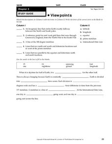
Viewpoints
In this map learning exercise, students review latitude, longitude, equator, and prime meridian. This learning exercise has 5 matching and 8 fill in the blank questions.
Curated OER
Vocabulary for Dimensions of the Earth
In this Earth dimensions learning exercise, students define 24 terms associated with contour maps, latitude, longitude, and time zones.
Curated OER
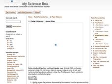
Plate Patterns
Learners read about a volcano and use the latitude and longitude information to plot and describe the volcano on the map. They discuss patterns seen on the map. In addition, they color code a map according to zones, plates, etc.
Curated OER
Using Vegetation, Precipitation, and Surface Temperature to Study Climate Zones
Students begin their examination of the climate zones found around the world. Using a software program, they identify the relationship between the vegetation, climate and temperatures of the different zones. They also plot coordinates...
Curated OER
Medieval African Kingdoms
Seventh graders examine the geography and political history of West Africa. They role-play as applicants to a company that transports customers to any historic time period. Working in teams, they create promotional products encouraging...
Curated OER
Weather, Migrations, and Plants
Students research the effects of day-to-day weather on animal migrations, plant growth and other seasonal events. They consult maps, observe and record local conditions, keep journals and use their collected data check hypotheses.
Curated OER
MEDIEVAL SUB-SAHARAN AFRICA
Seventh graders examine the area of medieval Sub-Saharan Africa through eyes of travelers in the company of one of history's greatest travelers, Ibn Battuta. The project has been structured to include all the State standards for this unit.
Curated OER
Plate Patterns
Students review the patterns they discovered from a previous activity. In this investigative lesson students plot data as a class and color a map.
Curated OER
Air Masses & Fronts
Young scholars identify two distinct air masses and the frontal boundary and determine whether the front is moving in time and in what direction the front is moving.
Curated OER
Air Masses & Fronts
Students use a set of maps depicting a front passing through the state to identify two distinct air masses and the frontal boundary. They then deterine whether the front is moving in time and in what direction the front is moving.
Curated OER
Native Americans and Topography at Rose Bay
Young scholars visit a wetland ecosystem. While they are there, students explore how to read topography maps of Rose Bay.
Curated OER
Jump Rope Around the World (Target Heart Rate)
Students participate in a game where they get 5 "lives." When they miss with the rope the fifth time, they go to another area in the gym. They continue jumping to keep their heart rates elevated.
Curated OER
What's Down There?
High schoolers analyze data on coral reefs and use this to help characterize reefs. In this mapping coral reefs lesson students identify and explain the major threats to coral reefs.
Curated OER
Abundant Lakes
Students define lake life zones. They define stormwater runoff and its effects on lakes. They identify the relationship between decaying substances and water pollution. They construct a freshwater food web.
Curated OER
Arbor Day Across the United States
Students perform research about hardiness zones used to guide planting. They read a hardiness zone color-key map and create their own color-key maps to show when different states celebrate Arbor Day.
Curated OER
States of Fitness
Students participate in physical activities coordinating to divisions on a map.
Curated OER
A Brand New Day
Students locate Maine on a classroom map and discuss if Maine is where the nation's first light is found, where would the nation's last light be seen. They explore the idea of the sun rising in the east and setting in the west.
Curated OER
Location of Cities 201
Students work in pairs to locate the ancient cities on a world atlas using the longitude and latitude measurements. They examine the physical and human futures that explain their locations.
Curated OER
The Arctic and Taiga Ecozone of Canada
Students examine the various sub-regions of the Arctic and Taiga zones in Canada. Using the online Canadian Atlas, they locate and describe the characteristics of each zone. They organize their information into a chart and share it with...
Curated OER
Exploring For Copper Deposits
Young scholars examine ore deposits and identify factors in their origin. They analyze geologic maps, and locate porphyry copper deposits on a sediment geochemistry map.
Curated OER
Comparing Amount of Rainfall in Different Geographical Areas
Students construct rain gauges and use them to log rainfall in their school zone, local city, and region and then compare and discuss them by plotting this information.
Other popular searches
- Time Zone Map Questions
- Geography Time Zones Map
- World Time Zone Map
- Time Zone Map Reading
- Reading Time Zone Maps


