Curated OER
Understanding Topographic Maps
Underclassmen create a cone-shaped landform and then draw a contour map for it. Then they examine a quadrangle (which was easily located with an online search), and relate it to what they experienced. The accompanying worksheet is...
Curated OER
Topographic Maps
Sometimes it is difficult to grasp topographic maps. Here is a clever presentation designed to help your middle school earth scientists understand. Beginning with a side view of a pair of mountains, a graphic guy walks up one slope. As...
Curated OER
Exploring Earth Through Maps and Technology
In this maps worksheet, students read 3 pages of detailed information about maps, latitude, longitude, topography, satellites and global positioning. Students then answer 10 questions. There is also a research project assignment available.
Curated OER
GEOGRAPHY: SPACE CENTERS
Students examine the descriptive science dealing with the surface of Earth, its division into continents and countries, climate, natural resources, inhabitants and industries of the various divisions and analyze the political geography...
Curated OER
Salad Tray 3D Topographic Model
Pupils explore the characteristics of topographical maps. They examine the relationship of contour lines and vertical elevation. Students create a three-dimensional model of a landscape represented by a topographic contour map.
National Geographic
Mapping the Shape of Everest
With Mount Everest as the motivator, your earth science class learns about topographic maps. Begin by showing a film clip from The Wildest Dream: Conquest of Everest, featuring fearsome virtual imagery of a path up world's tallest peak....
KOG Ranger Program
Fire Behavior in Forests
Understanding the ways a fire will act is a key factor in fire safety and fire prevention. Young campers focus on how the weather and terrain can affect the behavior of a fire with topographic maps and different scenarios.
Curated OER
Changing Planet: Sea Levels Rising
Begin by showing a six-minute video, Changing Planet: Rising Sea Level as an anticipatory set. Pupils draw a topographic map of a potato continent. Finally, they will visit NOAA's sea levels online map and NASA's carbon dioxide...
Curated OER
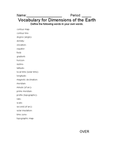
Vocabulary for Dimensions of the Earth
In this Earth dimensions worksheet, students define 24 terms associated with contour maps, latitude, longitude, and time zones.
Midnight Martian
Mars Globe HD
Explore the surface of Mars without leaving the comforts of your home or classroom! Learn about volcanoes, missions to the red planet, view the topography, and more.
Curated OER
Sonar Simulation
Students explore how a side-scan sonar can help locate underwater objects. In this hands- on lesson students compare side-scan sonar and other methods used to search for underwater objects by creating their own "simulation" of a...
Curated OER
Customized Topographic Maps and Models
Students explore the information depicted on topographic maps. They construct a 3-D topographic map of a local area. They go on a field trip to the depicted area and compare the 'real world' with their models.
NorthEast Ohio Geoscience Education Outreach
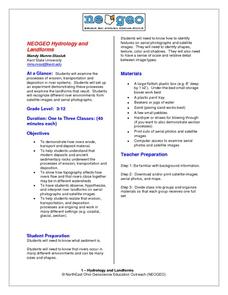
Hydrology and Landforms
Three days of erosion exploration await your elementary geologists. Learners begin by examining rivers via Google Earth, then they model water flow in sand, and finally, they identify resulting landforms. This lesson is written...
Curated OER
Earth: The Water Planet
Students elicit data on the water cycle, ocean topography, and island formation in this six lesson unit. The ocean floor and the properties of water are examined through a variety of discussions and hands-on experiments.
Curated OER
Landslides!
Learners discover soil and Earth movement by experimenting in class. In this Earth Science lesson, students utilize a stream table, soil, graduated cylinder and water to create a re-enactment of a landslide. Learners simulate different...
NOAA
Plate Tectonics II
Mid-ocean ridges, rift valleys, island arcs, mountain ranges, earthquakes, volcanoes ... there are so many features associated with plate tectonics. The 14th installment of a 23-part NOAA Enrichment in Marine sciences and Oceanography...
Curated OER
Oceanography Worksheet #1
If you are teaching physical oceanography to middle school earth scientists, here is a terrific multiple choice worksheet. Learners look at a diagram of a landscape created by glacial sediment deposition and the resulting ocean floor....
Curated OER
Identifying Watersheds with Topographic Maps
Students model a watershed and delineate one using topographic maps. In this hydrology lesson, students use aluminum foil to model a landscape and observe how water moves on it. They also observe the features of a topographic map and use...
Curated OER
Interior of the Earth
Sixth graders identify and describe the composition and physical properties of the layers of the Earth. They also explain how scientists used the scientific process to know about the center of the Earth. Finally, 6th graders read a...
Texas State Energy Conservation Office
Investigation: Blowing in the Wind
Using a simulated air sample, environmental or earth science pupils examine the components. You will need to prepare the faux air by using a hole punch and various colors of construction paper. Each color will represent a different...
Curated OER
Design an Island
Students explore islands. They create a two- or three-dimensional map of an island. They explain how the topography of an area influences the location of water sources, ecosystems, and human settlements. Lesson includes adaptations for...
Curated OER
Common Themes
Tenth graders test usefulness of a model Earth by comparing its predictions to observations in the real world. In this landforms lesson students construct an island from a contour map using model clay then analyze the landscape features...
Curated OER
Cookie Mapping
Students study the components of a bedrock geology map through a hands-on activity involving a cookie and graph paper.
Curated OER
Gallery Walk Questions on Weathering and Mass Wasting
A set of questions on weathering and erosion are found in this resource. Some of them can be used as discussion topics or lecture guides. There are also suggested activities such as the examination of topographic quadrangles and the...


